File:Mikimoto Road in 2012.png
Jump to navigation
Jump to search
Size of this preview: 628 × 600 pixels. Other resolutions: 251 × 240 pixels | 503 × 480 pixels | 882 × 842 pixels.
Original file (882 × 842 pixels, file size: 134 KB, MIME type: image/png)
Captions
Captions
Add a one-line explanation of what this file represents
Summary
[edit]
| Description |
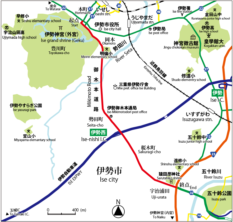
English: This is a map of Mikimoto Road in 2012. Mikimoto Road connects Hommachi, Ise and Ujiurata, Ise. It is a part of Mie prefectural road No.32 Ise-Isobe line.
日本語:2012年現在の御木本道路の地図。御木本道路は伊勢市本町と伊勢市宇治浦田を結ぶ。三重県道32号伊勢磯部線の一部。 |
| Date | |
| Source | Own work |
| Author | Miyuki Meinaka |
Licensing
[edit]
I, the copyright holder of this work, hereby publish it under the following license:
This file is licensed under the Creative Commons Attribution-Share Alike 3.0 Unported license.
- You are free:
- to share – to copy, distribute and transmit the work
- to remix – to adapt the work
- Under the following conditions:
- attribution – You must give appropriate credit, provide a link to the license, and indicate if changes were made. You may do so in any reasonable manner, but not in any way that suggests the licensor endorses you or your use.
- share alike – If you remix, transform, or build upon the material, you must distribute your contributions under the same or compatible license as the original.
File history
Click on a date/time to view the file as it appeared at that time.
| Date/Time | Thumbnail | Dimensions | User | Comment | |
|---|---|---|---|---|---|
| current | 08:19, 29 August 2012 | | 882 × 842 (134 KB) | Miyuki Meinaka (talk | contribs) | User created page with UploadWizard |
You cannot overwrite this file.
File usage on Commons
There are no pages that use this file.
File usage on other wikis
The following other wikis use this file:
- Usage on ja.wikipedia.org