File:Middle East (historical definition)(orthographic projection).svg
Jump to navigation
Jump to search

Size of this PNG preview of this SVG file: 553 × 553 pixels. Other resolutions: 240 × 240 pixels | 480 × 480 pixels | 768 × 768 pixels | 1,024 × 1,024 pixels | 2,048 × 2,048 pixels.
Original file (SVG file, nominally 553 × 553 pixels, file size: 408 KB)
Captions
Captions
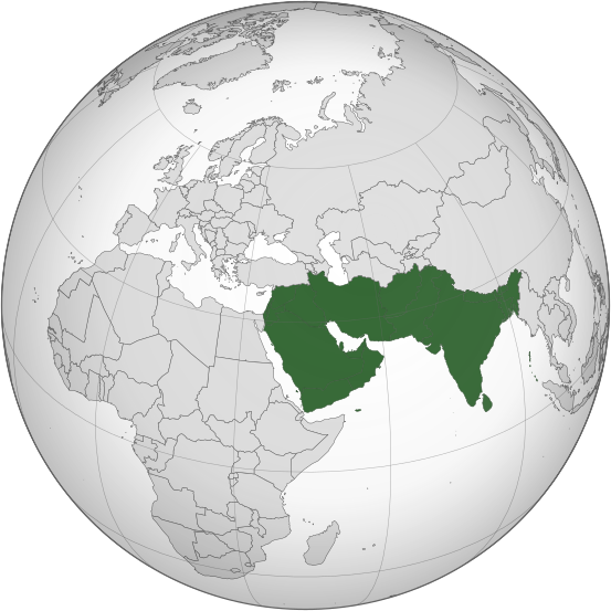
Map of the historical definition of the Middle East, with modern international borders
Summary
[edit](orthographic_projection).svg&action=edit§ion=1)
| Description |
English: Orthographic grey-and-green locator map of the Middle East's historical definition as the Asian lands and islands to the west of the "Far East", with 21st-century international borders.
The Indian subcontinent here is the eastern extreme of the Middle East, with Burma counted as the "Far East". Sinai, Egypt, and Africa as a whole are here excluded, as are modern Turkey and the countries of the Caucasus. Afghanistan is here included, but Turkmenistan and other central Asian countries are excluded. This file was derived from: Middle East (orthographic projection).svg:.svg) |
| Date | |
| Source | Own work |
| Author | GPinkerton |
Licensing
[edit](orthographic_projection).svg&action=edit§ion=2)
I, the copyright holder of this work, hereby publish it under the following license:
This file is licensed under the Creative Commons Attribution-Share Alike 4.0 International license.
- You are free:
- to share – to copy, distribute and transmit the work
- to remix – to adapt the work
- Under the following conditions:
- attribution – You must give appropriate credit, provide a link to the license, and indicate if changes were made. You may do so in any reasonable manner, but not in any way that suggests the licensor endorses you or your use.
- share alike – If you remix, transform, or build upon the material, you must distribute your contributions under the same or compatible license as the original.
File history
Click on a date/time to view the file as it appeared at that time.
| Date/Time | Thumbnail | Dimensions | User | Comment | |
|---|---|---|---|---|---|
| current | 13:40, 12 November 2022 | | 553 × 553 (408 KB) | GPinkerton (talk | contribs) | Reverted to version as of 11:38, 1 April 2021 (UTC) Incorrect |
| 07:00, 12 November 2022 |  | 550 × 550 (2.77 MB) | Sourav Bapuli (talk | contribs) | Excluded India, as historically it was never part of the Middle East. | |
| 11:38, 1 April 2021 |  | 553 × 553 (408 KB) | GPinkerton (talk | contribs) | Uploaded own work with UploadWizard |
You cannot overwrite this file.
File usage on Commons
The following page uses this file:
(orthographic_projection).svg&oldid=868099229)