File:Micronesia regions map.png
Jump to navigation
Jump to search

Size of this preview: 766 × 599 pixels. Other resolutions: 307 × 240 pixels | 614 × 480 pixels | 982 × 768 pixels | 1,280 × 1,001 pixels | 2,177 × 1,703 pixels.
Original file (2,177 × 1,703 pixels, file size: 1.29 MB, MIME type: image/png)
Captions
Captions
Add a one-line explanation of what this file represents
Summary
[edit]
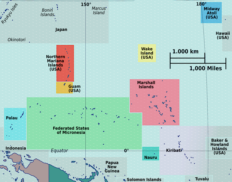
| Description | Micronesia regions map for use on Wikivoyage, English version |
| Date | |
| Source | Own work based on the map by TUBS |
| Author | Peter Fitzgerald |
| Other versions |
.png)
Licensing
[edit]

|
Permission is granted to copy, distribute and/or modify this document under the terms of the GNU Free Documentation License, Version 1.2 or any later version published by the Free Software Foundation; with no Invariant Sections, no Front-Cover Texts, and no Back-Cover Texts. A copy of the license is included in the section entitled GNU Free Documentation License. |
This file is licensed under the Creative Commons Attribution-Share Alike 3.0 Unported license.
- You are free:
- to share – to copy, distribute and transmit the work
- to remix – to adapt the work
- Under the following conditions:
- attribution – You must give appropriate credit, provide a link to the license, and indicate if changes were made. You may do so in any reasonable manner, but not in any way that suggests the licensor endorses you or your use.
- share alike – If you remix, transform, or build upon the material, you must distribute your contributions under the same or compatible license as the original.
Original upload log
[edit]
| This file was imported from Wikivoyage WTS. |
The original description page was here. All following user names refer to wts.wikivoyage-old.
- 2011-08-11 22:09 (WT-shared) Peterfitzgerald archive copy at the Wayback Machine 2185×1709 (749927 bytes) {{Imagecredit|credit=Peter Fitzgerald, [[:wmc:User:TUBS]]|captureDate=11 August 2011|location=Oceania|source=[[:Image:Oceania regions map.sv (Import from wikitravel.org/shared)
- 2011-10-04 03:33 (WT-shared) Joelf[dead link] 2177×1703 (749164 bytes) Izu Islands -> Bonin Islands (Import from wikitravel.org/shared)
File history
Click on a date/time to view the file as it appeared at that time.
| Date/Time | Thumbnail | Dimensions | User | Comment | |
|---|---|---|---|---|---|
| current | 18:25, 26 September 2023 | | 2,177 × 1,703 (1.29 MB) | Ponor (talk | contribs) | less gloomy |
| 17:38, 21 November 2012 |  | 2,177 × 1,703 (732 KB) | OgreBot (talk | contribs) | (BOT): Reverting to most recent version before archival | |
| 17:38, 21 November 2012 |  | 2,185 × 1,709 (732 KB) | OgreBot (talk | contribs) | (BOT): Uploading old version of file from wts.wikivoyage-old; originally uploaded on 2011-08-11 22:09:31 by (WT-shared) Peterfitzgerald | |
| 01:22, 18 November 2012 |  | 2,177 × 1,703 (732 KB) | MGA73bot2 (talk | contribs) | {{BotMoveToCommons|wts.oldwikivoyage|year={{subst:CURRENTYEAR}}|month={{subst:CURRENTMONTHNAME}}|day={{subst:CURRENTDAY}}}} == {{int:filedesc}} == {{Information |description=Micronesia regions map. English version, Oceania * Map of: Micronesia¤ |date=... |
You cannot overwrite this file.
File usage on Commons
The following 2 pages use this file:
File usage on other wikis
The following other wikis use this file:
- Usage on el.wikivoyage.org
- Usage on en.wikipedia.org
- Geography of Nauru
- Lelu, Federated States of Micronesia
- Tabuaeran
- Tamana, Kiribati
- Abaiang
- Banaba
- Tabiteuea
- Butaritari
- Tarawa
- Teraina
- South Tarawa
- Arorae
- Abemama
- Aranuka
- Beru (atoll)
- Kuria (atoll)
- Maiana
- Marakei
- Nikunau
- Nonouti
- Onotoa
- McKean Island
- Utwe
- Walung, Federated States of Micronesia
- Makin (atoll)
- Nuribenua
- Marakei Airport
- Tokaen Island
- Ta (island)
- Nimpal Channel Marine Conservation Area
- North Tarawa
- Yela Ka Forest
- Runit Island
- Avock
- North Tabiteuea
- South Tabiteuea
- Module:Location map/data/Micronesia
- File talk:Micronesia regions map.png
- Module:Location map/data/Micronesia/doc
- Naval Base Tarawa
- Naval Base Abemama
- Naval Base Gilbert Islands
- Aanikai
- Usage on en.wikivoyage.org
- Usage on he.wikivoyage.org
- Usage on hr.wikipedia.org
View more global usage of this file.