File:Michigan Senate District 36 (2010).png
Jump to navigation
Jump to search

Size of this preview: 556 × 599 pixels. Other resolutions: 223 × 240 pixels | 445 × 480 pixels | 712 × 768 pixels | 950 × 1,024 pixels | 1,900 × 2,048 pixels | 3,200 × 3,450 pixels.
Original file (3,200 × 3,450 pixels, file size: 689 KB, MIME type: image/png)
Captions
Captions
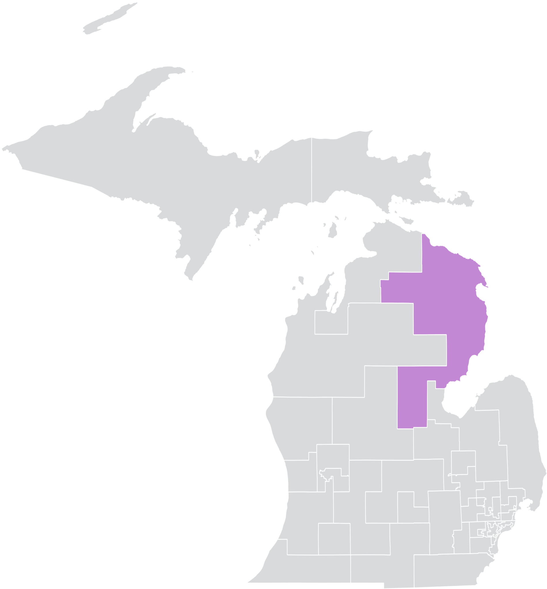
An outline of Michigan's 36th Senate district
Summary
[edit].png&action=edit§ion=1)
| Description |
English: An outline of Michigan's 36th Senate district, created using public data on QGIS. These district boundaries were drawn after the 2010 census and will be redrawn following the 2020 census. |
| Date | |
| Source | Own work |
| Author | Blizzardwind |
Licensing
[edit].png&action=edit§ion=2)
I, the copyright holder of this work, hereby publish it under the following license:
This file is licensed under the Creative Commons Attribution-Share Alike 4.0 International license.
- You are free:
- to share – to copy, distribute and transmit the work
- to remix – to adapt the work
- Under the following conditions:
- attribution – You must give appropriate credit, provide a link to the license, and indicate if changes were made. You may do so in any reasonable manner, but not in any way that suggests the licensor endorses you or your use.
- share alike – If you remix, transform, or build upon the material, you must distribute your contributions under the same or compatible license as the original.
File history
Click on a date/time to view the file as it appeared at that time.
| Date/Time | Thumbnail | Dimensions | User | Comment | |
|---|---|---|---|---|---|
| current | 00:40, 15 May 2020 | | 3,200 × 3,450 (689 KB) | Blizzardwind (talk | contribs) | Uploaded own work with UploadWizard |
You cannot overwrite this file.
File usage on Commons
The following page uses this file:
File usage on other wikis
The following other wikis use this file:
- Usage on en.wikipedia.org
Metadata
.png&oldid=786404897)
Categories:
- Maps of Alcona County, Michigan
- Maps of Alpena County, Michigan
- Maps of Arenac County, Michigan
- Maps of Gladwin County, Michigan
- Maps of Iosco County, Michigan
- Maps of Midland County, Michigan
- Maps of Montmorency County, Michigan
- Maps of Oscoda County, Michigan
- Maps of Otsego County, Michigan
- Maps of Presque Isle County, Michigan
- Maps of Michigan Senate districts from the 2011 Apportionment Plan