File:Michel Hollards Routen in die Schweiz.svg

Original file (SVG file, nominally 2,000 × 1,898 pixels, file size: 908 KB)
Captions
Captions
Summary
[edit]| Camera location | | View this and other nearby images on: OpenStreetMap |
|---|
| Description |
English:
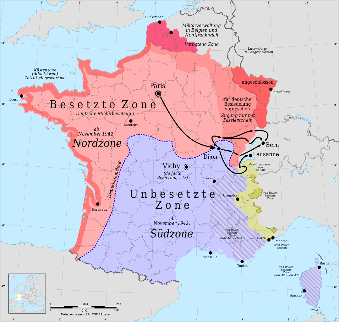
Routes of Michel Hollard from Paris via Dijon and the forbidden zone resp. the demarcation line to Berne and Lausanne. Deutsch: Routen von Michel Hollard von Paris über Dijon und die Sperrzone resp. Demarkationslinie nach Bern und Lausanne. |
| Date | |
| Source |
Own work This W3C-unspecified vector image was created with Inkscape .
|
| Author | |
| Other versions |
|

Licensing
[edit]
- You are free:
- to share – to copy, distribute and transmit the work
- to remix – to adapt the work
- Under the following conditions:
- attribution – You must give appropriate credit, provide a link to the license, and indicate if changes were made. You may do so in any reasonable manner, but not in any way that suggests the licensor endorses you or your use.
- share alike – If you remix, transform, or build upon the material, you must distribute your contributions under the same or compatible license as the original.

|
This media was created by Chriusha/Хрюша.
|
| Attribution (required by the license) | |
| Additional information: | |
|
The mentioned licence on my media is exclusively valid for the version and resolution up to the shown on Wikimedia Commons. Any other version of the shown media or higher resolution optionally available on another website is not included in this licencing and not allowed for free use. | |
|
The values of focal length and aperture in the metadata need to be read with precaution! |
| Annotations | This image is annotated: View the annotations at Commons |
File history
Click on a date/time to view the file as it appeared at that time.
| Date/Time | Thumbnail | Dimensions | User | Comment | |
|---|---|---|---|---|---|
| current | 09:14, 13 September 2010 | | 2,000 × 1,898 (908 KB) | Chriusha (talk | contribs) | == {{int:filedesc}} == {{Location|46|15|00|N|02|06|00|E|scale:10000000}} {{Information |Description={{en}}Routes of Michel Hollard from Paris via Dijon and the forbidden zone resp. the demarcation line to Berne and Lausanne. {{de}}R |
You cannot overwrite this file.
File usage on Commons
The following 2 pages use this file:
File usage on other wikis
The following other wikis use this file:
- Usage on de.wikipedia.org