File:Michael 2000 rainfall.gif
Jump to navigation
Jump to search

Size of this preview: 800 × 596 pixels. Other resolutions: 320 × 238 pixels | 640 × 476 pixels | 1,024 × 762 pixels | 1,280 × 953 pixels | 1,475 × 1,098 pixels.
Original file (1,475 × 1,098 pixels, file size: 46 KB, MIME type: image/gif)
Captions
Captions
Add a one-line explanation of what this file represents
Summary
[edit]
Summary
| Description |
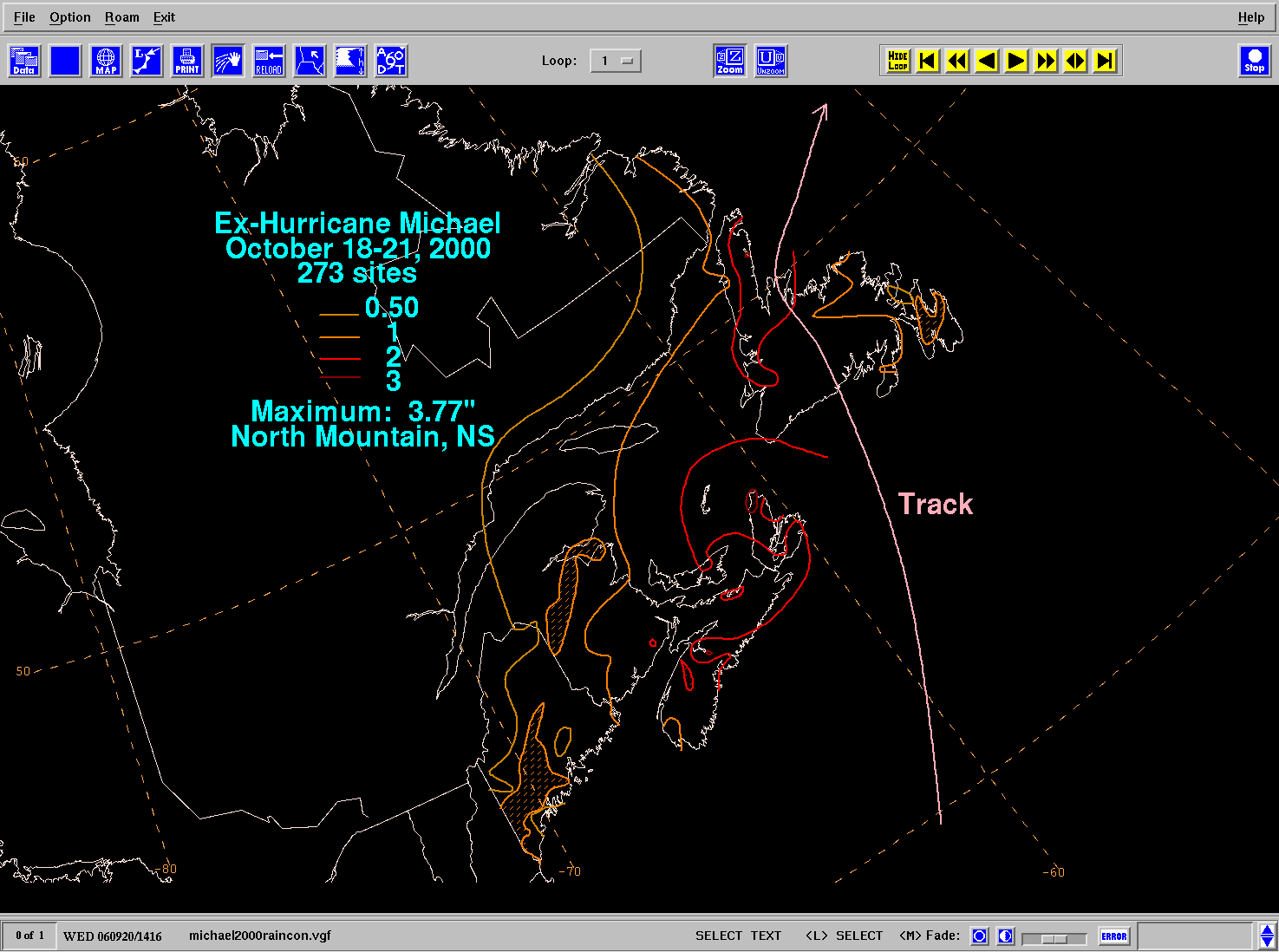
English: Storm total rainfall map of Hurricane Michael during October 2000. Français : Carte des accumulations de pluie associées avec l'ouragan Michael de la saison cyclonique 2000 dans l'Atlantique Nord. |
|||
| Date | ||||
| Source | WPC tropical cyclone rainfall data | |||
| Author | David Roth, Weather Prediction Center, Camp Springs, Maryland | |||
| Permission (Reusing this file) |
|
Derivative works of this file: Michael 2000 rainfall fr.png
Licensing
[edit]
This image is in the public domain because it contains materials that originally came from the U.S. National Oceanic and Atmospheric Administration, taken or made as part of an employee's official duties.
|
File history
Click on a date/time to view the file as it appeared at that time.
| Date/Time | Thumbnail | Dimensions | User | Comment | |
|---|---|---|---|---|---|
| current | 10:52, 17 March 2015 | | 1,475 × 1,098 (46 KB) | Cyclonebiskit (talk | contribs) | Reverted to version as of 22:29, 2 March 2012 |
| 04:53, 16 April 2012 |  | 790 × 519 (66 KB) | 12george1 (talk | contribs) | Cropped | |
| 22:51, 2 March 2012 |  | 1,475 × 1,098 (123 KB) | Pierre cb (talk | contribs) | {{fr|1=Rehaussement des zones colorées}} {{en|1=Coloring zones for better visualization}} | |
| 22:29, 2 March 2012 |  | 1,475 × 1,098 (46 KB) | Pierre cb (talk | contribs) |
You cannot overwrite this file.
File usage on Commons
The following 3 pages use this file:
- File:20120416045353!Michael2000rain.gif (file redirect)
- File:Michael2000rain.gif (file redirect)
- File:Michael 2000 rainfall fr.png
File usage on other wikis
The following other wikis use this file:
- Usage on en.wikipedia.org