File:MiG Alley Map (zh-hant).svg
Jump to navigation
Jump to search

Size of this PNG preview of this SVG file: 557 × 599 pixels. Other resolutions: 223 × 240 pixels | 446 × 480 pixels | 714 × 768 pixels | 952 × 1,024 pixels | 1,903 × 2,048 pixels | 696 × 749 pixels.
Original file (SVG file, nominally 696 × 749 pixels, file size: 130 KB)
Captions
Captions
Add a one-line explanation of what this file represents
Summary
[edit]| Description |
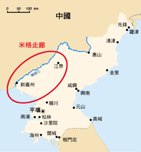
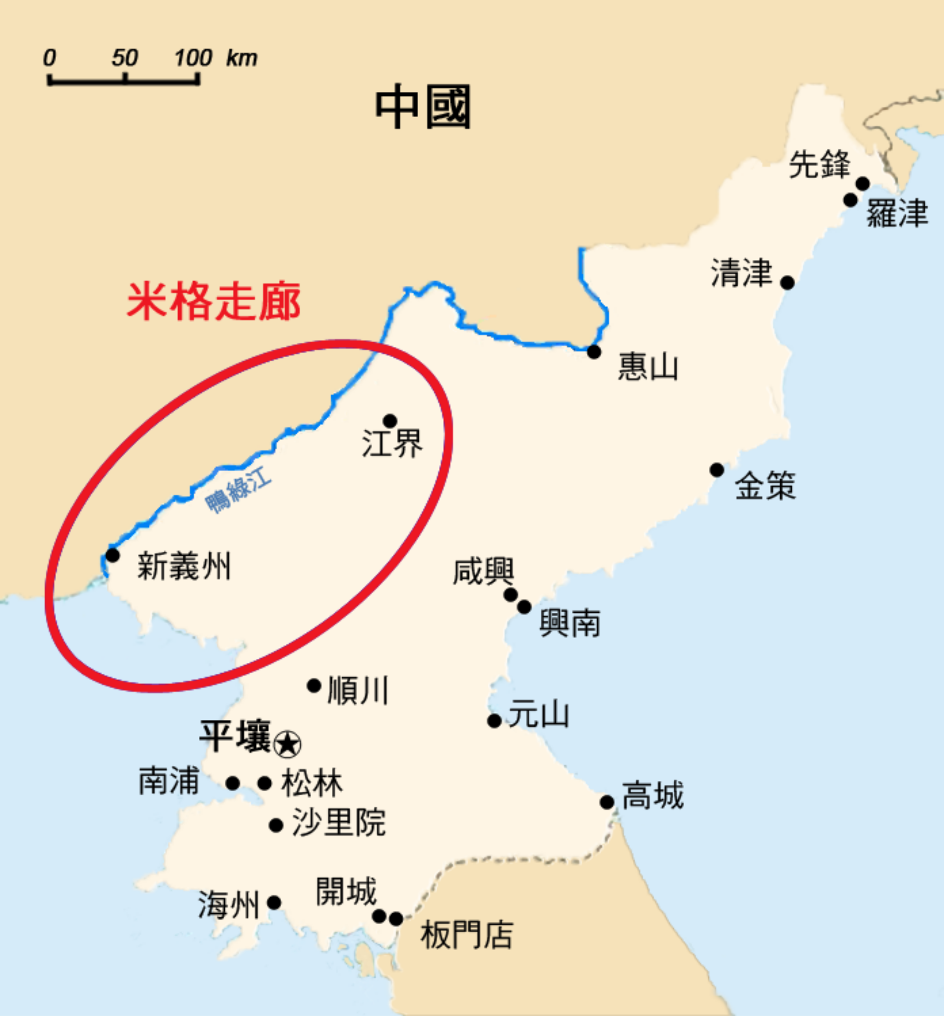
English: The area called "MiG Alley" during the Korean War (1950-53) on the Chinese-North Korean border.
中文(繁體):韓戰(1950年—1953年)期間名為「米格走廊」的中朝邊境沿線地區
|
| Typeface |
|
| Date | |
| Source |
This file was derived from: MiG Alley Map.JPG |
| Author |
|
| Other versions |
|
| SVG development |
.svg)
.svg)
.svg)
.svg)

.svg&action=edit§ion=1)
Licensing
[edit].svg&action=edit§ion=2)
| I, the copyright holder of this work, release this work into the public domain. This applies worldwide. In some countries this may not be legally possible; if so: I grant anyone the right to use this work for any purpose, without any conditions, unless such conditions are required by law. |
File history
Click on a date/time to view the file as it appeared at that time.
| Date/Time | Thumbnail | Dimensions | User | Comment | |
|---|---|---|---|---|---|
| current | 21:25, 14 June 2017 | | 696 × 749 (130 KB) | Howard61313 (talk | contribs) | new |
| 17:13, 14 June 2017 |  | 696 × 749 (131 KB) | Howard61313 (talk | contribs) | new | |
| 17:04, 14 June 2017 |  | 696 × 749 (132 KB) | Howard61313 (talk | contribs) | new | |
| 15:29, 14 June 2017 |  | 696 × 749 (132 KB) | Howard61313 (talk | contribs) | {{Information |Description={{en| The area called "MiG Alley" during the Korean War (1950-53) on the Chinese-North Korean border.}} {{zh-hant|1=韓戰(1950年—1953年)期間稱為「米格走廊」的中朝邊境沿線地區}} |Source={{Derived fr... |
You cannot overwrite this file.
File usage on Commons
The following 8 pages use this file:
.svg&oldid=704640762)