File:Międzyrzec Podlaski (gmina wiejska) location map.png

Original file (1,490 × 1,484 pixels, file size: 450 KB, MIME type: image/png)
Captions
Captions
Summary
[edit]_location_map.png&action=edit§ion=1)
| Description |
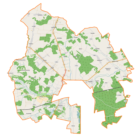
English: Location map |
| Date | |
| Source | Own work |
| Author | Smat |
| Description |
Polski: Mapa gminy wiejskiej Międzyrzec Podlaski, Polska
English: Map of Międzyrzec Podlaski (gmina wiejska), Poland |
|||||||||
| Date | ||||||||||
| Source | You may find a page on the OpenStreetMap wiki page for Międzyrzec Podlaski (gmina wiejska) | |||||||||
| Creator |
OpenStreetMap contributors OpenStreetMap contributors |
|||||||||
| Permission (Reusing this file) |
OpenStreetMap data is available under the Open Database License (details). Map tiles are licensed under the Creative Commons Attribution-ShareAlike 2.0 license (CC-BY-SA 2.0).
This file is licensed under the Creative Commons Attribution-Share Alike 2.0 Generic license.
|
|||||||||
| Geotemporal data | ||||||||||
| Bounding box |
|
|||||||||
| Georeferencing | If inappropriate please set warp_status = skip to hide. | |||||||||
Licensing
[edit]_location_map.png&action=edit§ion=2)
| This work contains information from OpenStreetMap, which is made available under the Open Database License (ODbL).
The ODbL does not require any particular license for maps produced from ODbL data. Prior to 1 August 2020, map tiles produced by the OpenStreetMap Foundation were licensed under the CC-BY-SA-2.0 license. Maps produced by other people may be subject to other licences. |
File history
Click on a date/time to view the file as it appeared at that time.
| Date/Time | Thumbnail | Dimensions | User | Comment | |
|---|---|---|---|---|---|
| current | 10:50, 23 August 2017 | | 1,490 × 1,484 (450 KB) | Smat (talk | contribs) | User created page with UploadWizard |
You cannot overwrite this file.
File usage on Commons
There are no pages that use this file.
File usage on other wikis
The following other wikis use this file:
- Usage on pl.wikipedia.org
- Międzyrzec Podlaski (gmina wiejska)
- Bereza (województwo lubelskie)
- Dołhołęka
- Halasy
- Jelnica
- Krzymoszyce
- Kolonia Wolańska
- Koszeliki
- Łukowisko
- Łuniew
- Manie
- Misie
- Pościsze
- Puchacze (województwo lubelskie)
- Rogoźnica-Kolonia
- Rogoźniczka
- Sawki
- Strzakły
- Tłuściec
- Tuliłów
- Utrówka
- Wólka Krzymowska
- Żabce
- Zasiadki
- Kożuszki (województwo lubelskie)
- Łuby (województwo lubelskie)
- Przychody (powiat bialski)
- Rogoźnica (województwo lubelskie)
- Rudniki (województwo lubelskie)
- Zaścianki (województwo lubelskie)
- Krzewica (powiat bialski)
- Rzeczyca (powiat bialski)
- Sitno (powiat bialski)
- Wysokie (powiat bialski)
- Zawadki (powiat bialski)
- Parafia Niepokalanego Poczęcia Najświętszej Maryi Panny w Kożuszkach
- Parafia Matki Bożej Szkaplerznej w Krzewicy
- Przyłuki (województwo lubelskie)
- Misie (przystanek kolejowy)
- Sitno (przystanek kolejowy)
- Parafia Matki Bożej Nieustającej Pomocy w Maniach
- Moduł:Mapa/dane/Międzyrzec Podlaski (gmina wiejska)
- Cmentarz wojenny w Tuliłowie
- Usage on pl.wikibooks.org
_location_map.png&oldid=708056947)