File:Mexico Michoacan Alvaro Obregon location map.svg
Jump to navigation
Jump to search

Size of this PNG preview of this SVG file: 800 × 566 pixels. Other resolutions: 320 × 227 pixels | 640 × 453 pixels | 1,024 × 725 pixels | 1,280 × 906 pixels | 2,560 × 1,812 pixels | 3,532 × 2,500 pixels.
Original file (SVG file, nominally 3,532 × 2,500 pixels, file size: 1.26 MB)
Captions
Captions
Add a one-line explanation of what this file represents
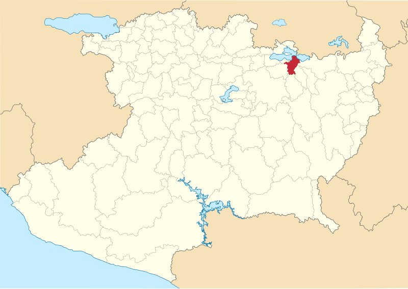
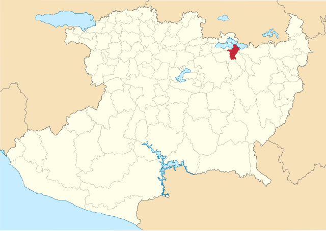
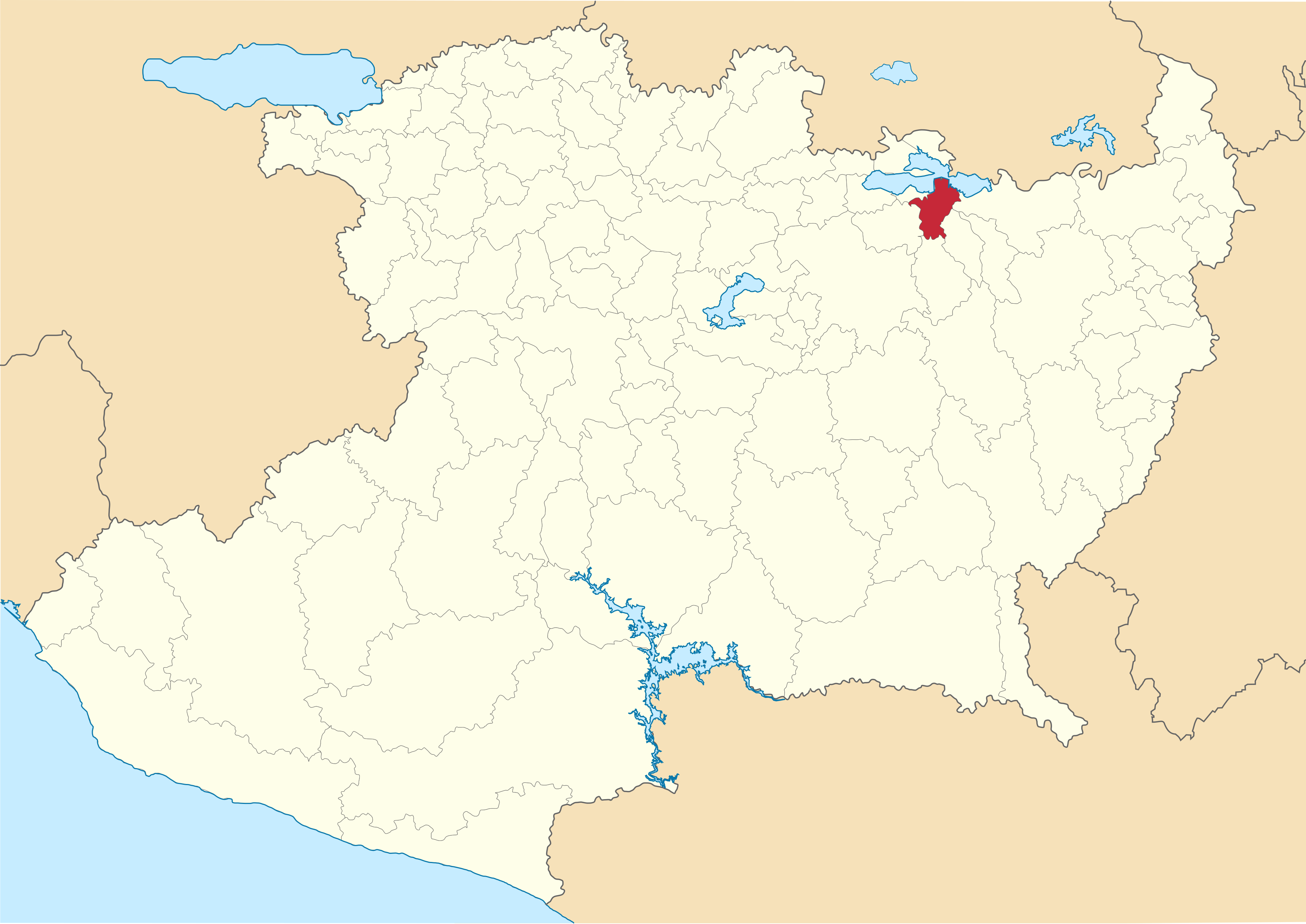
| Description | Mapa de localización del municipio de Álvaro Obregón en estado de Michoacán, México. | ||
| Date | |||
| Source |
Own work This W3C-unspecified vector image was created with Inkscape . |
||
| Author | Battroid | ||
| Permission (Reusing this file) |
|
File history
Click on a date/time to view the file as it appeared at that time.
| Date/Time | Thumbnail | Dimensions | User | Comment | |
|---|---|---|---|---|---|
| current | 17:16, 7 August 2016 | | 3,532 × 2,500 (1.26 MB) | Battroid (talk | contribs) | {{Information |Description=Mapa de localización del municipio de Álvaro Obregón en estado de Michoacán, México. |Source={{own}} {{Inkscape}} |Date=2016-08-07 |Author= Battroid |Permission={{PD-self}} |other_versions= }} [[Catego... |
You cannot overwrite this file.
File usage on Commons
There are no pages that use this file.
File usage on other wikis
The following other wikis use this file:
- Usage on en.wikipedia.org
- Usage on it.wikipedia.org