File:Mexico-2669 - Palenque (2213894589).jpg
Original file (3,308 × 2,506 pixels, file size: 7.78 MB, MIME type: image/jpeg)
Captions
Captions
Summary
[edit]| Description |
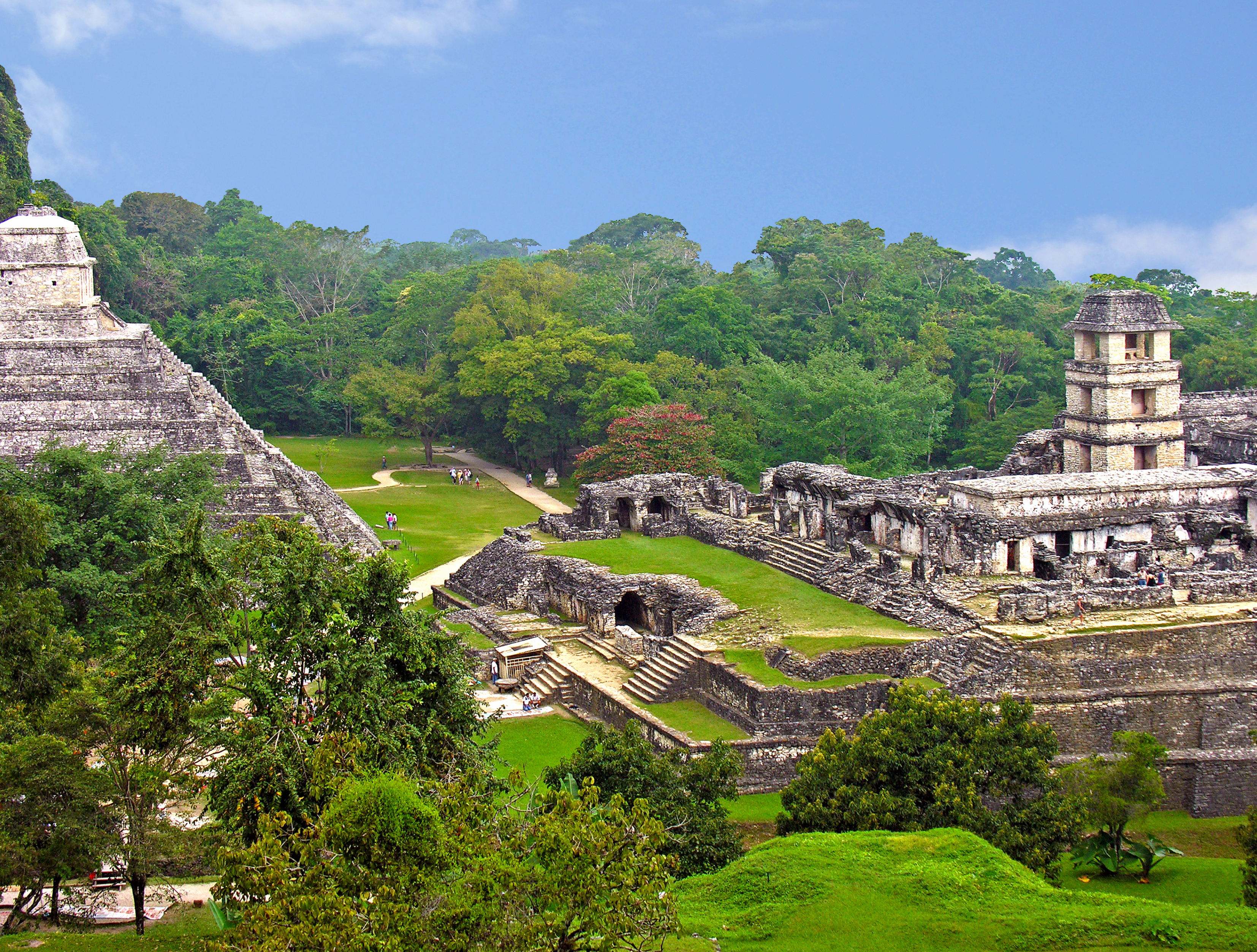
English: English: The Mayan site of Palenque - View from the Temple of the Cross, Palace complex to the right and Temple of Inscriptions to the left.
Palenque is a Spanish word for "fortification". An ancient name for the city was Lakam Ha, which translates as "Great Water", for the springs and small rivers which flow from the site. Palenque is definitely one of the most beautiful sites in all of Mesoamerica. The richest and most elaborate tomb ever discovered in Mexico is located in the Temple of Inscriptions at Palenque. Lord Pakal's tomb is now closed as is the Temple of Inscriptions. The first permanent settlement of Palenque was about 300 AD. The apex of Maya civilization begins about 600 AD. During the next hundred years, the rulers of Palenque commissioned some of the best Maya artwork discovered. Most of the great structures in Palenque's central area date from this time period. These works were built by the two greatest Palenque rulers, K'inich Janaab' Pakal I and his oldest son, K’inich Kan B’alam II. After 731 AD. most construction had stopped. Unfortunately, Palenque's best known 8th century ruler, K'inich K'an Joy Chitam II, is famous only for his defeat and capture in 711 AD by the new military power of Tonina. By 810 AD. the ritual activity in Palenque comes to an end. Then by 900 AD. Palenque becomes deserted and reclaimed by the forest. |
||||||||||||||
| Date | |||||||||||||||
| Source | Mexico-2669 - Palenque | ||||||||||||||
| Author |
|
||||||||||||||
.jpg)
.jpg&action=edit§ion=1)
| Camera location | | View this and other nearby images on: OpenStreetMap |
|---|
.jpg¶ms=017.376852_N_-091.996765_E_globe:Earth_type:camera_source:Flickr_&language=en)
Licensing
[edit].jpg&action=edit§ion=2)
- You are free:
- to share – to copy, distribute and transmit the work
- to remix – to adapt the work
- Under the following conditions:
- attribution – You must give appropriate credit, provide a link to the license, and indicate if changes were made. You may do so in any reasonable manner, but not in any way that suggests the licensor endorses you or your use.
- share alike – If you remix, transform, or build upon the material, you must distribute your contributions under the same or compatible license as the original.
| This image was originally posted to Flickr by archer10 (Dennis) REPOSTING at https://www.flickr.com/photos/22490717@N02/2213894589. It was reviewed on 28 May 2015 by FlickreviewR and was confirmed to be licensed under the terms of the cc-by-sa-2.0. |
File history
Click on a date/time to view the file as it appeared at that time.
| Date/Time | Thumbnail | Dimensions | User | Comment | |
|---|---|---|---|---|---|
| current | 16:28, 28 May 2015 | | 3,308 × 2,506 (7.78 MB) | Wilfredor (talk | contribs) | Transferred from Flickr via Flickr2Commons |
You cannot overwrite this file.
File usage on Commons
There are no pages that use this file.
File usage on other wikis
The following other wikis use this file:
- Usage on en.wikibooks.org
- Usage on es.wikipedia.org
- Usage on ko.wikipedia.org
- Usage on pt.wikipedia.org
.jpg&oldid=910905600)