File:Mettingen Westerkappelner Strasse 07.jpg
Jump to navigation
Jump to search
Size of this preview: 800 × 597 pixels. Other resolutions: 320 × 239 pixels | 640 × 477 pixels | 1,024 × 764 pixels | 1,280 × 955 pixels | 2,560 × 1,909 pixels | 4,784 × 3,568 pixels.
Original file (4,784 × 3,568 pixels, file size: 7.1 MB, MIME type: image/jpeg)
Captions
Captions
Add a one-line explanation of what this file represents
Summary
[edit]
| Description |
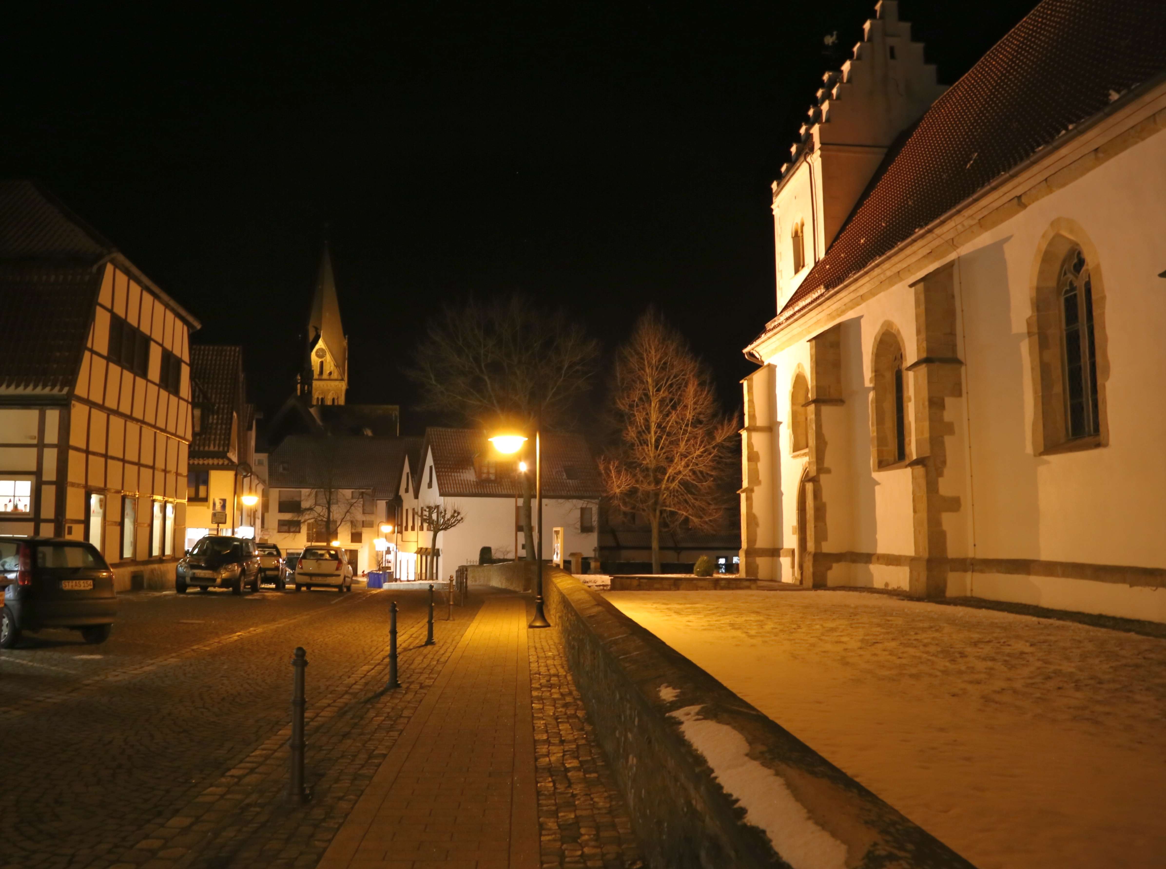
English: Westerkappelner Straße (Westerkappeln Street) in Mettingen, Kreis Steinfurt, North Rhine-Westphalia, Germany. The picture shows three cultural heritage monuments: the timber framed house “Kapellchen” (left), the Saint Agatha Church (center) and the Protestant Church (right).
Deutsch: Die Westerkappelner Straße im Ortskern von Mettingen, Kreis Steinfurt, Nordrhein-Westfalen, Deutschland. Das Bild zeigt drei unter Denkmalschutz stehende Gebäude: das Fachwerkhaus “Kapellchen” (links), die römisch-katholische Pfarrkirche St. Agatha (Mitte) und die Evangelische Kirche (rechts).
This is a photograph of an architectural monument.
It is on the list of cultural monuments of Mettingen, no. 01. This is a photograph of an architectural monument.
It is on the list of cultural monuments of Mettingen, no. 02. This is a photograph of an architectural monument. It is on the list of cultural monuments of Mettingen, no. 08. |
| Date | |
| Source | Own work |
| Author | J.-H. Janßen |
| Camera location | | View this and other nearby images on: OpenStreetMap |
|---|
Licensing
[edit]
I, the copyright holder of this work, hereby publish it under the following licenses:

|
Permission is granted to copy, distribute and/or modify this document under the terms of the GNU Free Documentation License, Version 1.2 or any later version published by the Free Software Foundation; with no Invariant Sections, no Front-Cover Texts, and no Back-Cover Texts. A copy of the license is included in the section entitled GNU Free Documentation License. |
This file is licensed under the Creative Commons Attribution-Share Alike 3.0 Unported, 2.5 Generic, 2.0 Generic and 1.0 Generic license.
- You are free:
- to share – to copy, distribute and transmit the work
- to remix – to adapt the work
- Under the following conditions:
- attribution – You must give appropriate credit, provide a link to the license, and indicate if changes were made. You may do so in any reasonable manner, but not in any way that suggests the licensor endorses you or your use.
- share alike – If you remix, transform, or build upon the material, you must distribute your contributions under the same or compatible license as the original.
You may select the license of your choice.
| Annotations | This image is annotated: View the annotations at Commons |
File history
Click on a date/time to view the file as it appeared at that time.
| Date/Time | Thumbnail | Dimensions | User | Comment | |
|---|---|---|---|---|---|
| current | 21:14, 15 March 2013 | | 4,784 × 3,568 (7.1 MB) | J.-H. Janßen (talk | contribs) | {{Information |Description={{en|1=Westerkappelner Straße (''Westerkappeln Street'') in Mettingen, Kreis Steinfurt, North Rhine-Westphalia, Germany. The picture shows three cultural heritage monuments: the timber fra... |
You cannot overwrite this file.
File usage on Commons
There are no pages that use this file.