File:Metropolitan Road Guide 1959, Fremantle (p45).png
Jump to navigation
Jump to search
Size of this preview: 800 × 544 pixels. Other resolutions: 320 × 217 pixels | 640 × 435 pixels | 1,024 × 696 pixels | 1,280 × 870 pixels | 2,560 × 1,740 pixels | 4,415 × 3,000 pixels.
Original file (4,415 × 3,000 pixels, file size: 64.38 MB, MIME type: image/png)
Captions
Captions
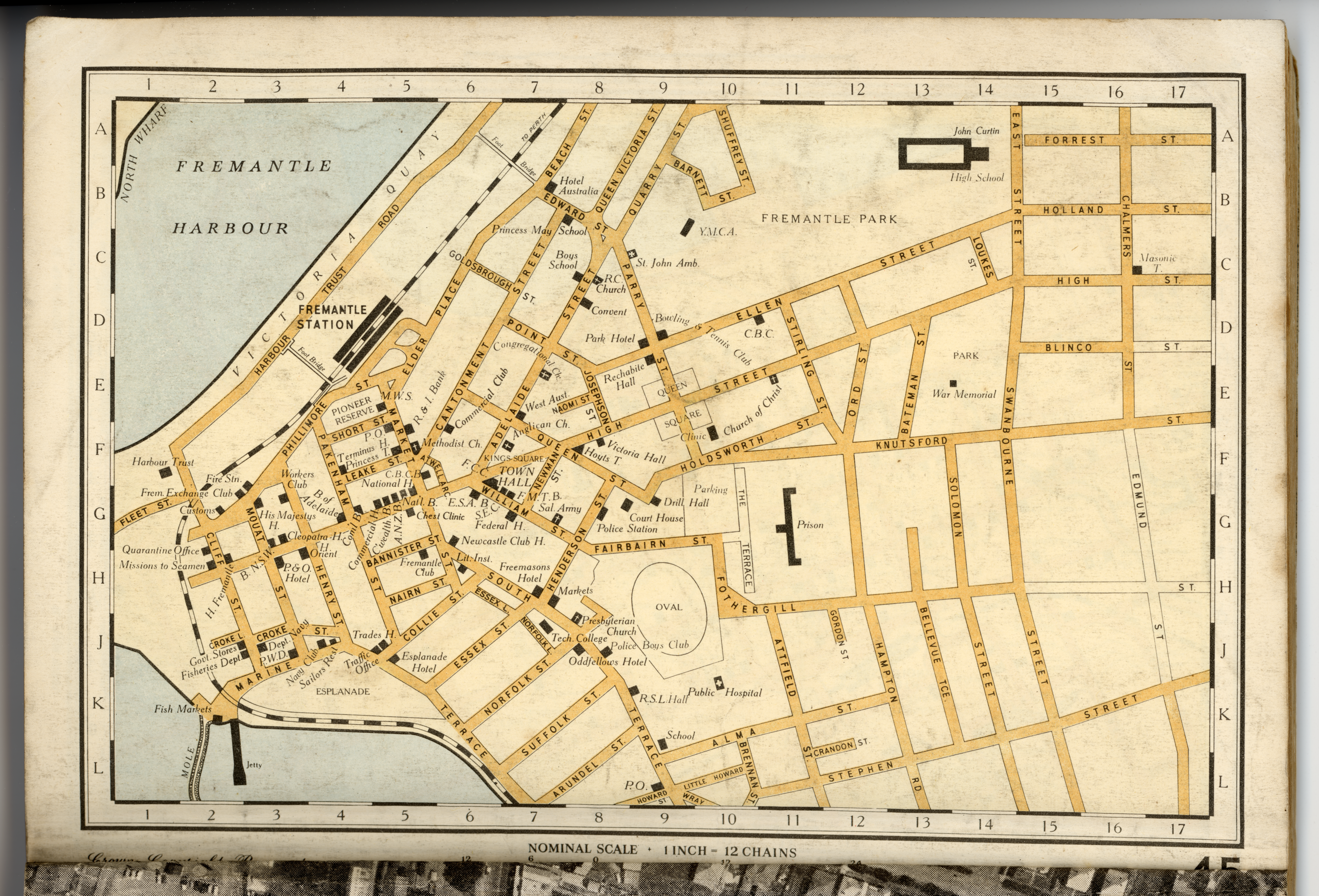
Page from the 6th edition of the Metropolitan Road Guide to Perth, Western Australia (February 1959).
Summary
[edit].png&action=edit§ion=1)
Licensing
[edit].png&action=edit§ion=2)
This image or other work is of Australian origin and is now in the public domain because its term of copyright has expired. According to the Australian Copyright Council (ACC), ACC Information Sheet G023v19 (Duration of copyright) (January 2019).1
When using this template, please provide information of where the image was first published and who created it. |
 | |||||||||||||||||||
File history
Click on a date/time to view the file as it appeared at that time.
| Date/Time | Thumbnail | Dimensions | User | Comment | |
|---|---|---|---|---|---|
| current | 10:28, 11 October 2022 | | 4,415 × 3,000 (64.38 MB) | Samwilson (talk | contribs) | Uploaded a work by J.M. Ryan, Superintendent of Mapping from Department of Lands and Surveys, Western Australia with UploadWizard |
You cannot overwrite this file.
File usage on Commons
There are no pages that use this file.
.png&oldid=695632501)