File:Methley Junction railway station (site), Yorkshire (geograph 3468676).jpg
Jump to navigation
Jump to search
Size of this preview: 800 × 600 pixels. Other resolutions: 320 × 240 pixels | 640 × 480 pixels | 1,024 × 768 pixels.
Original file (1,024 × 768 pixels, file size: 165 KB, MIME type: image/jpeg)
Captions
Captions
Add a one-line explanation of what this file represents
Summary
[edit],_Yorkshire_(geograph_3468676).jpg&action=edit§ion=1)
| Description |
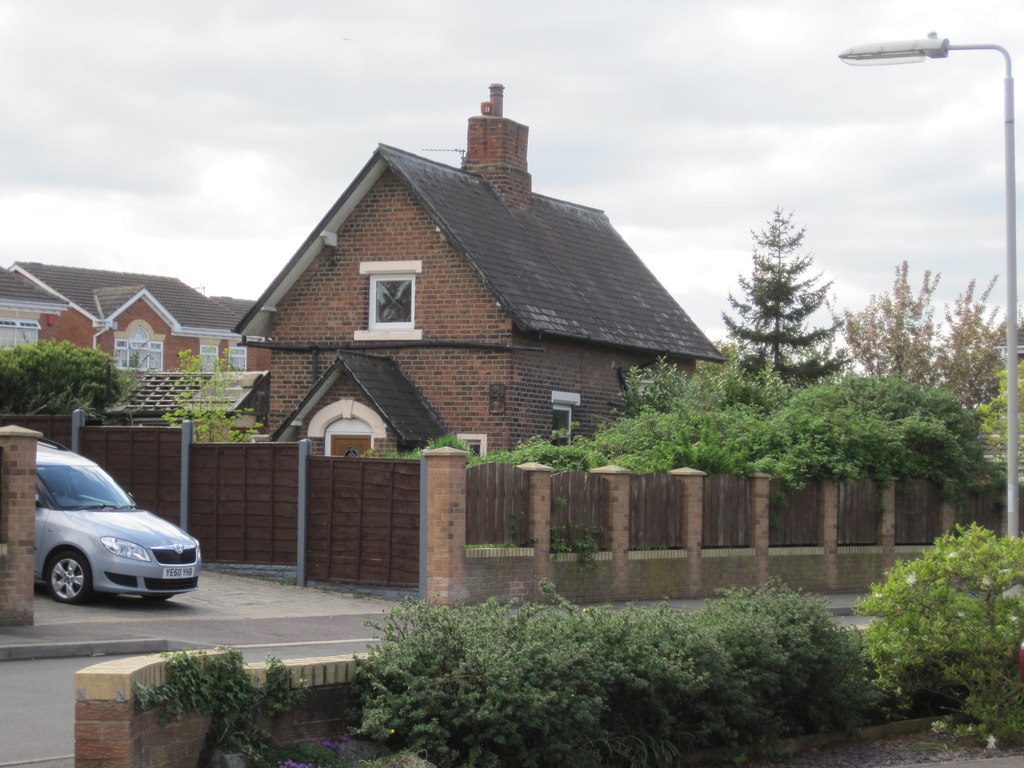
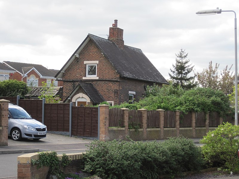
English: Methley Junction railway station (site), Yorkshire Opened in 1849 by the Lancashire & Yorkshire Railway on its line from Methley North to Castleford Cutsyke, this station closed to passengers in 1943. It was one of a trio of stations to serve Methley. Now there are none, and this building is situated in the middle of a housing estate. The line used to run roughly where the road now is. |
| Date | |
| Source | From geograph.org.uk |
| Author | Nigel Thompson |
| Permission (Reusing this file) |
Creative Commons Attribution Share-alike license 2.0 |
| Attribution (required by the license) | Nigel Thompson / Methley Junction railway station (site), Yorkshire / |
| Camera location | | View this and other nearby images on: OpenStreetMap |
|---|
,_Yorkshire_(geograph_3468676).jpg¶ms=053.727726_N_-001.399915_E_globe:Earth_type:camera_heading:292.00_source:geograph&language=en)
| Object location | | View this and other nearby images on: OpenStreetMap |
|---|
,_Yorkshire_(geograph_3468676).jpg¶ms=053.727860_N_-001.400400_E_globe:Earth_class:object_type:object_source:geograph-osgb36(SE39652588)_region:GB-GBN_heading:292.00&language=en)
Licensing
[edit],_Yorkshire_(geograph_3468676).jpg&action=edit§ion=2)

|
This image was taken from the Geograph project collection. See this photograph's page on the Geograph website for the photographer's contact details. The copyright on this image is owned by Nigel Thompson and is licensed for reuse under the Creative Commons Attribution-ShareAlike 2.0 license.
|
This file is licensed under the Creative Commons Attribution-Share Alike 2.0 Generic license.
Attribution: Nigel Thompson
- You are free:
- to share – to copy, distribute and transmit the work
- to remix – to adapt the work
- Under the following conditions:
- attribution – You must give appropriate credit, provide a link to the license, and indicate if changes were made. You may do so in any reasonable manner, but not in any way that suggests the licensor endorses you or your use.
- share alike – If you remix, transform, or build upon the material, you must distribute your contributions under the same or compatible license as the original.
File history
Click on a date/time to view the file as it appeared at that time.
| Date/Time | Thumbnail | Dimensions | User | Comment | |
|---|---|---|---|---|---|
| current | 06:53, 22 May 2017 | | 1,024 × 768 (165 KB) | Schlosser67 (talk | contribs) | Transferred from geograph.co.uk using [https://tools.wmflabs.org/geograph2commons/ geograph2commons] |
You cannot overwrite this file.
File usage on Commons
The following page uses this file:
File usage on other wikis
The following other wikis use this file:
- Usage on en.wikipedia.org
- Usage on www.wikidata.org
,_Yorkshire_(geograph_3468676).jpg&oldid=933954572)