File:Merida, Mexico ESA216551.jpg
Jump to navigation
Jump to search
Size of this preview: 800 × 560 pixels. Other resolutions: 320 × 224 pixels | 640 × 448 pixels | 926 × 648 pixels.
Original file (926 × 648 pixels, file size: 119 KB, MIME type: image/jpeg)
Captions
Captions
Add a one-line explanation of what this file represents
Summary
[edit]| Description |
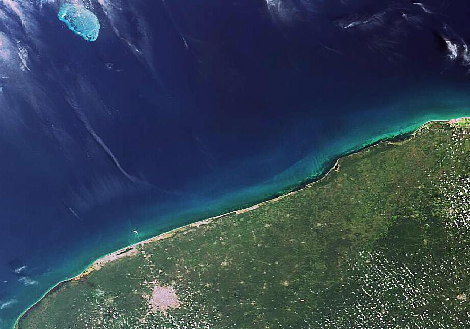
English: The northern tip of Mexico’s Yucatan Peninsula, a northeastern projection of Central America, is visible in this Envisat image. Merida, the Yucatan state capital, is clearly seen as a large whitish area to the west some 35 km from the Gulf of Mexico. |
| Date | |
| Source | http://www.esa.int/spaceinimages/Images/2007/05/Merida_Mexico |
| Author | European Space Agency |
| Permission (Reusing this file) |
ESA,CC BY-SA 3.0 IGO |
| Other versions |
|
| Title | Merida, Mexico |
| Keywords | Oceans and coastal zones; Land use |
| Set | Earth observation image of the week |
| Mission | Envisat |
| Activity | Observing the Earth |

Licensing
[edit]
This file is licensed under the Creative Commons Attribution-ShareAlike 3.0 IGO license.
Attribution: ESA
- You are free:
- to share – to copy, distribute and transmit the work
- to remix – to adapt the work
- Under the following conditions:
- attribution – You must give appropriate credit, provide a link to the license, and indicate if changes were made. You may do so in any reasonable manner, but not in any way that suggests the licensor endorses you or your use.
- share alike – If you remix, transform, or build upon the material, you must distribute your contributions under the same or compatible license as the original.
File history
Click on a date/time to view the file as it appeared at that time.
| Date/Time | Thumbnail | Dimensions | User | Comment | |
|---|---|---|---|---|---|
| current | 19:32, 24 May 2017 | | 926 × 648 (119 KB) | Fæ (talk | contribs) | European Space Agency, Id 216551, http://www.esa.int/spaceinimages/Images/2007/05/Merida_Mexico, User:Fæ/Project_list/ESA |
You cannot overwrite this file.
File usage on Commons
The following page uses this file: