File:Mennonite house in Żuławki.jpg
From Wikimedia Commons, the free media repository
Jump to navigation
Jump to search
Size of this preview: 800 × 532 pixels. Other resolutions: 320 × 213 pixels | 640 × 426 pixels | 1,024 × 682 pixels | 1,280 × 852 pixels | 2,560 × 1,704 pixels | 3,648 × 2,428 pixels.
Original file (3,648 × 2,428 pixels, file size: 1.32 MB, MIME type: image/jpeg)
File information
Structured data
Captions
Summary
[edit]DescriptionMennonite house in Żuławki.jpg |
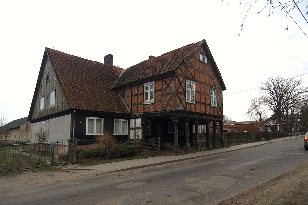
English: Mennonite house in Żuławki. Polski: Żuławki - dom podcieniowy nr 32/33, 1797, 1851 |
Date | |
Source | p4029826 |
Author | tomasz przechlewski from Sopot, Poland |
Camera location | 54° 16′ 58.98″ N, 18° 58′ 07.83″ E | View this and other nearby images on: OpenStreetMap | 54.283050; 18.968841 |
---|
Licensing
[edit]This file is licensed under the Creative Commons Attribution 2.0 Generic license.
- You are free:
- to share – to copy, distribute and transmit the work
- to remix – to adapt the work
- Under the following conditions:
- attribution – You must give appropriate credit, provide a link to the license, and indicate if changes were made. You may do so in any reasonable manner, but not in any way that suggests the licensor endorses you or your use.
This image, originally posted to Flickr, was reviewed on 9 December 2011 by the administrator or reviewer Morning Sunshine, who confirmed that it was available on Flickr under the stated license on that date. |
File history
Click on a date/time to view the file as it appeared at that time.
Date/Time | Thumbnail | Dimensions | User | Comment | |
---|---|---|---|---|---|
current | 10:54, 9 December 2011 | 3,648 × 2,428 (1.32 MB) | Artur Andrzej (talk | contribs) | {{Information |Description=Mennonite house in Drewnica. |Source=[http://www.flickr.com/photos/tprzechlewski/4484145959/ p4029826] |Date=2010-04-02 14:45 |Author=[http://www.flickr.com/people/20425995@N00 tomasz przechlewski] from Sopot, Poland |Permission |
You cannot overwrite this file.
File usage on Commons
There are no pages that use this file.
Metadata
This file contains additional information such as Exif metadata which may have been added by the digital camera, scanner, or software program used to create or digitize it. If the file has been modified from its original state, some details such as the timestamp may not fully reflect those of the original file. The timestamp is only as accurate as the clock in the camera, and it may be completely wrong.
Image title | OLYMPUS DIGITAL CAMERA |
---|---|
Camera manufacturer | OLYMPUS IMAGING CORP. |
Camera model | E-510 |
Author | Creator: Tomasz Przechlewski |
Copyright holder | Licence: CC Attribution |
Exposure time | 1/640 sec (0.0015625) |
F-number | f/2.8 |
ISO speed rating | 100 |
Date and time of data generation | 14:45, 2 April 2010 |
Lens focal length | 11 mm |
User comments | house, werder, żuławy, arcade house, dom podcieniowy |
Latitude | 54° 16′ 58.98″ N |
Longitude | 18° 58′ 7.83″ E |
Altitude | 2 meters below sea level |
Orientation | Normal |
Horizontal resolution | 314 dpi |
Vertical resolution | 314 dpi |
Software used | Microsoft Windows Photo Gallery 6.0.6001.18000 |
File change date and time | 11:52, 9 December 2011 |
Y and C positioning | Co-sited |
Exposure Program | Creative program (biased toward depth of field) |
Exif version | 2.21 |
Date and time of digitizing | 14:45, 2 April 2010 |
Meaning of each component |
|
APEX exposure bias | 0 |
Maximum land aperture | 2.97265625 APEX (f/2.8) |
Metering mode | Pattern |
Light source | Unknown |
Flash | Flash did not fire, auto mode |
Supported Flashpix version | 1 |
File source | Digital still camera |
Custom image processing | Normal process |
Exposure mode | Auto exposure |
White balance | Auto white balance |
Digital zoom ratio | 1 |
Scene capture type | Standard |
Scene control | None |
Contrast | Normal |
Saturation | High saturation |
Sharpness | Normal |
Unique image ID | C8FF5C0D8E1C46B1941DA62F81214AA6 |
GPS time (atomic clock) | 13:39 |
Reference for direction of image | True direction |
Direction of image | 0 |
Geodetic survey data used | WGS-84 |
GPS date | 2 April 2010 |
GPS tag version | 2.2.0.0 |
Special instructions | Lat 54.283050969, Lon 18.968842747 - Bearing: 0 - Altitude: -2m |
IIM version | 4 |
Structured data
Items portrayed in this file
depicts
some value
2 April 2010
54°16'58.98"N, 18°58'7.82"E
1,384,228 byte
2,428 pixel
3,648 pixel
image/jpeg
95e98e057c0a9b2323976c13367977f75e922585
0.0015625 second
2.8
100
11 millimetre
Hidden categories: