File:Megi 2016-09-27 0400Z.png
Jump to navigation
Jump to search

Size of this preview: 450 × 600 pixels. Other resolutions: 180 × 240 pixels | 360 × 480 pixels | 576 × 768 pixels | 768 × 1,024 pixels | 1,800 × 2,400 pixels.
Original file (1,800 × 2,400 pixels, file size: 6.92 MB, MIME type: image/png)
Captions
Captions
Add a one-line explanation of what this file represents
Summary
[edit]| Description |
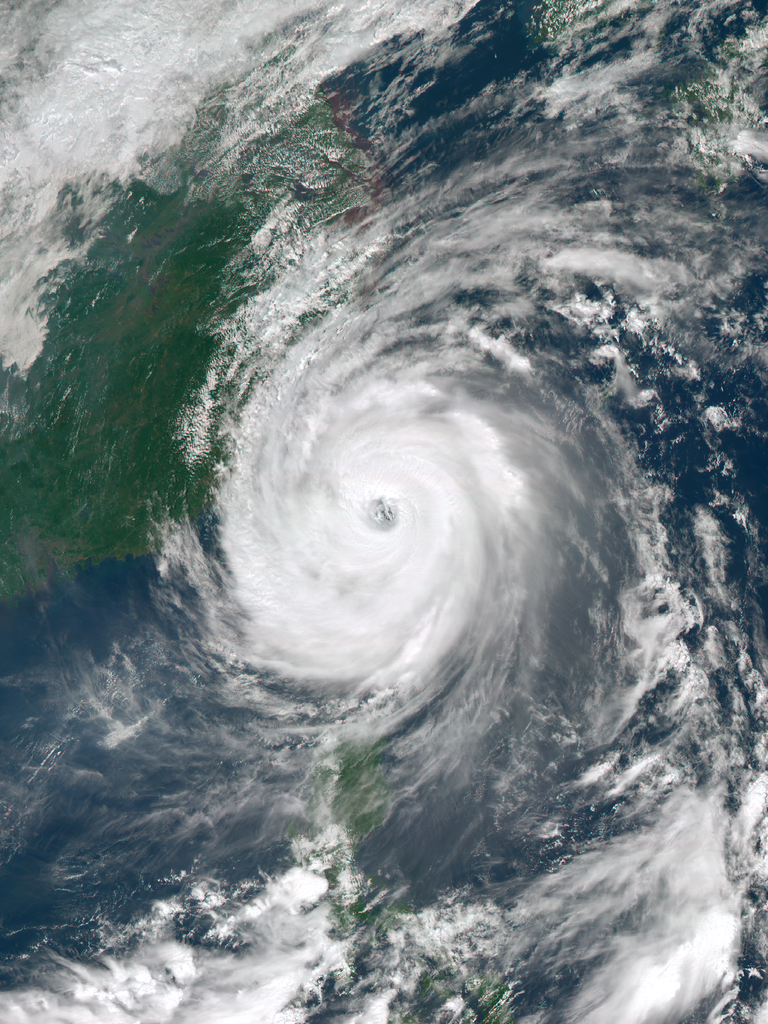
English: Typhoon Megi making landfall over Taiwan at peak intensity on September 27, 2016. |
| Date | |
| Source | RealEarth™ |
| Author | AHI image captured by the Japan Meteorology Agency’s Himawari-8 satellite |
| Camera location | | View this and other nearby images on: OpenStreetMap |
|---|
Licensing
[edit]This image was produced by the SSEC/CIMSS, University of Wisconsin–Madison. All the images published on their website can be freely used, as long as the source is acknowledged. (disclaimer (archive))
|
 |

File history
Click on a date/time to view the file as it appeared at that time.
| Date/Time | Thumbnail | Dimensions | User | Comment | |
|---|---|---|---|---|---|
| current | 05:23, 27 September 2016 | | 1,800 × 2,400 (6.92 MB) | Meow (talk | contribs) | User created page with UploadWizard |
You cannot overwrite this file.
File usage on Commons
The following 2 pages use this file:
File usage on other wikis
The following other wikis use this file:
- Usage on de.wikipedia.org
- Usage on en.wikipedia.org
- Usage on ja.wikipedia.org
- Usage on th.wikipedia.org
- Usage on www.wikidata.org
- Usage on zh-min-nan.wikipedia.org
- Usage on zh.wikipedia.org