File:Mega corridors MAP.jpg
Jump to navigation
Jump to search
Size of this preview: 660 × 600 pixels. Other resolutions: 264 × 240 pixels | 528 × 480 pixels | 846 × 768 pixels | 1,113 × 1,011 pixels.
Original file (1,113 × 1,011 pixels, file size: 117 KB, MIME type: image/jpeg)
Captions
Captions
Add a one-line explanation of what this file represents
Summary
[edit]
| Description |
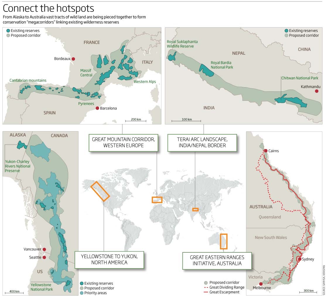
English: Conservation on a mega scale map from Megaconservation article pp.40-43. |
| Date | |
| Source | Jim Giles. (25 March) 2009. Megaconservation: Saving wildernesses on a giant scale. NewScientist Weekly |
| Author | Jim Giles, Map Source: Samhsa, Verispan |
Licensing
[edit]

|
The copyright holder of this file allows anyone to use it for any purpose, provided that the copyright holder is properly attributed. Redistribution, derivative work, commercial use, and all other use is permitted. |
|
|
File history
Click on a date/time to view the file as it appeared at that time.
| Date/Time | Thumbnail | Dimensions | User | Comment | |
|---|---|---|---|---|---|
| current | 19:50, 14 September 2009 | | 1,113 × 1,011 (117 KB) | ELHF (talk | contribs) | {{Information |Description= Conservation on a mega scale, Map |Source=NewScientist Weekly |Date=25 March 2009 |Author=Jimm Giles, Map Source:Samhsa, Verispan |Permission= |other_versions= }} Category:Conservation |
You cannot overwrite this file.
File usage on Commons
There are no pages that use this file.
File usage on other wikis
The following other wikis use this file:
- Usage on en.wikipedia.org
- Usage on fr.wikipedia.org