File:Meeting of the Great Rivers Scenic Rte-20140421-047.jpg
From Wikimedia Commons, the free media repository
Jump to navigation
Jump to search
![File:Meeting of the Great Rivers Scenic Rte-20140421-047.jpg](https://upload.wikimedia.org/wikipedia/commons/thumb/3/3f/Meeting_of_the_Great_Rivers_Scenic_Rte-20140421-047.jpg/800px-Meeting_of_the_Great_Rivers_Scenic_Rte-20140421-047.jpg?20150421175621)
Size of this preview: 800 × 450 pixels. Other resolutions: 320 × 180 pixels | 640 × 360 pixels | 1,024 × 576 pixels | 1,280 × 720 pixels | 2,560 × 1,440 pixels | 4,608 × 2,592 pixels.
Original file (4,608 × 2,592 pixels, file size: 3.23 MB, MIME type: image/jpeg)
File information
Structured data
Captions
Captions
Add a one-line explanation of what this file represents
Summary
[edit]DescriptionMeeting of the Great Rivers Scenic Rte-20140421-047.jpg |
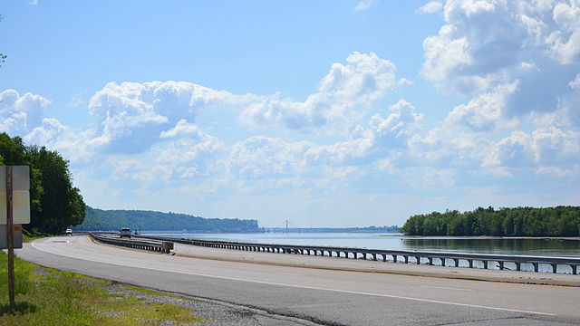
English: Illinois Route 100 below Godfrey, Illinois along the Mississippi River, part of the Meeting of the Great Rivers Scenic Route section of the Great River Road. |
Date | |
Source | Own work |
Author | Kbh3rd |
Camera location | 38° 56′ 06.07″ N, 90° 16′ 26.94″ W ![]() ![]() | View this and other nearby images on: OpenStreetMap | ![]() |
---|
![](https://upload.wikimedia.org/wikipedia/commons/thumb/2/23/Nikon_D3100.jpg/28px-Nikon_D3100.jpg)
This photograph was taken with a Nikon D3100
Licensing
[edit]I, the copyright holder of this work, hereby publish it under the following license:
![w:en:Creative Commons](https://upload.wikimedia.org/wikipedia/commons/thumb/7/79/CC_some_rights_reserved.svg/90px-CC_some_rights_reserved.svg.png)
![attribution](https://upload.wikimedia.org/wikipedia/commons/thumb/1/11/Cc-by_new_white.svg/24px-Cc-by_new_white.svg.png)
This file is licensed under the Creative Commons Attribution 4.0 International license.
- You are free:
- to share – to copy, distribute and transmit the work
- to remix – to adapt the work
- Under the following conditions:
- attribution – You must give appropriate credit, provide a link to the license, and indicate if changes were made. You may do so in any reasonable manner, but not in any way that suggests the licensor endorses you or your use.
File history
Click on a date/time to view the file as it appeared at that time.
Date/Time | Thumbnail | Dimensions | User | Comment | |
---|---|---|---|---|---|
current | 17:56, 21 April 2015 | ![]() | 4,608 × 2,592 (3.23 MB) | Kbh3rd (talk | contribs) | User created page with UploadWizard |
You cannot overwrite this file.
File usage on Commons
The following page uses this file:
File usage on other wikis
The following other wikis use this file:
- Usage on en.wikipedia.org
Metadata
This file contains additional information such as Exif metadata which may have been added by the digital camera, scanner, or software program used to create or digitize it. If the file has been modified from its original state, some details such as the timestamp may not fully reflect those of the original file. The timestamp is only as accurate as the clock in the camera, and it may be completely wrong.
Camera manufacturer | NIKON CORPORATION |
---|---|
Camera model | NIKON D3100 |
Exposure time | 1/2,000 sec (0.0005) |
F-number | f/7.1 |
ISO speed rating | 320 |
Date and time of data generation | 09:30, 17 May 2014 |
Lens focal length | 55 mm |
Latitude | 38° 56′ 6.07″ N |
Longitude | 90° 16′ 26.94″ W |
Altitude | 134 meters above sea level |
City shown | Godfrey |
Credit/Provider | Wikimedia Commons by Kbh3rd |
Copyright holder | http://en.wikipedia.org/wiki/User:Kbh3rd |
Image title | Illinois Route 100 below Godfrey, Illinois |
Orientation | Normal |
Horizontal resolution | 300 dpi |
Vertical resolution | 300 dpi |
Software used | Ver.1.01 |
File change date and time | 09:30, 17 May 2014 |
Y and C positioning | Co-sited |
Exposure Program | Not defined |
Exif version | 2.21 |
Date and time of digitizing | 09:30, 17 May 2014 |
Meaning of each component |
|
Image compression mode | 2 |
APEX exposure bias | 0 |
Maximum land aperture | 4 APEX (f/4) |
Metering mode | Pattern |
Light source | Unknown |
Flash | Flash did not fire, compulsory flash suppression |
DateTime subseconds | 00 |
DateTimeOriginal subseconds | 00 |
DateTimeDigitized subseconds | 00 |
Supported Flashpix version | 1 |
Color space | sRGB |
Sensing method | One-chip color area sensor |
File source | Digital still camera |
Scene type | A directly photographed image |
Custom image processing | Normal process |
Exposure mode | Auto exposure |
White balance | Auto white balance |
Digital zoom ratio | 1 |
Focal length in 35 mm film | 82 mm |
Scene capture type | Standard |
Scene control | None |
Contrast | Normal |
Saturation | Normal |
Sharpness | Normal |
Subject distance range | Unknown |
GPS time (atomic clock) | 09:30 |
Reference for direction of image | True direction |
Direction of image | 0 |
Geodetic survey data used | WGS-84 |
GPS date | 17 May 2014 |
GPS tag version | 2.2.0.0 |
Special instructions | Lat 38.93502, Lon -90.27415 - Bearing: 0 - Altitude: 134m |
Province or state shown | Illinois |
Country shown | US |
IIM version | 4 |