File:Medieval buckle (FindID 971496).jpg
Original file (2,463 × 1,780 pixels, file size: 550 KB, MIME type: image/jpeg)
Captions
Captions
Summary
[edit].jpg&action=edit§ion=1)
| Medieval buckle | |||
|---|---|---|---|
| Photographer |
The Portable Antiquities Scheme, Lucy Shipley, 2019-09-18 15:29:21 |
||
| Title |
Medieval buckle |
||
| Description |
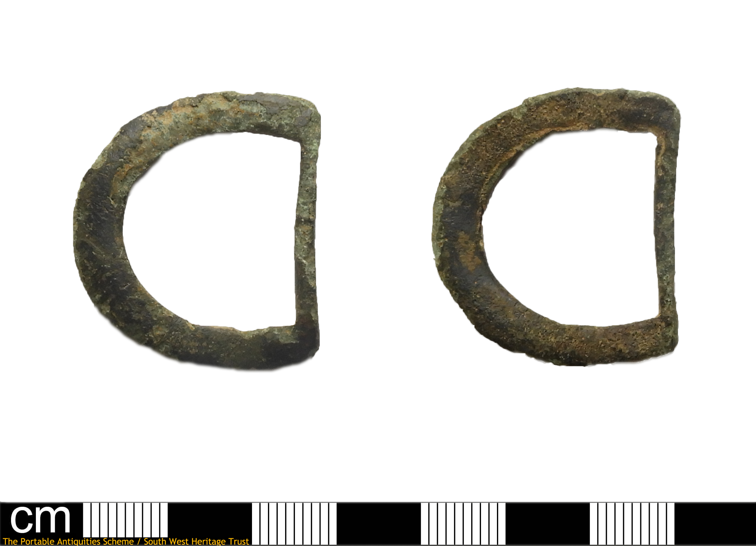
English: An incomplete copper alloy buckle dating to the medieval period, c. AD 1200-1500.
The buckle consists of the single looped D-shaped frame. It is shallow D-shaped in cross section, and markedly flattened on the bottom surface. The curving part of the frame is markedly thicker than the slender linear part. No pin rest or decoration is visible, although there may be wear markings on the bar where the pin was originally sited. Whitehead (2003: 16) presents no. 39, a similar example, but comments that simple D-shaped buckles are difficult to date due to their generic presence, but can be largely associated with the 13th to 15th centuries. Egan and Pritchard (1991: 70) no. 271 is similar, and comes from their context 7, dated to c. 1200-1230. Measurements: 36.3mm diameter, 27.3mm width, 3.1mm thickness, weight 5.07g. |
||
| Depicted place | (County of findspot) Devon | ||
| Date | between 1200 and 1500 | ||
| Accession number |
FindIdentifier: 971496 |
||
| Credit line |
|
||
| Source |
https://finds.org.uk/database/ajax/download/id/1073430 Catalog: https://finds.org.uk/database/images/image/id/1073430/recordtype/artefacts archive copy at the Wayback Machine Artefact: https://finds.org.uk/database/artefacts/record/id/971496 |
||
| Permission (Reusing this file) |
Attribution License | ||
| Object location | | View this and other nearby images on: OpenStreetMap |
|---|
.jpg¶ms=050.917700_N_-003.462270_E_globe:Earth_class:object_type:object__&language=en)
Licensing
[edit].jpg&action=edit§ion=2)
- You are free:
- to share – to copy, distribute and transmit the work
- to remix – to adapt the work
- Under the following conditions:
- attribution – You must give appropriate credit, provide a link to the license, and indicate if changes were made. You may do so in any reasonable manner, but not in any way that suggests the licensor endorses you or your use.
File history
Click on a date/time to view the file as it appeared at that time.
| Date/Time | Thumbnail | Dimensions | User | Comment | |
|---|---|---|---|---|---|
| current | 03:20, 2 December 2020 | | 2,463 × 1,780 (550 KB) | Fæ (talk | contribs) | Portable Antiquities Scheme, DEV, FindID: 971496-1073430, medieval, page 1424, batch count 25105 |
You cannot overwrite this file.
File usage on Commons
The following page uses this file:
.jpg)
.jpg&oldid=736106977)