File:Medieval barrel padlock (FindID 102426).jpg
Jump to navigation
Jump to search
Size of this preview: 800 × 475 pixels. Other resolutions: 320 × 190 pixels | 640 × 380 pixels | 1,024 × 607 pixels | 1,280 × 759 pixels | 3,196 × 1,896 pixels.
Original file (3,196 × 1,896 pixels, file size: 280 KB, MIME type: image/jpeg)
Captions
Captions
Add a one-line explanation of what this file represents
Summary
[edit].jpg&action=edit§ion=1)
| Medieval barrel padlock | |||
|---|---|---|---|
| Photographer |
The Portable Antiquities Scheme, Adam Daubney, 2005-07-25 16:25:55 |
||
| Title |
Medieval barrel padlock |
||
| Description |
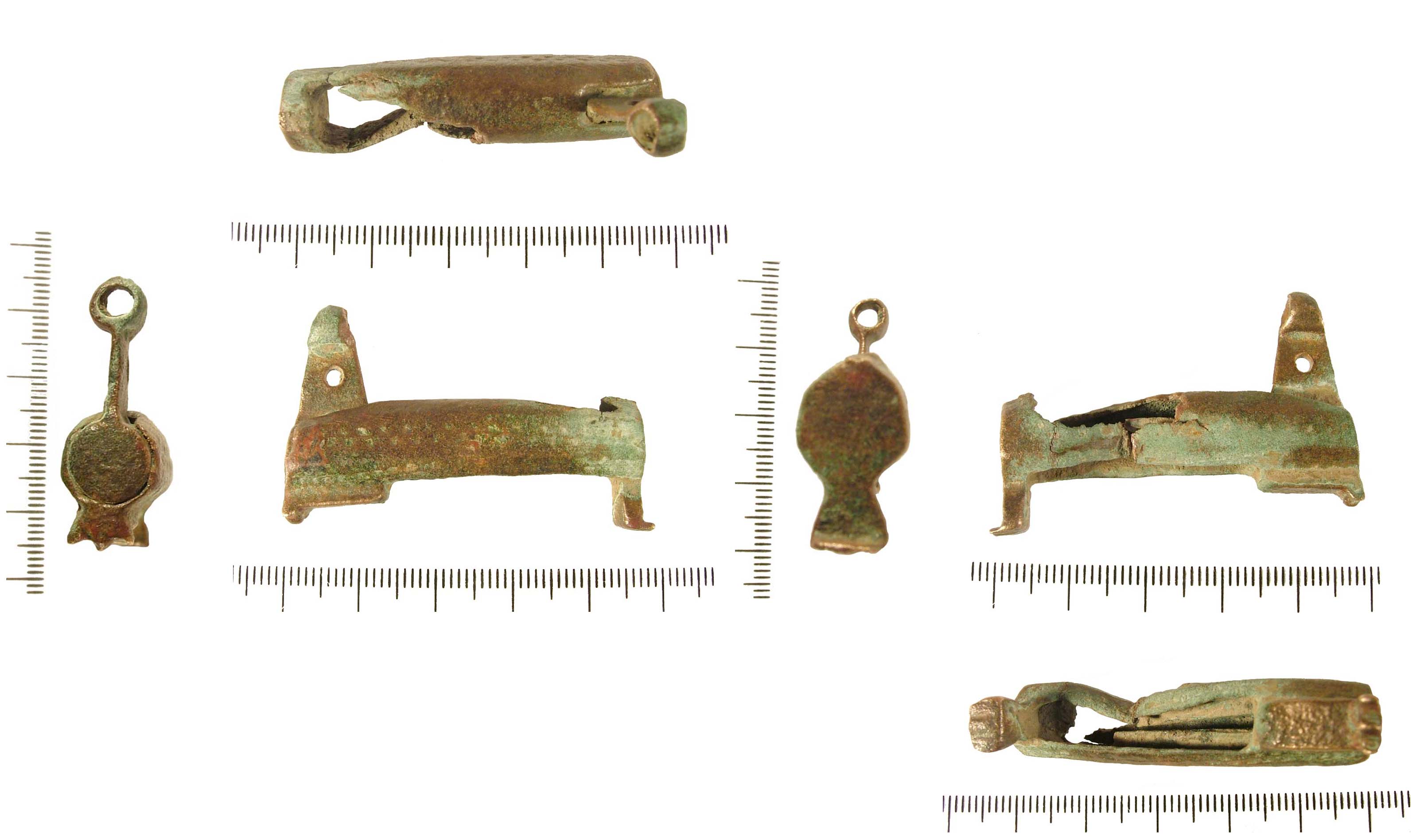
English: Incomplete copper alloy barrel padlock. The lock is a hollow octagonal tube with two original solid terminals. There is a rectangular opening on the underside through which two rectangular arms are visible. Two further rectangular arms were discovered with the object, however they are now detached. At either end at on the bottom is a small foot. One has a flat terminal and the other has three points and two channels. The upper side of this terminal has an integral triangular shaped projection. This projection has a circular hole in the side, and terminates with a tubular head set on the same angle as the plane of the object. Each panel of the surface is decorated with two rows of punched dots. |
||
| Depicted place | (County of findspot) Lincolnshire | ||
| Date | between 1250 and 1399 | ||
| Accession number |
FindID: 102426 Old ref: LIN-50F952 Filename: LIN3049.jpg |
||
| Credit line |
|
||
| Source |
https://finds.org.uk/database/ajax/download/id/70092 Catalog: https://finds.org.uk/database/images/image/id/70092/recordtype/artefacts archive copy at the Wayback Machine Artefact: https://finds.org.uk/database/artefacts/record/id/102426 |
||
| Permission (Reusing this file) |
Attribution-ShareAlike License version 4.0 (verified 16 November 2020) | ||
| Object location | | View this and other nearby images on: OpenStreetMap |
|---|
.jpg¶ms=052.906600_N_-000.203253_E_globe:Earth_class:object_type:object__&language=en)
Licensing
[edit].jpg&action=edit§ion=2)
This file is licensed under the Creative Commons Attribution-Share Alike 4.0 International license.
Attribution: The Portable Antiquities Scheme/ The Trustees of the British Museum
- You are free:
- to share – to copy, distribute and transmit the work
- to remix – to adapt the work
- Under the following conditions:
- attribution – You must give appropriate credit, provide a link to the license, and indicate if changes were made. You may do so in any reasonable manner, but not in any way that suggests the licensor endorses you or your use.
- share alike – If you remix, transform, or build upon the material, you must distribute your contributions under the same or compatible license as the original.
File history
Click on a date/time to view the file as it appeared at that time.
| Date/Time | Thumbnail | Dimensions | User | Comment | |
|---|---|---|---|---|---|
| current | 00:46, 4 February 2017 | | 3,196 × 1,896 (280 KB) | Fæ (talk | contribs) | Portable Antiquities Scheme, LIN, FindID: 102426, medieval, page 3394, batch direction-asc count 41162 |
You cannot overwrite this file.
File usage on Commons
The following page uses this file:
.jpg)
.jpg&oldid=810123975)