File:Medieval Coin (FindID 882205).jpg
Jump to navigation
Jump to search

Size of this preview: 800 × 481 pixels. Other resolutions: 320 × 193 pixels | 640 × 385 pixels | 1,024 × 616 pixels | 1,280 × 770 pixels | 2,560 × 1,540 pixels | 3,977 × 2,393 pixels.
Original file (3,977 × 2,393 pixels, file size: 3 MB, MIME type: image/jpeg)
Captions
Captions
Add a one-line explanation of what this file represents
Summary
[edit].jpg&action=edit§ion=1)
| Medieval Coin | |||
|---|---|---|---|
| Photographer |
West Yorkshire Archaeology Advisory Service, Ian Whitehead, 2018-02-20 13:27:43 |
||
| Title |
Medieval Coin |
||
| Description |
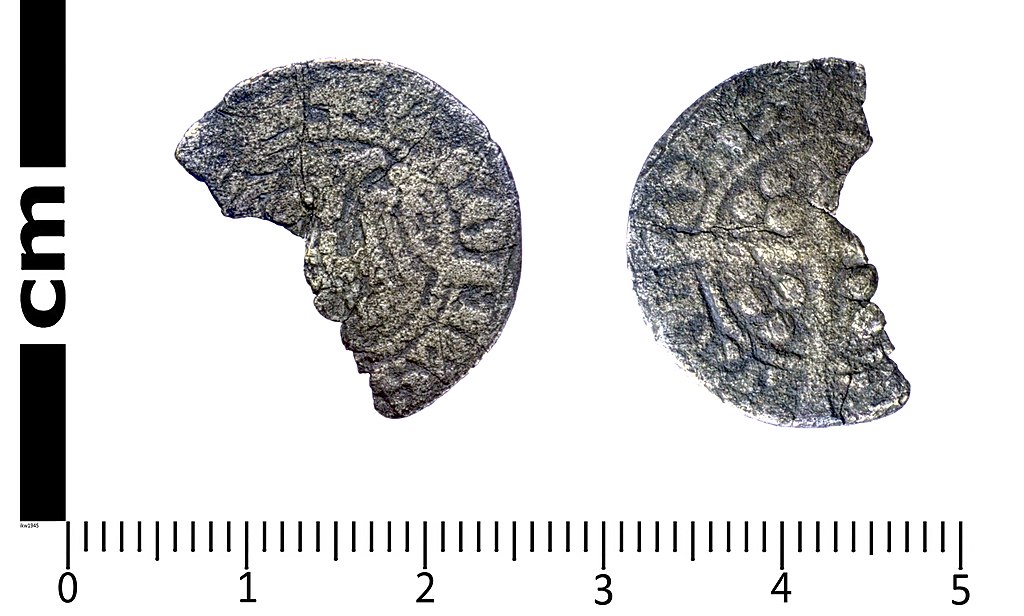
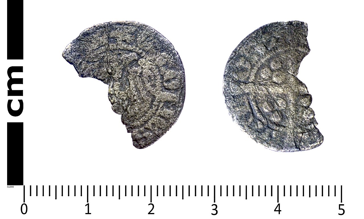
English: An incomplete Medieval silver coin: a continental sterling imitation Edwardian coin of Gui de Dampierre, Count of Flanders (AD 1280-1305), probably dating from AD 1288 - 1292 and minted at Alost (modern Aalst, Belgium). The obverse shows a double headed eagle while the reverse has a long cross with three pellets in each angle. The legends have been identified from a list kindly provided to PAS by P and B Withers. Compare Mayhew, N. J. 1983. Sterling Imitations of Edwardian Type, ref. 1-3 and also BERK-1A4553 and NMS-8D1E15. The coin is 19.2mm long, 13.6mm wide and 0.9mm thick. It weighs 0.94gm. A little over half the coin survives. |
||
| Depicted place | (County of findspot) North Yorkshire | ||
| Date | between 1288 and 1292 | ||
| Accession number |
FindID: 882205 Old ref: SWYOR-4C6907 Filename: SWYOR4C6907MedievalCoinikw.jpg |
||
| Credit line |
|
||
| Source |
https://finds.org.uk/database/ajax/download/id/1002571 Catalog: https://finds.org.uk/database/images/image/id/1002571/recordtype/artefacts archive copy at the Wayback Machine Artefact: https://finds.org.uk/database/artefacts/record/id/882205 |
||
| Permission (Reusing this file) |
Attribution License version 2.0 (verified 1 December 2020) | ||
| Object location | | View this and other nearby images on: OpenStreetMap |
|---|
.jpg¶ms=054.150800_N_-001.364280_E_globe:Earth_class:object_type:object__&language=en)
Licensing
[edit].jpg&action=edit§ion=2)
This file is licensed under the Creative Commons Attribution 2.0 Generic license.
Attribution: West Yorkshire Archaeology Advisory Service
- You are free:
- to share – to copy, distribute and transmit the work
- to remix – to adapt the work
- Under the following conditions:
- attribution – You must give appropriate credit, provide a link to the license, and indicate if changes were made. You may do so in any reasonable manner, but not in any way that suggests the licensor endorses you or your use.
File history
Click on a date/time to view the file as it appeared at that time.
| Date/Time | Thumbnail | Dimensions | User | Comment | |
|---|---|---|---|---|---|
| current | 03:20, 5 December 2018 | | 3,977 × 2,393 (3 MB) | Fæ (talk | contribs) | Portable Antiquities Scheme, SWYOR, FindID: 882205, medieval, page 115, batch count 798 |
You cannot overwrite this file.
File usage on Commons
The following 2 pages use this file:
.jpg)
.jpg&oldid=546390747)