File:Mełgiew (gmina) location map.png

Original file (887 × 905 pixels, file size: 270 KB, MIME type: image/png)
Captions
Captions
Summary
[edit]_location_map.png&action=edit§ion=1)
| Description |
English: Location map |
| Date | |
| Source | Own work |
| Author | Smat |
| Description |
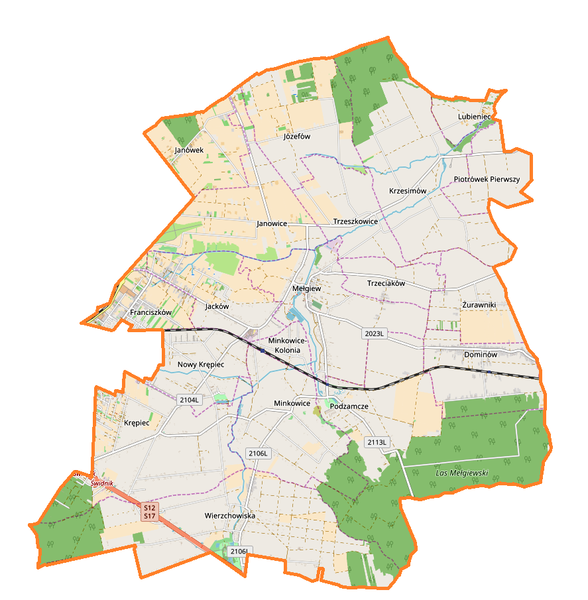
Polski: Mapa gminy Mełgiew, Polska
English: Map of Mełgiew (gmina), Poland |
|||||||||
| Date | ||||||||||
| Source | You may find a page on the OpenStreetMap wiki page for Mełgiew (gmina) | |||||||||
| Creator |
OpenStreetMap contributors OpenStreetMap contributors |
|||||||||
| Permission (Reusing this file) |
OpenStreetMap data is available under the Open Database License (details). Map tiles are licensed under the Creative Commons Attribution-ShareAlike 2.0 license (CC-BY-SA 2.0).
This file is licensed under the Creative Commons Attribution-Share Alike 2.0 Generic license.
|
|||||||||
| Geotemporal data | ||||||||||
| Bounding box |
|
|||||||||
| Georeferencing | If inappropriate please set warp_status = skip to hide. | |||||||||
Licensing
[edit]_location_map.png&action=edit§ion=2)
| This work contains information from OpenStreetMap, which is made available under the Open Database License (ODbL).
The ODbL does not require any particular license for maps produced from ODbL data. Prior to 1 August 2020, map tiles produced by the OpenStreetMap Foundation were licensed under the CC-BY-SA-2.0 license. Maps produced by other people may be subject to other licences. |
File history
Click on a date/time to view the file as it appeared at that time.
| Date/Time | Thumbnail | Dimensions | User | Comment | |
|---|---|---|---|---|---|
| current | 12:19, 7 October 2017 | | 887 × 905 (270 KB) | Smat (talk | contribs) | User created page with UploadWizard |
You cannot overwrite this file.
File usage on Commons
There are no pages that use this file.
File usage on other wikis
The following other wikis use this file:
- Usage on pl.wikipedia.org
- Mełgiew (gmina)
- Krzesimów
- Mełgiew
- Minkowice-Kolonia
- Nowy Krępiec
- Piotrówek Pierwszy
- Trzeciaków
- Trzeszkowice
- Jacków (województwo lubelskie)
- Krępiec (województwo lubelskie)
- Lubieniec (województwo lubelskie)
- Minkowice (województwo lubelskie)
- Żurawniki (województwo lubelskie)
- Dominów (powiat świdnicki)
- Franciszków (powiat świdnicki)
- Janowice (powiat świdnicki)
- Podzamcze (powiat świdnicki)
- Janówek (gmina Mełgiew)
- Józefów (gmina Mełgiew)
- Minkowice (stacja kolejowa)
- Podzamcze (przystanek kolejowy)
- Dominów (przystanek kolejowy)
- Parafia św. Wita w Mełgwi
- Kościół św. Wita w Mełgwi
- Moduł:Mapa/dane/Mełgiew (gmina)
- Centralny Obóz Pracy w Krzesimowie
- Wikipedysta:FR. Mełgiew/Graniczny Rów (dopływ Sławki)
- Usage on pl.wikibooks.org
_location_map.png&oldid=708056526)