File:Maupertuis 1768 Carte de l'arc du Meridien mesuré au Cercle Polaire b30529700 0003 0188.jpg
Jump to navigation
Jump to search

Size of this preview: 332 × 599 pixels. Other resolutions: 133 × 240 pixels | 266 × 480 pixels | 425 × 768 pixels | 567 × 1,024 pixels | 2,041 × 3,685 pixels.
Original file (2,041 × 3,685 pixels, file size: 1.61 MB, MIME type: image/jpeg)
Captions
Captions
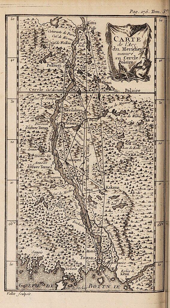
Map of the meridian arc measured at the arctic circle
Summary
[edit]
| Description |
Français : Carte de l'arc du Meridien mesuré au Cercle Polaire
English: Map of the triangulation of the meridian arc measured at the arctic circle. From Œuvres de Maupertuis volume 3. |
|||||||||
| Date | ||||||||||
| Source | https://archive.org/details/b30529700_0003 | |||||||||
| Creator |
Pierre-Louis Moreau de Maupertuis (1698-1759) |
|||||||||
| Geotemporal data | ||||||||||
| Bounding box |
|
|||||||||
| Georeferencing | ||||||||||
Licensing
[edit]
|
This work is in the public domain in its country of origin and other countries and areas where the copyright term is the author's life plus 70 years or fewer. This work is in the public domain in the United States because it was published (or registered with the U.S. Copyright Office) before January 1, 1929. | |
| This file has been identified as being free of known restrictions under copyright law, including all related and neighboring rights. | |
File history
Click on a date/time to view the file as it appeared at that time.
| Date/Time | Thumbnail | Dimensions | User | Comment | |
|---|---|---|---|---|---|
| current | 22:01, 12 October 2023 | | 2,041 × 3,685 (1.61 MB) | Kognos (talk | contribs) | Uploaded a work by Pierre-Louis Moreau de Maupertuis (1698-1759) from https://archive.org/details/b30529700_0003 with UploadWizard |
You cannot overwrite this file.
File usage on Commons
The following page uses this file: