File:Massive Winter Storm Sweeps Across the United States (MODIS 2022-02-05).jpg

Original file (7,918 × 6,480 pixels, file size: 6.29 MB, MIME type: image/jpeg)
Captions
Captions
Summary
[edit].jpg&action=edit§ion=1)
| Description |
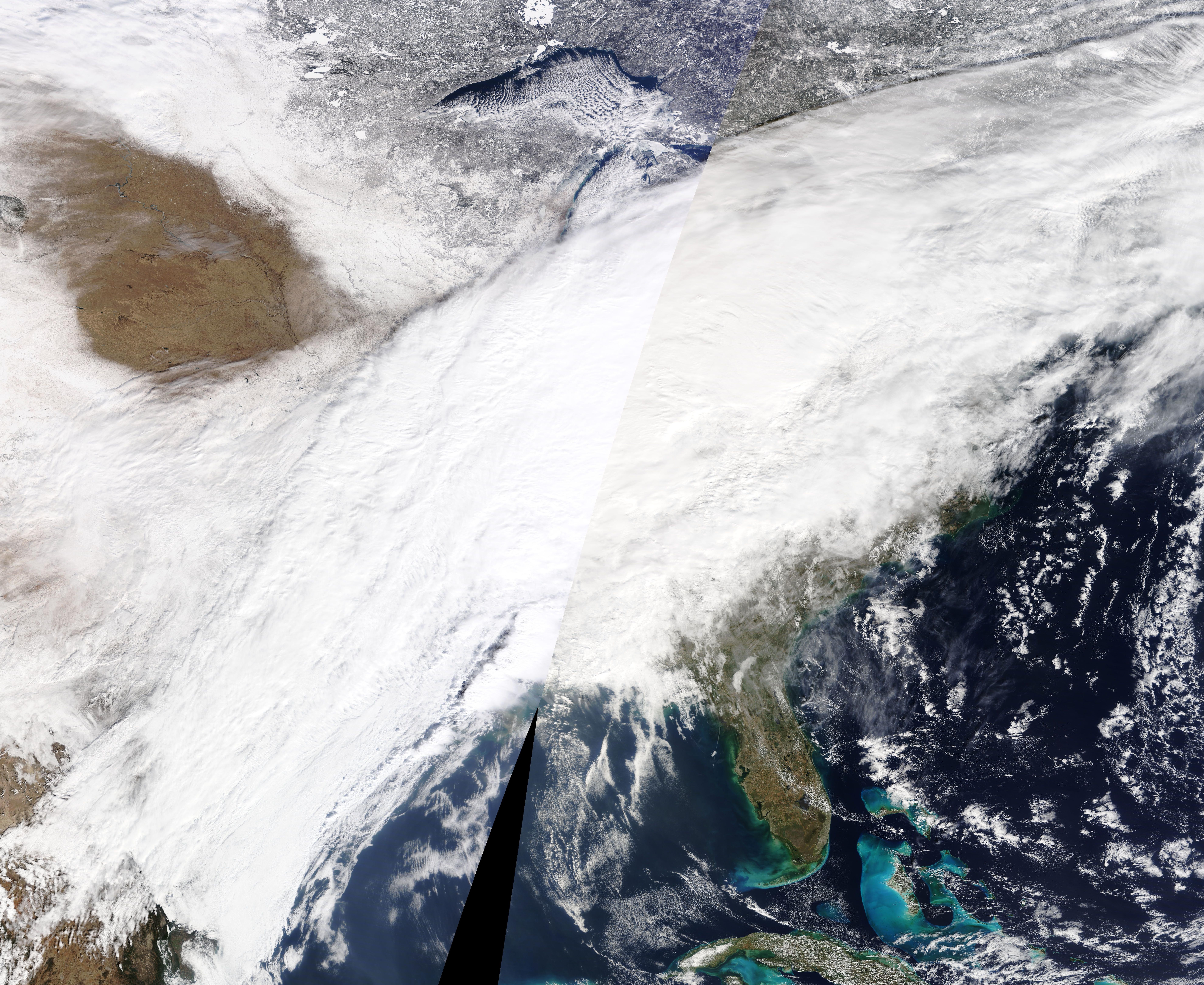
English: A winter storm spanning nearly 2,000 miles (3,000 kilometers) brought bitter cold temperatures, heavy snow, freezing rain, and treacherous ice to more than dozen states during the first week of February 2022. The storm began on February 1 with a cold front surging from the Rockies to the Midwest and bringing extreme cold and heavy snow. By week’s end, the storm had cut a massive swath across the country from Texas to Maine.
The National Weather Service reported temperatures ranging 15 to 30 degrees below average across the Plains and Ohio Valley. Freezing rain and sleet coated roads and trees, bringing down power lines and causing extensive power outages, thousands of flight cancellations, and hazardous travel conditions. The potent front also stirred up a tornado in Alabama amid heavy rainfall and flooding. As of February 4, dozens of cities had reported snow totals in the double digits and wind chill and hard freeze advisories remained in effect in many areas. The extensive cloud cover associated with the storm appears in this true-color image acquired by the Moderate Resolution Imaging Spectroradiometer (MODIS) on board NASA’s Terra satellite on February 3, 2022. The vast storm closely followed a blizzard from which millions of people from North Carolina to Maine were still digging out. |
||
| Date | Taken on 3 February 2022 | ||
| Source |
Massive Winter Storm Sweeps Across the United States (direct link)
|
||
| Author | MODIS Land Rapid Response Team, NASA GSFC |
| This media is a product of the Terra mission Credit and attribution belongs to the mission team, if not already specified in the "author" row |
Licensing
[edit].jpg&action=edit§ion=2)
| This file is in the public domain in the United States because it was solely created by NASA. NASA copyright policy states that "NASA material is not protected by copyright unless noted". (See Template:PD-USGov, NASA copyright policy page or JPL Image Use Policy.) | ||
 |
Warnings:
|
File history
Click on a date/time to view the file as it appeared at that time.
| Date/Time | Thumbnail | Dimensions | User | Comment | |
|---|---|---|---|---|---|
| current | 22:18, 9 January 2024 | | 7,918 × 6,480 (6.29 MB) | OptimusPrimeBot (talk | contribs) | #Spacemedia - Upload of http://modis.gsfc.nasa.gov/gallery/images/image02052022_500m.jpg via Commons:Spacemedia |
You cannot overwrite this file.
File usage on Commons
There are no pages that use this file.
.jpg&oldid=840073022)