File:Masłowice (gmina) location map.png

Original file (2,021 × 1,962 pixels, file size: 350 KB, MIME type: image/png)
Captions
Captions
Summary
[edit]_location_map.png&action=edit§ion=1)
| Description |
English: Location map |
| Date | |
| Source | Own work |
| Author | Smat |
| Description |
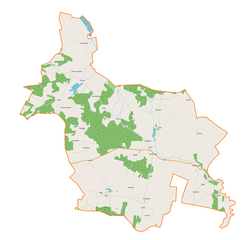
Polski: Mapa gminy Masłowice, Polska
English: Map of Masłowice (gmina), Poland |
|||||||||
| Date | ||||||||||
| Source | You may find a page on the OpenStreetMap wiki page for Masłowice (gmina) | |||||||||
| Creator |
OpenStreetMap contributors OpenStreetMap contributors |
|||||||||
| Permission (Reusing this file) |
OpenStreetMap data is available under the Open Database License (details). Map tiles are licensed under the Creative Commons Attribution-ShareAlike 2.0 license (CC-BY-SA 2.0).
This file is licensed under the Creative Commons Attribution-Share Alike 2.0 Generic license.
|
|||||||||
| Geotemporal data | ||||||||||
| Bounding box |
|
|||||||||
| Georeferencing | If inappropriate please set warp_status = skip to hide. | |||||||||
Licensing
[edit]_location_map.png&action=edit§ion=2)
| This work contains information from OpenStreetMap, which is made available under the Open Database License (ODbL).
The ODbL does not require any particular license for maps produced from ODbL data. Prior to 1 August 2020, map tiles produced by the OpenStreetMap Foundation were licensed under the CC-BY-SA-2.0 license. Maps produced by other people may be subject to other licences. |
File history
Click on a date/time to view the file as it appeared at that time.
| Date/Time | Thumbnail | Dimensions | User | Comment | |
|---|---|---|---|---|---|
| current | 19:28, 21 December 2017 | | 2,021 × 1,962 (350 KB) | Smat (talk | contribs) | User created page with UploadWizard |
You cannot overwrite this file.
File usage on Commons
There are no pages that use this file.
File usage on other wikis
The following other wikis use this file:
- Usage on pl.wikipedia.org
- Przerąb
- Chełmo
- Huta Przerębska
- Kalinki
- Koconia
- Korytno
- Łączkowice (powiat radomszczański)
- Tworowice
- Wola Przerębska
- Ochotnik (województwo łódzkie)
- Bartodzieje (województwo łódzkie)
- Granice (województwo łódzkie)
- Kraszewice (województwo łódzkie)
- Krery (województwo łódzkie)
- Strzelce Małe (województwo łódzkie)
- Kawęczyn (powiat radomszczański)
- Masłowice (powiat radomszczański)
- Borki (gmina Masłowice)
- Kolonia Przerąb
- Góra Chełmo
- Jaskółki (Strzelce Małe)
- Cyganka (województwo łódzkie)
- Dąbrowa Lipowska
- Leonów (Chełmo)
- Marianka (Chełmo)
- Wierzbowiec (Polska)
- Chaptyzów
- Będzyn (powiat radomszczański)
- Chylczów
- Grabowiec (powiat radomszczański)
- Konstantynów (powiat radomszczański)
- Koń (kolonia)
- Lipowczyce-Bór
- Podkrosno
- Psarki
- Wymysłów (gmina Masłowice)
- Rezerwat przyrody Góra Chełmo
- Parafia św. Rozalii z Palermo w Przerębie
- Parafia Chrystusa Króla w Strzelcach Małych
- Parafia św. Mikołaja w Chełmie
- Kościół św. Rozalii z Palermo w Przerębie
- Barak (Korytno)
- Niwa Korycińska
- Rejtan Drugi
- Rejtan Pierwszy
- Sowiniec (Korytno)
- Tarki (Korytno)
- Moduł:Mapa/dane/Masłowice (gmina)
- Łąka w Bęczkowicach
- Usage on pl.wikibooks.org
_location_map.png&oldid=897106608)