File:Marshall Islands 1897 German inset map (cropped).jpg
Jump to navigation
Jump to search

Size of this preview: 404 × 600 pixels. Other resolutions: 161 × 240 pixels | 435 × 646 pixels.
Original file (435 × 646 pixels, file size: 131 KB, MIME type: image/jpeg)
Captions
Captions
Add a one-line explanation of what this file represents
Summary
[edit]| Description |
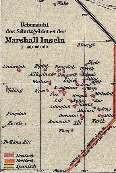
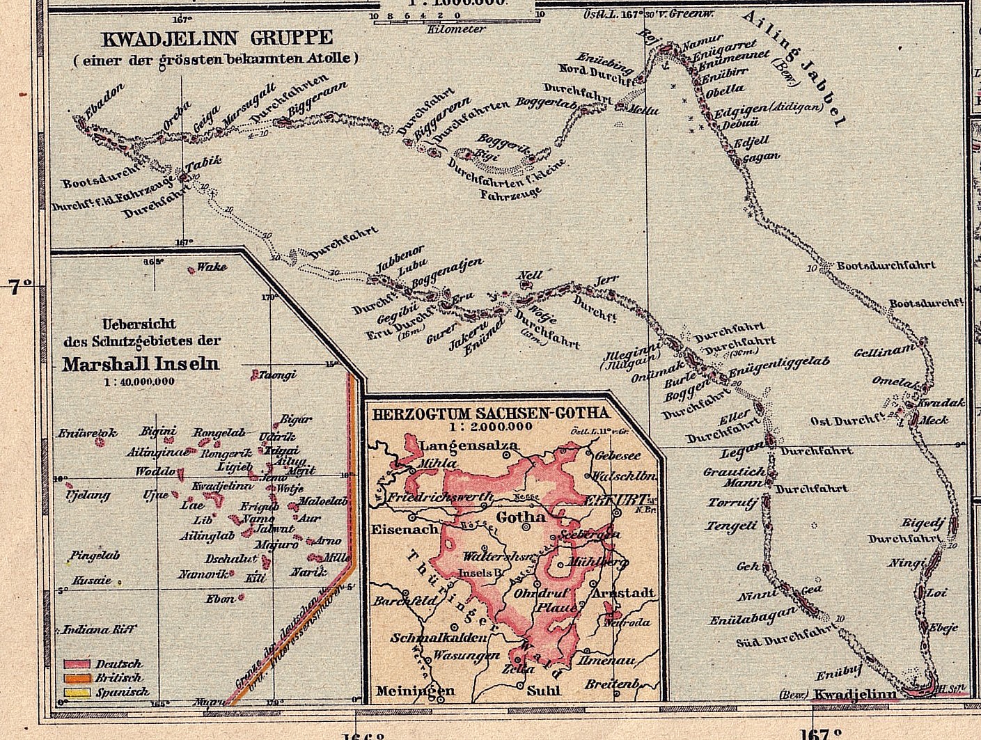
English: 1897 German map of Kwajalein Atoll, Marshall Islands |
| Date | |
| Source | http://marshall.csu.edu.au/Marshalls/html/histmaps/Langhans1897_map_Kwajalein.jpg |
| Author | Langhans? |
| Other versions |

.jpg&action=edit§ion=1)
Licensing
[edit].jpg&action=edit§ion=2)
|
This work is in the public domain in its country of origin and other countries and areas where the copyright term is the author's life plus 100 years or fewer. | |
| This file has been identified as being free of known restrictions under copyright law, including all related and neighboring rights. | |
File history
Click on a date/time to view the file as it appeared at that time.
| Date/Time | Thumbnail | Dimensions | User | Comment | |
|---|---|---|---|---|---|
| current | 21:30, 16 January 2023 | | 435 × 646 (131 KB) | Ooligan (talk | contribs) | File:Kwajalein, Marshall Islands and Gotha 1897 inset maps.jpg cropped 69 % horizontally, 39 % vertically, rotated 0.8° using CropTool with precise mode. |
You cannot overwrite this file.
File usage on Commons
The following page uses this file:
.jpg&oldid=727017370)