File:Mariner 9 - Valles Marineris-Argyre (40977373712).png
Jump to navigation
Jump to search

Size of this preview: 425 × 599 pixels. Other resolutions: 170 × 240 pixels | 340 × 480 pixels | 544 × 768 pixels | 726 × 1,024 pixels | 1,647 × 2,323 pixels.
Original file (1,647 × 2,323 pixels, file size: 1.26 MB, MIME type: image/png)
Captions
Captions
Add a one-line explanation of what this file represents
Summary
[edit].png&action=edit§ion=1)
| Description |
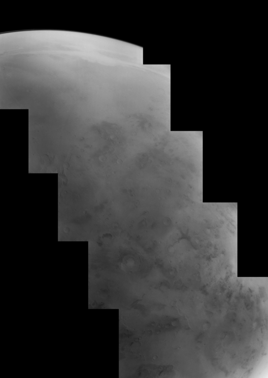
Mariner 9 mosaic of Solis Planum taken on January 5, 1972. This image mosaic was taken as part of a global mapping campaign of Mars shortly after the 1971 global dust storm settled out. The mosaic captures Valles Marineris south across Solis Planum and the Thaumasia plateau to the western edge of the Argyre Impact basin. This mosaic was acquired during Mariner 9's 106th orbit of Mars. Image Credit: NASA / JPL / Justin Cowart |
| Date | |
| Source | Mariner 9 - Valles Marineris-Argyre |
| Author | Justin Cowart |
Licensing
[edit].png&action=edit§ion=2)
| This file is in the public domain in the United States because it was solely created by NASA. NASA copyright policy states that "NASA material is not protected by copyright unless noted". (See Template:PD-USGov, NASA copyright policy page or JPL Image Use Policy.) | ||
 |
Warnings:
|
This file is licensed under the Creative Commons Attribution 2.0 Generic license.
- You are free:
- to share – to copy, distribute and transmit the work
- to remix – to adapt the work
- Under the following conditions:
- attribution – You must give appropriate credit, provide a link to the license, and indicate if changes were made. You may do so in any reasonable manner, but not in any way that suggests the licensor endorses you or your use.
| This image was originally posted to Flickr by jccwrt at https://flickr.com/photos/132160802@N06/40977373712. It was reviewed on 3 December 2020 by FlickreviewR 2 and was confirmed to be licensed under the terms of the cc-by-2.0. |
File history
Click on a date/time to view the file as it appeared at that time.
| Date/Time | Thumbnail | Dimensions | User | Comment | |
|---|---|---|---|---|---|
| current | 12:21, 3 December 2020 | | 1,647 × 2,323 (1.26 MB) | Eyes Roger (talk | contribs) | Transferred from Flickr via #flickr2commons |
You cannot overwrite this file.
File usage on Commons
There are no pages that use this file.
.png&oldid=897021984)