File:Marievka on the Shubert's map.png
Jump to navigation
Jump to search

Size of this preview: 545 × 600 pixels. Other resolutions: 218 × 240 pixels | 436 × 480 pixels | 1,000 × 1,100 pixels.
Original file (1,000 × 1,100 pixels, file size: 385 KB, MIME type: image/png)
Captions
Captions
Add a one-line explanation of what this file represents
Summary
[edit]| Description |
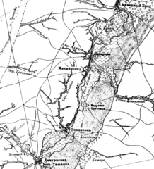
Русский: Деревня Марьевка (Ореховая) и её окрестности на фрагменте листа (ряд 22, лист 22) из комплекта топографических карт Российской империи работы Шуберта. Масштаб: 3 версты в дюйме (1 : 126 000; в 1 см 840 м). |
| Date | between 1850 and 1890 |
| Source | File:Shubert map - R22L22.png |
| Author |
Русский: Фёдор Фёдорович Шуберт (1789—1865) |
| Other versions |

Licensing
[edit]
|
This work is in the public domain in its country of origin and other countries and areas where the copyright term is the author's life plus 70 years or fewer. | |
| This file has been identified as being free of known restrictions under copyright law, including all related and neighboring rights. | |
File history
Click on a date/time to view the file as it appeared at that time.
| Date/Time | Thumbnail | Dimensions | User | Comment | |
|---|---|---|---|---|---|
| current | 19:15, 1 February 2024 | | 1,000 × 1,100 (385 KB) | Redboston (talk | contribs) | Uploaded a work by {{ru|1=Фёдор Фёдорович Шуберт (1789—1865)}} from File:Shubert map - R22L22.png with UploadWizard |
You cannot overwrite this file.
File usage on Commons
The following page uses this file:
File usage on other wikis
The following other wikis use this file:
- Usage on ru.wikipedia.org