File:Maria-Lanzendorf - Kalvarienberg.JPG
Jump to navigation
Jump to search
Size of this preview: 800 × 567 pixels. Other resolutions: 320 × 227 pixels | 640 × 454 pixels | 1,024 × 726 pixels | 1,280 × 908 pixels | 2,560 × 1,815 pixels | 4,134 × 2,931 pixels.
Original file (4,134 × 2,931 pixels, file size: 9.76 MB, MIME type: image/jpeg)
Captions
Captions
Add a one-line explanation of what this file represents
Summary
[edit]
| Description |
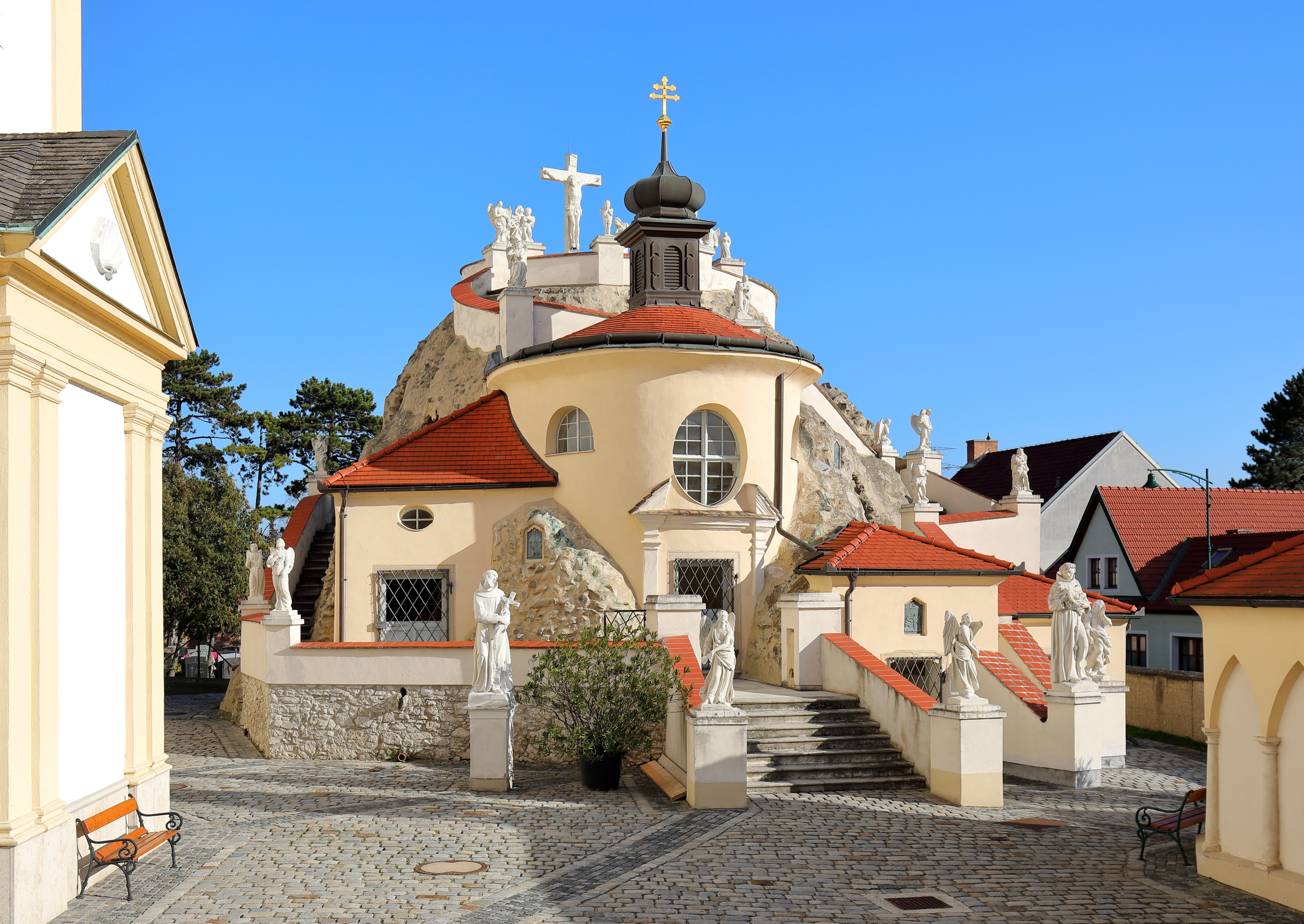
Deutsch: Westansicht des Kalvarienberges in der niederösterreichischen Gemeinde Maria-Lanzendorf sowie links ein Teil der Pfarr- und Wallfahrtskirche und rechts ein Teil der Heilig-Grab-Kapelle, die zum Kriegerdenkmal umgestaltet wurde.
Errichtet wurde die leicht begehbare Anlage zur Darstellung der Leidensszenen Jesu durch den Franziskaner-Laienbruder Felix Niering und Helfern von 1699 bis 1701. Im Jahr 1709 wurde die Nachbildung der Hl. Stiege, über die Christus zum Palast des Pilatus hinauf geführt worden war, hinzugefügt. |
| Date | |
| Source | Own work |
| Author | C.Stadler/Bwag |
| Permission (Reusing this file) |
Deutsch: Hallo, du darfst mein Foto kostenlos nutzen, aber nenne mich bitte als Fotograf, beispielsweise „Foto: C.Stadler/Bwag“ oder © C.Stadler/Bwag; CC-BY-SA-4.0. Auf mehr Angaben bestehe ich nicht - im Gegensatz zu manch anderen, die die Vorgaben der unten angeführten Lizenzierung auf Punkt und Beistrich einfordern. English: Feel free to use my photos, but please mention me as the author like © C.Stadler/Bwag or © C.Stadler/Bwag; CC-BY-SA-4.0 (that's good enough) and if you want send me a message: bwag@gmx.net. |
| Camera location | | View this and other nearby images on: OpenStreetMap |
|---|
Licensing
[edit]
I, the copyright holder of this work, hereby publish it under the following license:
This file is licensed under the Creative Commons Attribution-Share Alike 3.0 Unported license.
- You are free:
- to share – to copy, distribute and transmit the work
- to remix – to adapt the work
- Under the following conditions:
- attribution – You must give appropriate credit, provide a link to the license, and indicate if changes were made. You may do so in any reasonable manner, but not in any way that suggests the licensor endorses you or your use.
- share alike – If you remix, transform, or build upon the material, you must distribute your contributions under the same or compatible license as the original.
File history
Click on a date/time to view the file as it appeared at that time.
| Date/Time | Thumbnail | Dimensions | User | Comment | |
|---|---|---|---|---|---|
| current | 18:19, 23 November 2016 | | 4,134 × 2,931 (9.76 MB) | Bwag (talk | contribs) | {{Information |Description= {{de|1= Westansicht des Kalvarienberges in der niederösterreichischen Gemeinde Maria-Lanzendorf sowie links ein Teil der Pfarr- und Wallfahrtskirche und re... |
You cannot overwrite this file.
File usage on Commons
There are no pages that use this file.
File usage on other wikis
The following other wikis use this file:
- Usage on de.wikipedia.org
- Usage on de.wiktionary.org
- Usage on en.wikipedia.org
- Usage on hu.wikipedia.org
- Usage on uk.wikipedia.org
- Usage on vi.wikipedia.org