File:March Whitemoor Up Yard LNE O4 2-8-0 geograph-2855181-by-Ben-Brooksbank.jpg
Jump to navigation
Jump to search

Size of this preview: 800 × 468 pixels. Other resolutions: 320 × 187 pixels | 640 × 375 pixels | 1,024 × 599 pixels | 1,280 × 749 pixels | 2,392 × 1,400 pixels.
Original file (2,392 × 1,400 pixels, file size: 1.29 MB, MIME type: image/jpeg)
Captions
Captions
Add a one-line explanation of what this file represents
Summary
[edit]
| Description |
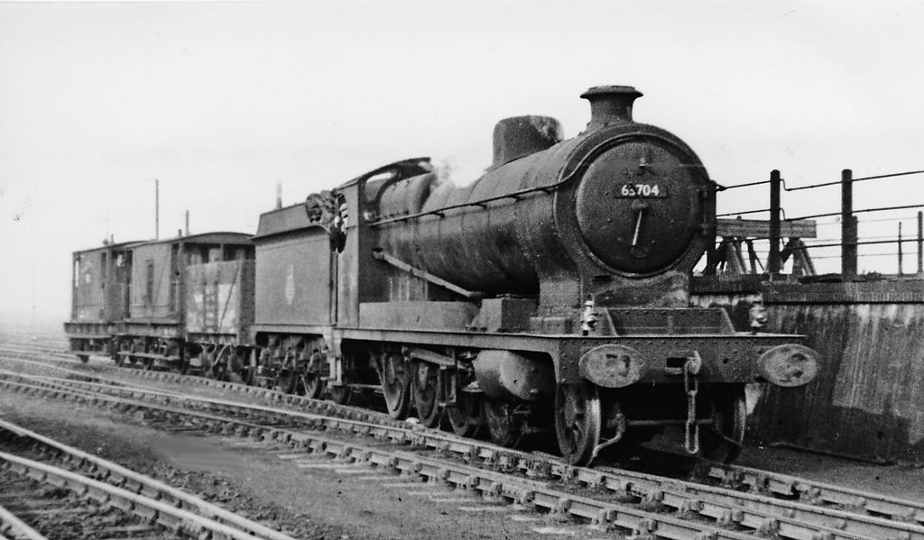
English: LNE O4 2-8-0 at Whitemoor Up Yard. View northward near the exit of the Up Yard of the Whitemoor complex near March. With one wagon and two brake-vans - and 'express' headcode, No. 63704 was No. 6550 until 1946: built as ROD No. 1647 in 10/18 to Government order, it served in France and after repatriation was used by the GCR 1920-1, then stored at Morecambe until purchased by the LNER in 12/28; as BR No. 63704 it was rebuilt as an O4/8 in 12/53 and withdrawn in 3/63 |
| Date | |
| Source | From geograph.org.uk |
| Author | Ben Brooksbank |
| Permission (Reusing this file) |
Creative Commons Attribution Share-alike license 2.0 |
| Attribution (required by the license) | Ben Brooksbank / LNE O4 2-8-0 at Whitemoor Up Yard / |
| Camera location | | View this and other nearby images on: OpenStreetMap |
|---|
Licensing
[edit]

|
This image was taken from the Geograph project collection. See this photograph's page on the Geograph website for the photographer's contact details. The copyright on this image is owned by Ben Brooksbank and is licensed for reuse under the Creative Commons Attribution-ShareAlike 2.0 license.
|
This file is licensed under the Creative Commons Attribution-Share Alike 2.0 Generic license.
Attribution: Ben Brooksbank
- You are free:
- to share – to copy, distribute and transmit the work
- to remix – to adapt the work
- Under the following conditions:
- attribution – You must give appropriate credit, provide a link to the license, and indicate if changes were made. You may do so in any reasonable manner, but not in any way that suggests the licensor endorses you or your use.
- share alike – If you remix, transform, or build upon the material, you must distribute your contributions under the same or compatible license as the original.
File history
Click on a date/time to view the file as it appeared at that time.
| Date/Time | Thumbnail | Dimensions | User | Comment | |
|---|---|---|---|---|---|
| current | 16:38, 31 March 2012 | | 2,392 × 1,400 (1.29 MB) | Chevin (talk | contribs) | == {{int:filedesc}} == {{Information |Description={{en|1='''LNE O4 2-8-0 at Whitemoor Up Yard.'''<br/> View northward near the exit of the Up Yard of the Whitemoor complex near March. With one wagon and two brake-vans - and 'express' headcode, No. 6370... |
You cannot overwrite this file.
File usage on Commons
There are no pages that use this file.