File:March Whitemoor Junction geograph-2353272-by-Ben-Brooksbank.jpg
Jump to navigation
Jump to search
Size of this preview: 800 × 520 pixels. Other resolutions: 320 × 208 pixels | 640 × 416 pixels | 1,024 × 666 pixels | 1,280 × 832 pixels | 1,809 × 1,176 pixels.
Original file (1,809 × 1,176 pixels, file size: 378 KB, MIME type: image/jpeg)
Captions
Captions
Add a one-line explanation of what this file represents
Summary
[edit]
| Description |
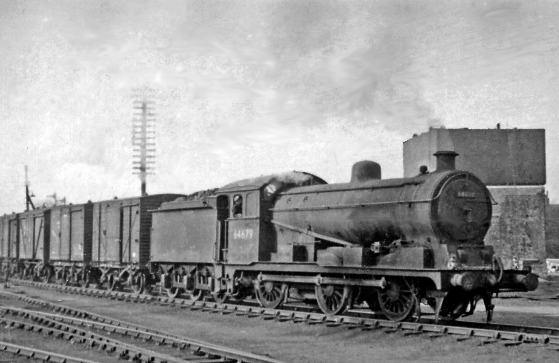
English: A large ex-Great Eastern 0-6-0 shunting at Whitemoor Junction, March. View eastward, where the great Whitemoor Yards debouch onto the GN&GE Joint line at March. No. 64679 is a Hill J20/1 0-6-0, the most powerful of all 0-6-0's |
| Date | |
| Source | From geograph.org.uk |
| Author | Ben Brooksbank |
| Permission (Reusing this file) |
Creative Commons Attribution Share-alike license 2.0 |
| Camera location | | View this and other nearby images on: OpenStreetMap |
|---|
Licensing
[edit]

|
This image was taken from the Geograph project collection. See this photograph's page on the Geograph website for the photographer's contact details. The copyright on this image is owned by Ben Brooksbank and is licensed for reuse under the Creative Commons Attribution-ShareAlike 2.0 license.
|
This file is licensed under the Creative Commons Attribution-Share Alike 2.0 Generic license.
Attribution: Ben Brooksbank
- You are free:
- to share – to copy, distribute and transmit the work
- to remix – to adapt the work
- Under the following conditions:
- attribution – You must give appropriate credit, provide a link to the license, and indicate if changes were made. You may do so in any reasonable manner, but not in any way that suggests the licensor endorses you or your use.
- share alike – If you remix, transform, or build upon the material, you must distribute your contributions under the same or compatible license as the original.
File history
Click on a date/time to view the file as it appeared at that time.
| Date/Time | Thumbnail | Dimensions | User | Comment | |
|---|---|---|---|---|---|
| current | 13:05, 29 September 2018 | | 1,809 × 1,176 (378 KB) | Geograph Update Bot (talk | contribs) | Higher-resolution version from Geograph. |
| 12:41, 15 April 2011 |  | 1,024 × 666 (126 KB) | Chevin (talk | contribs) | == {{int:filedesc}} == {{Information |Description={{en|1=A large ex-Great Eastern 0-6-0 shunting at Whitemoor Junction, March View eastward, where the great Whitemoor Yards debouch onto the GN&GE Joint line at March. No. 64679 is a Hill J20/1 0-6-0, the m |
You cannot overwrite this file.
File usage on Commons
The following page uses this file: