File:March Whitemoor Junction contrasting 0-6-0s geograph-2789913-by-Ben-Brooksbank.jpg
Jump to navigation
Jump to search
Size of this preview: 800 × 494 pixels. Other resolutions: 320 × 198 pixels | 640 × 395 pixels | 1,024 × 632 pixels | 1,280 × 791 pixels | 2,346 × 1,449 pixels.
Original file (2,346 × 1,449 pixels, file size: 1.82 MB, MIME type: image/jpeg)
Captions
Captions
Add a one-line explanation of what this file represents
Summary
[edit]
| Description |
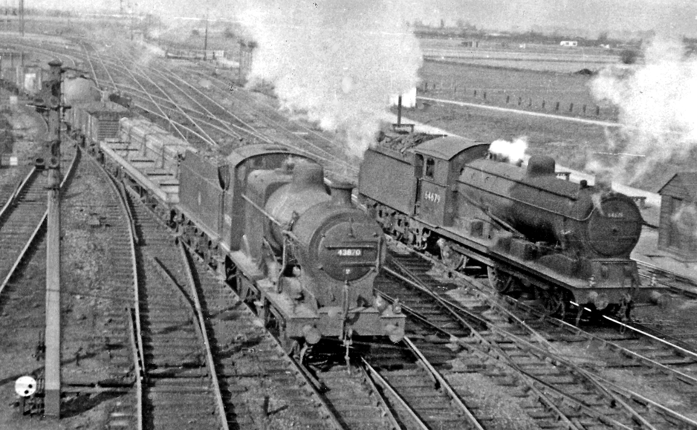
English: Contrasting 0-6-0s at Whitemoor Junction, March. View northward to Whitemoor Marshalling Yards and towards Spalding and the North, also Wisbech and Kings Lynn, BR(ER) ex-GE&GN Joint. On the left is ex-Midland Fowler 4F 0-6-0 No. 43870 (built c. 1914, withdrawn 10/63) leaving the Up Yard on a Class K freight for Peterborough, LMR locomotives being relatively rare at Whitemoor: on the right is ex-GE Hill LNER J20/1 class 0-6-0 No. 64679 (built 12/20, withdrawn 1/61). |
| Date | |
| Source | From geograph.org.uk |
| Author | Ben Brooksbank |
| Permission (Reusing this file) |
Creative Commons Attribution Share-alike license 2.0 |
| Attribution (required by the license) | Ben Brooksbank / Contrasting 0-6-0s at Whitemoor Junction, March / |
| Camera location | | View this and other nearby images on: OpenStreetMap |
|---|
Licensing
[edit]

|
This image was taken from the Geograph project collection. See this photograph's page on the Geograph website for the photographer's contact details. The copyright on this image is owned by Ben Brooksbank and is licensed for reuse under the Creative Commons Attribution-ShareAlike 2.0 license.
|
This file is licensed under the Creative Commons Attribution-Share Alike 2.0 Generic license.
Attribution: Ben Brooksbank
- You are free:
- to share – to copy, distribute and transmit the work
- to remix – to adapt the work
- Under the following conditions:
- attribution – You must give appropriate credit, provide a link to the license, and indicate if changes were made. You may do so in any reasonable manner, but not in any way that suggests the licensor endorses you or your use.
- share alike – If you remix, transform, or build upon the material, you must distribute your contributions under the same or compatible license as the original.
File history
Click on a date/time to view the file as it appeared at that time.
| Date/Time | Thumbnail | Dimensions | User | Comment | |
|---|---|---|---|---|---|
| current | 10:22, 14 February 2012 | | 2,346 × 1,449 (1.82 MB) | Chevin (talk | contribs) | == {{int:filedesc}} == {{Information |Description={{en|1='''Contrasting 0-6-0s at Whitemoor Junction, March.'''<br/> View northward to Whitemoor Marshalling Yards and towards Spalding and the North, also Wisbech and Kings Lynn, BR(ER) ex-GE&GN Joint. On t |
You cannot overwrite this file.
File usage on Commons
There are no pages that use this file.
File usage on other wikis
The following other wikis use this file:
- Usage on de.wikipedia.org
- Usage on en.wikipedia.org