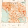
File:Maps of the Balkan Peninsula. LOC map46000385-6.jpg

Original file (6,870 × 7,063 pixels, file size: 7.04 MB, MIME type: image/jpeg)
Captions
Captions
Summary
[edit]| DescriptionMaps of the Balkan Peninsula. LOC map46000385-6.jpg |
English: Relief shown by spot heights; relief also shown by contours and gradient tints on some sheets. Depths shown by gradient tints and soundings on some sheets. Portfolio title. Common title in upper margin of some 1:1,000,000-scale sheets: Europe, scale 1:1,000,000 -- International map, Europe 1:1,000,000. Statement of attribution in lower margin of some sheets, e.g.: War Office, Jan'y 1912 -- War Office, December 1918 -- Compiled at the Royal Geographical Society under the direction of the Geographical Section, General Staff. Ed. statements in margins of some sheets, e.g.: Drawn and printed by the Ordnance Survey 1915 -- Corrections and additions Aug. 1917 -- Revised Jan'y 1916. Boundary revised Nov'r 1918 -- Provisional edition. Publication date on portfolio: April 1919. Sheets variously include notes, adjoining-sheet index diagram, coverage map, pronunciation glossary, list of source-material "Authorities", and hypsometric tint diagram in margins. Accompanied by supplementary sheet: Table of treaties affecting Balkan boundaries, to explain historical map. [1] sheet : table ; 32 x 38 cm. Table of contents on inside of portfolio. Some LC sheets torn at fold lines. LC set originally classified in PreMARC database under: D6.G73 no. 15; later classified as G&M atlas under: G1995.G7 1919. Available also through the Library of Congress Web site as a raster image. |
||
| Title InfoField | Maps of the Balkan Peninsula. | ||
| Shelf ID InfoField | G6800 s1000 .G7 | ||
| Parent InfoField | https://www.loc.gov/resource/g6800m.gct00398/ | ||
| Sheet title InfoField | Sofiya | ||
| Date | |||
| Source | https://www.loc.gov/item/map46000385/ | ||
| Author | Great Britain. Foreign Office. Historical Section; Great Britain. War Office. General Staff. Geographical Section; Royal Geographical Society (Great Britain); Great Britain. Ordnance Survey | ||
| Permission (Reusing this file) |
|
||
| Other versions |
|
||
| Location InfoField | Balkan Peninsula. · Balkan Peninsula | ||
| Part of InfoField | Military Battles And Campaigns · General Maps · Catalog · American Memory · Geography And Map Division | ||
| Subject InfoField | Treaties · Boundaries · Maps · World War · Balkan Peninsula · Territorial Questions |
Licensing
[edit]|
This is a faithful photographic reproduction of a two-dimensional, public domain work of art. The work of art itself is in the public domain for the following reason:
The official position taken by the Wikimedia Foundation is that "faithful reproductions of two-dimensional public domain works of art are public domain".
This photographic reproduction is therefore also considered to be in the public domain in the United States. In other jurisdictions, re-use of this content may be restricted; see Reuse of PD-Art photographs for details. | |||||
File history
Click on a date/time to view the file as it appeared at that time.
| Date/Time | Thumbnail | Dimensions | User | Comment | |
|---|---|---|---|---|---|
| current | 04:47, 8 June 2018 |  | 6,870 × 7,063 (7.04 MB) | Fæ (talk | contribs) | LOC Maps multisheet https://www.loc.gov/item/map46000385/ sheet 6 of 10 #3330 |
You cannot overwrite this file.
File usage on Commons
The following page uses this file:

