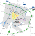
File:Mappa Tram Padova 5 linee.svg
From Wikimedia Commons, the free media repository
Jump to navigation
Jump to search

Size of this PNG preview of this SVG file: 570 × 600 pixels. Other resolutions: 228 × 240 pixels | 456 × 480 pixels | 730 × 768 pixels | 973 × 1,024 pixels | 1,946 × 2,048 pixels | 950 × 1,000 pixels.
Original file (SVG file, nominally 950 × 1,000 pixels, file size: 574 KB)
File information
Structured data
Captions
Captions
Add a one-line explanation of what this file represents
Summary
[edit]| DescriptionMappa Tram Padova 5 linee.svg |
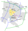
English: Map of Padua tram. Have been traced all the lines, existing and planned.
Italiano: Mappa del tram di Padova. Sono state tracciate tutte le linee, esistenti ed in progetto. |
| Date | |
| Source | Own work |
| Author | Danielemezzalira |
Licensing
[edit]| Public domainPublic domainfalsefalse |
| I, the copyright holder of this work, release this work into the public domain. This applies worldwide. In some countries this may not be legally possible; if so: I grant anyone the right to use this work for any purpose, without any conditions, unless such conditions are required by law. |
File history
Click on a date/time to view the file as it appeared at that time.
| Date/Time | Thumbnail | Dimensions | User | Comment | |
|---|---|---|---|---|---|
| current | 11:08, 7 October 2011 |  | 950 × 1,000 (574 KB) | Danielemezzalira (talk | contribs) | sfondo e correzione Stazione Padova Brusegana |
| 02:06, 29 January 2011 |  | 950 × 1,000 (573 KB) | Danielemezzalira (talk | contribs) | Il testo ora è tracciato, per le modifiche il font è ''Transport'' (font ufficiale della segnaletica stradale italiana, elaborato dal dipartimento dei trasporti UK). Per i capolinea del tram e per il nome delle linee sir la dimensione è 17, per le staz | |
| 19:34, 28 January 2011 |  | 950 × 1,000 (95 KB) | Danielemezzalira (talk | contribs) | Aggiunta la Ferrovia sono segnate anche le costruende fermate dell'SFMR (anche il progetto della gronda sud dalla ZIP ad Abano via Ponte san Nicolò / Albignasego). Numerate anche le tangenziali. | |
| 19:24, 23 January 2011 |  | 906 × 912 (38 KB) | Danielemezzalira (talk | contribs) | Eliminati i fastidiosi rettangoli neri | |
| 18:32, 23 January 2011 |  | 906 × 913 (41 KB) | Danielemezzalira (talk | contribs) | Simboli Autostrade; ridimensionamento. | |
| 18:11, 23 January 2011 |  | 906 × 983 (38 KB) | Danielemezzalira (talk | contribs) | Aggiunta dei confini del comune di Padova e spostamento del Capolinea del Sir2 a Busa di Vigonza presso la costruenda stazione FS | |
| 15:52, 23 January 2011 |  | 876 × 704 (29 KB) | Danielemezzalira (talk | contribs) | {{Information |Description ={{en|1=Map of Padua tram. Have been traced all the lines, existing and planned.}} {{it|1=Mappa del tram di Padova. Sono state tracciate tutte le linee, esistenti ed in progetto.}} |Source ={{own}} |Author =[[ |
You cannot overwrite this file.
File usage on Commons
The following page uses this file:
File usage on other wikis
The following other wikis use this file: