File:Mapamondi Vol Dir Aytant Con Ymage Del Mon E De Les Regions Que.jpg
Jump to navigation
Jump to search

Size of this preview: 764 × 599 pixels. Other resolutions: 306 × 240 pixels | 612 × 480 pixels | 979 × 768 pixels | 1,280 × 1,004 pixels | 2,560 × 2,008 pixels | 6,517 × 5,113 pixels.
Original file (6,517 × 5,113 pixels, file size: 8.44 MB, MIME type: image/jpeg)
Captions
Captions
Add a one-line explanation of what this file represents
Summary
[edit]
| Description |
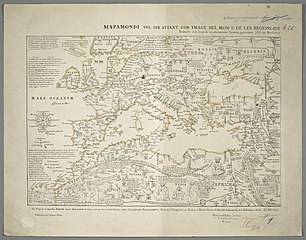
Deutsch: 1 Kt. : Grenzen kolor. (46 x 31 cm) ; Koordinaten W 26°27'00"-E 46°03'00"/N 60°59'00"-N 23°29'00" ; Aus: Notices et Extraits de Manuscrits de la Bibliothèque du Roi, Vol. XIV. - Ohne Maßstab. - Titel oberhalb des Kt.-Feldes. - Mit Anm. im Kt.-Feld. - Ohne Relief |
| Date | (original); 1843 (facsimilie) |
| Source | Leibniz-Institut für Länderkunde e.V., Leipzig |
| Author | Kraatz, Leopold ; Buchon, Jean Alexandre C. ; Tastu, Joseph |
Altkarte ; Weltkarte
Licensing
[edit]
| This file is made available under the Creative Commons CC0 1.0 Universal Public Domain Dedication. | |
| The person who associated a work with this deed has dedicated the work to the public domain by waiving all of their rights to the work worldwide under copyright law, including all related and neighboring rights, to the extent allowed by law. You can copy, modify, distribute and perform the work, even for commercial purposes, all without asking permission.
|
File history
Click on a date/time to view the file as it appeared at that time.
| Date/Time | Thumbnail | Dimensions | User | Comment | |
|---|---|---|---|---|---|
| current | 08:36, 11 March 2019 | | 6,517 × 5,113 (8.44 MB) | Higgenhorscht (talk | contribs) | User created page with UploadWizard |
You cannot overwrite this file.
File usage on Commons
There are no pages that use this file.