File:Mapa dos municípios do estado de Pernambuco, Brasil.svg
Jump to navigation
Jump to search

Size of this PNG preview of this SVG file: 800 × 328 pixels. Other resolutions: 320 × 131 pixels | 640 × 263 pixels | 1,024 × 420 pixels | 1,280 × 525 pixels | 2,560 × 1,050 pixels | 1,372 × 563 pixels.
Original file (SVG file, nominally 1,372 × 563 pixels, file size: 3.01 MB)
Captions
Captions
Add a one-line explanation of what this file represents
Summary
[edit]
| Description |
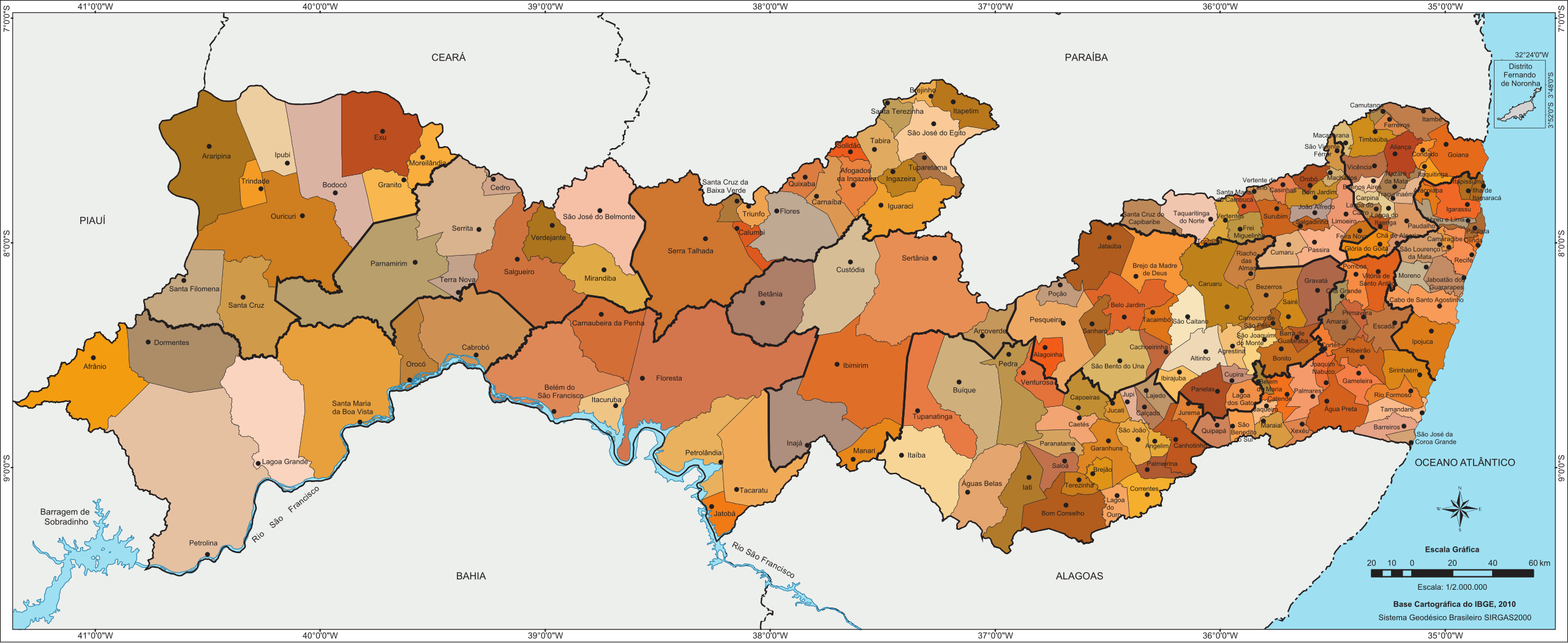
Português: Mapa dos municípios do estado de Pernambuco, Brasil. |
| Date | |
| Source |
Base cartográfica IBGE, 2010. Área Territorial Oficial - IBGE 2015. São treze os municípios pernambucanos que tiveram recentemente os limites geográficos revistos e ajustados a partir de uma ação realizada em parceria entre a Agência Estadual de Planejamento e Pesquisas de Pernambuco – Condepe/Fidem e o Instituto Brasileiro de Geografia e Estatística (IBGE)
|
| Author | Frag15 |
Licensing
[edit]
I, the copyright holder of this work, hereby publish it under the following license:
This file is licensed under the Creative Commons Attribution-Share Alike 4.0 International license.
- You are free:
- to share – to copy, distribute and transmit the work
- to remix – to adapt the work
- Under the following conditions:
- attribution – You must give appropriate credit, provide a link to the license, and indicate if changes were made. You may do so in any reasonable manner, but not in any way that suggests the licensor endorses you or your use.
- share alike – If you remix, transform, or build upon the material, you must distribute your contributions under the same or compatible license as the original.
File history
Click on a date/time to view the file as it appeared at that time.
| Date/Time | Thumbnail | Dimensions | User | Comment | |
|---|---|---|---|---|---|
| current | 17:07, 12 August 2016 | 1,372 × 563 (3.01 MB) | Frag15 (talk | contribs) | cor do mapa | |
| 19:25, 10 July 2016 |  | 1,002 × 414 (2.88 MB) | Frag15 (talk | contribs) | coordenadas | |
| 19:15, 10 July 2016 |  | 1,002 × 414 (2.88 MB) | Frag15 (talk | contribs) | User created page with UploadWizard |
You cannot overwrite this file.
File usage on Commons
There are no pages that use this file.