File:Mapa del Estado de Antioquia (1880).jpg
Jump to navigation
Jump to search
Size of this preview: 460 × 599 pixels. Other resolutions: 184 × 240 pixels | 368 × 480 pixels | 589 × 768 pixels | 786 × 1,024 pixels | 1,679 × 2,187 pixels.
Original file (1,679 × 2,187 pixels, file size: 2.29 MB, MIME type: image/jpeg)
Captions
Captions
Add a one-line explanation of what this file represents
Summary
[edit].jpg&action=edit§ion=1)
| Description |
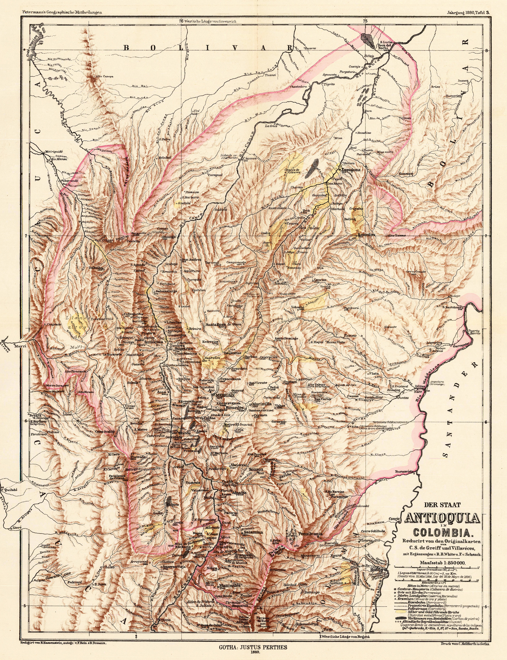
Español: Der Staat Antioquia in Colombia |
| Date | |
| Source | Archivo General de la Nación, Colombia |
| Author | Carlos Segismundo de Greiff |
Licensing
[edit].jpg&action=edit§ion=2)
This file is in the public domain because the copyright of this work, registered in Colombia, has expired, according to “Law 23 of 1982 on Copyright, Articles 11, 21-29”, amended by “Law 44 of 1993, Article 2” and “Law 1520 of 2012, Articles 4, 6 and 10” (details). However, some restrictions have to be addressed:
|

|
File history
Click on a date/time to view the file as it appeared at that time.
| Date/Time | Thumbnail | Dimensions | User | Comment | |
|---|---|---|---|---|---|
| current | 04:56, 18 December 2014 | | 1,679 × 2,187 (2.29 MB) | Milenioscuro (talk | contribs) | User created page with UploadWizard |
You cannot overwrite this file.
File usage on Commons
There are no pages that use this file.
File usage on other wikis
The following other wikis use this file:
- Usage on es.wikipedia.org
.jpg&oldid=809690827)