File:Mapa del Eje Cafetero.svg
Jump to navigation
Jump to search

Size of this PNG preview of this SVG file: 569 × 600 pixels. Other resolutions: 228 × 240 pixels | 455 × 480 pixels | 728 × 768 pixels | 971 × 1,024 pixels | 1,942 × 2,048 pixels | 1,196 × 1,261 pixels.
Original file (SVG file, nominally 1,196 × 1,261 pixels, file size: 933 KB)
Captions
Captions
Add a one-line explanation of what this file represents
Summary
[edit]
| Description |
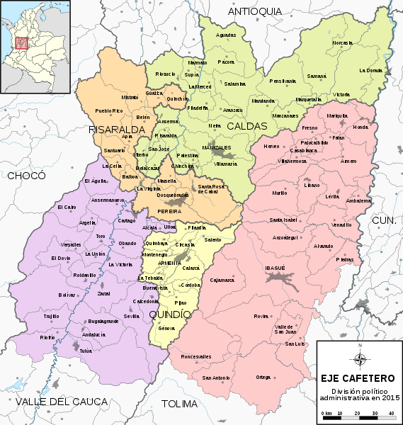
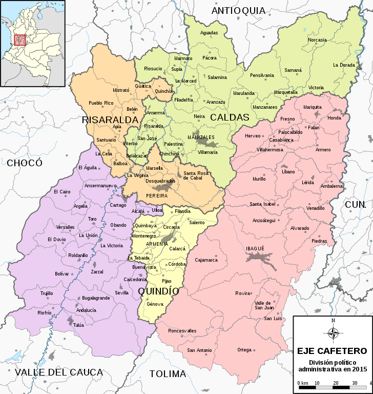
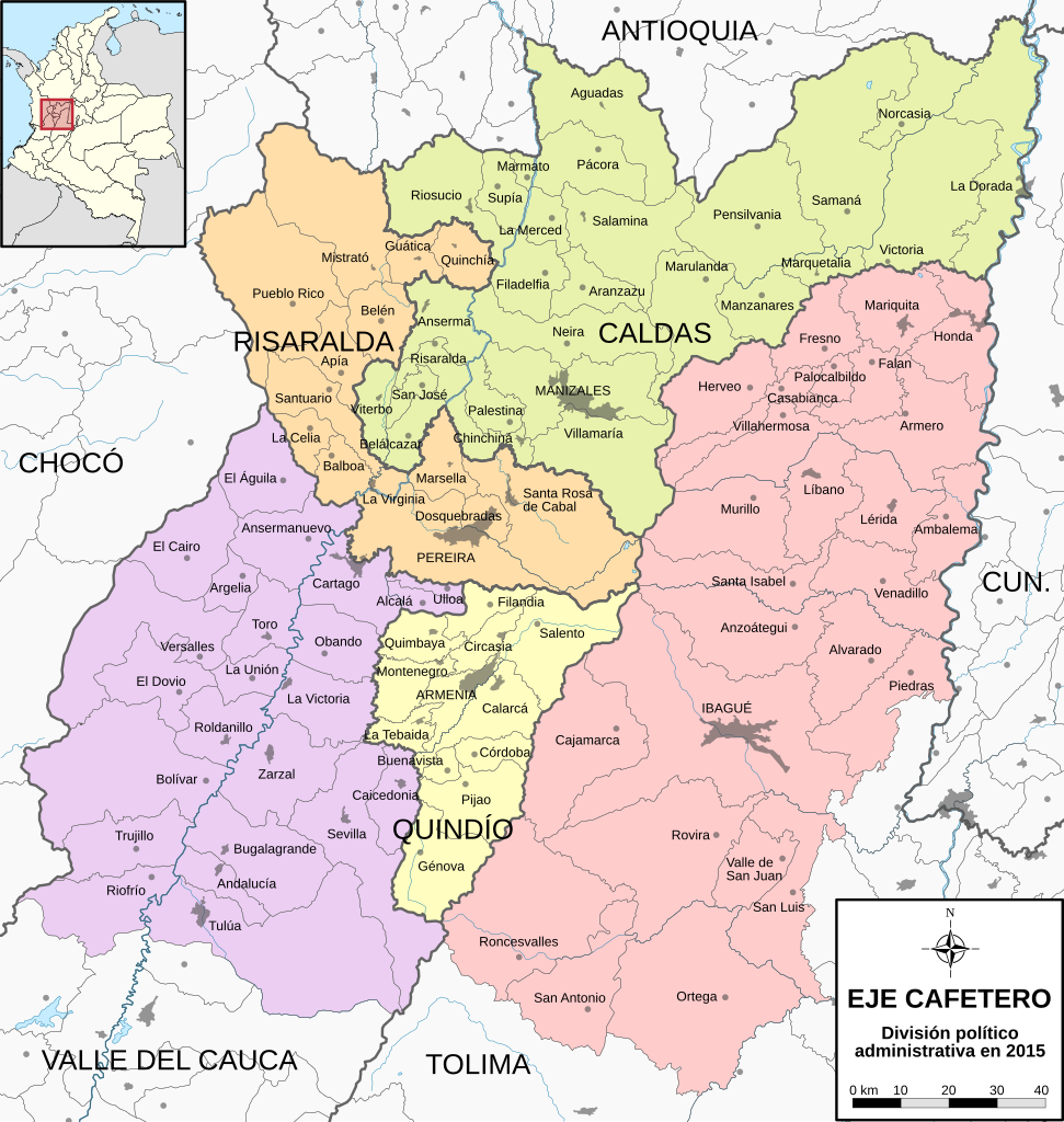
Español: Mapa de la región del Eje Cafetero, en Colombia |
| Date | |
| Source |
Own work Mapa territorial del Eje Cafetero Mapa de la ecorregión del Eje Cafetero Ubicación del SIRAP-EC |
| Author | Milenioscuro |
Licensing
[edit]
I, the copyright holder of this work, hereby publish it under the following license:
This file is licensed under the Creative Commons Attribution-Share Alike 4.0 International license.
- You are free:
- to share – to copy, distribute and transmit the work
- to remix – to adapt the work
- Under the following conditions:
- attribution – You must give appropriate credit, provide a link to the license, and indicate if changes were made. You may do so in any reasonable manner, but not in any way that suggests the licensor endorses you or your use.
- share alike – If you remix, transform, or build upon the material, you must distribute your contributions under the same or compatible license as the original.
File history
Click on a date/time to view the file as it appeared at that time.
| Date/Time | Thumbnail | Dimensions | User | Comment | |
|---|---|---|---|---|---|
| current | 04:24, 18 May 2018 | | 1,196 × 1,261 (933 KB) | Milenioscuro (talk | contribs) | mejoras del mapa |
| 02:10, 30 November 2014 |  | 796 × 576 (558 KB) | Milenioscuro (talk | contribs) | User created page with UploadWizard |
You cannot overwrite this file.
File usage on Commons
The following 2 pages use this file:
File usage on other wikis
The following other wikis use this file:
- Usage on de.wikipedia.org
- Usage on de.wikivoyage.org
- Usage on en.wikipedia.org
- Usage on es.wikipedia.org
- Usage on id.wikipedia.org
- Usage on ms.wikipedia.org
- Usage on sl.wikipedia.org
- Usage on vi.wikipedia.org