File:Mapa del Departamento de Tacna, Chile (año 1900).png
Jump to navigation
Jump to search
Size of this preview: 353 × 599 pixels. Other resolutions: 141 × 240 pixels | 283 × 480 pixels | 452 × 768 pixels | 1,251 × 2,123 pixels.
Original file (1,251 × 2,123 pixels, file size: 3.36 MB, MIME type: image/png)
Captions
Captions
Add a one-line explanation of what this file represents
Summary
[edit].png&action=edit§ion=1)
| Description |
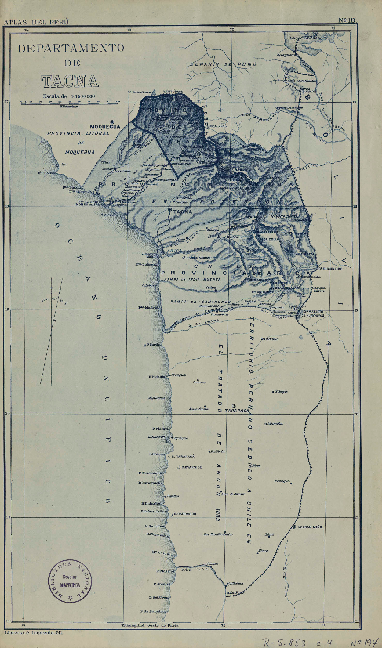
Español: Mapa del Departamento de Tacna, Chile (año 1900 aprox.)
Colección: Mapoteca / Colección General Materias: Mapas - Tacna (Chile) Tipo de objeto: Material cartográfico Año: 1900 Datos de publicación: [Perú] : Librería é Imprenta Gil, [entre 1900 a 1930] Tipo de acceso: Acceso en línea BN Código: MP0003897 N° Sistema: 1112552 BND id: 334739 |
| Date | |
| Source | http://www.bibliotecanacionaldigital.gob.cl/visor/BND:334739 |
| Author | Librería é Imprenta Gil |
Licensing
[edit].png&action=edit§ion=2)
This file has fallen into the public domain according to Chilean copyright law (No. 17336 and its amendments). Nevertheless, its author and source must be acknowledged.
See here for the type of material that is in the public domain (patrimonio cultural común / common cultural heritage).
|

|
File history
Click on a date/time to view the file as it appeared at that time.
| Date/Time | Thumbnail | Dimensions | User | Comment | |
|---|---|---|---|---|---|
| current | 20:39, 11 February 2020 | | 1,251 × 2,123 (3.36 MB) | Janitoalevic (talk | contribs) | User created page with UploadWizard |
You cannot overwrite this file.
File usage on Commons
There are no pages that use this file.
.png&oldid=851537071)