File:Mapa de Mexticacán.jpg
Jump to navigation
Jump to search
No higher resolution available.
Mapa_de_Mexticacán.jpg (407 × 277 pixels, file size: 49 KB, MIME type: image/jpeg)
Captions
Captions
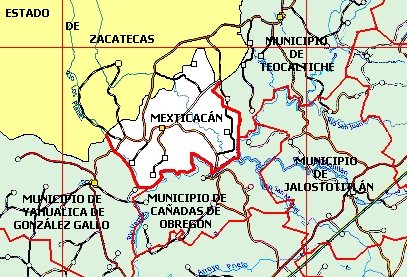
Map of Mexticacán.
Summary
[edit]
| Description |
English: Map of Mexticacán, Jalisco.
Español: Mapa de Mexticacán, Jalisco. |
| Date | Unknown date |
| Source | https://www.jalisco.gob.mx/es/jalisco/municipios/mexticacan |
| Author | Gobierno de Jalisco |
Licensing
[edit]
| This map is ineligible for copyright and therefore in the public domain, because it consists entirely of information that is common property and contains no original authorship. For more information, see Commons:Threshold of originality § Maps.
|
File history
Click on a date/time to view the file as it appeared at that time.
| Date/Time | Thumbnail | Dimensions | User | Comment | |
|---|---|---|---|---|---|
| current | 19:49, 25 October 2023 | | 407 × 277 (49 KB) | El Nuevo Doge (talk | contribs) | Uploaded a work by Gobierno de Jalisco from https://www.jalisco.gob.mx/es/jalisco/municipios/mexticacan with UploadWizard |
You cannot overwrite this file.
File usage on Commons
There are no pages that use this file.