File:Mapa de Europa en 1914.png

Original file (1,059 × 674 pixels, file size: 799 KB, MIME type: image/png)
Captions
Captions
Summary
[edit]
| Description |
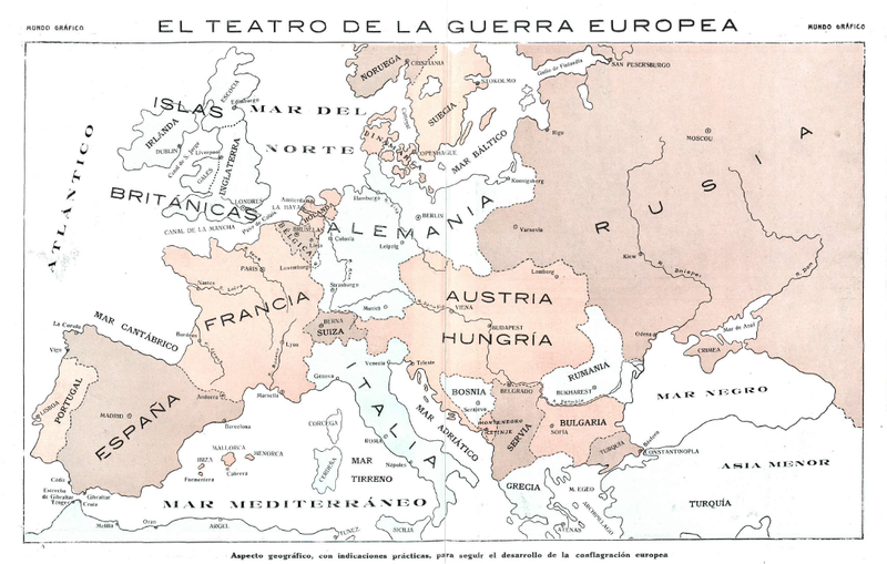
Español: Mapa de Europa publicado en 1914 con motivo del estallido de la guerra en el continente |
| Date | |
| Source | Mundo Gráfico, número 146 de 12 de agosto de 1914, página 25 |
| Author | No consta |
Licensing
[edit]
|
This work is in the public domain in its country of origin and other countries and areas where the copyright term is the author's life plus 80 years or fewer.
| |
| This file has been identified as being free of known restrictions under copyright law, including all related and neighboring rights. | |
File history
Click on a date/time to view the file as it appeared at that time.
| Date/Time | Thumbnail | Dimensions | User | Comment | |
|---|---|---|---|---|---|
| current | 10:05, 26 April 2015 | | 1,059 × 674 (799 KB) | Chamarasca (talk | contribs) | User created page with UploadWizard |
You cannot overwrite this file.
File usage on Commons
The following page uses this file:
File usage on other wikis
The following other wikis use this file:
- Usage on es.wikibooks.org