File:Mapa de Castilla la Nueva-Tomas Lopez 1785.jpg
Jump to navigation
Jump to search
Size of this preview: 728 × 599 pixels. Other resolutions: 292 × 240 pixels | 583 × 480 pixels | 933 × 768 pixels | 1,244 × 1,024 pixels | 1,313 × 1,081 pixels.
Original file (1,313 × 1,081 pixels, file size: 323 KB, MIME type: image/jpeg)
Captions
Captions
Add a one-line explanation of what this file represents
Summary
[edit]
| Description |
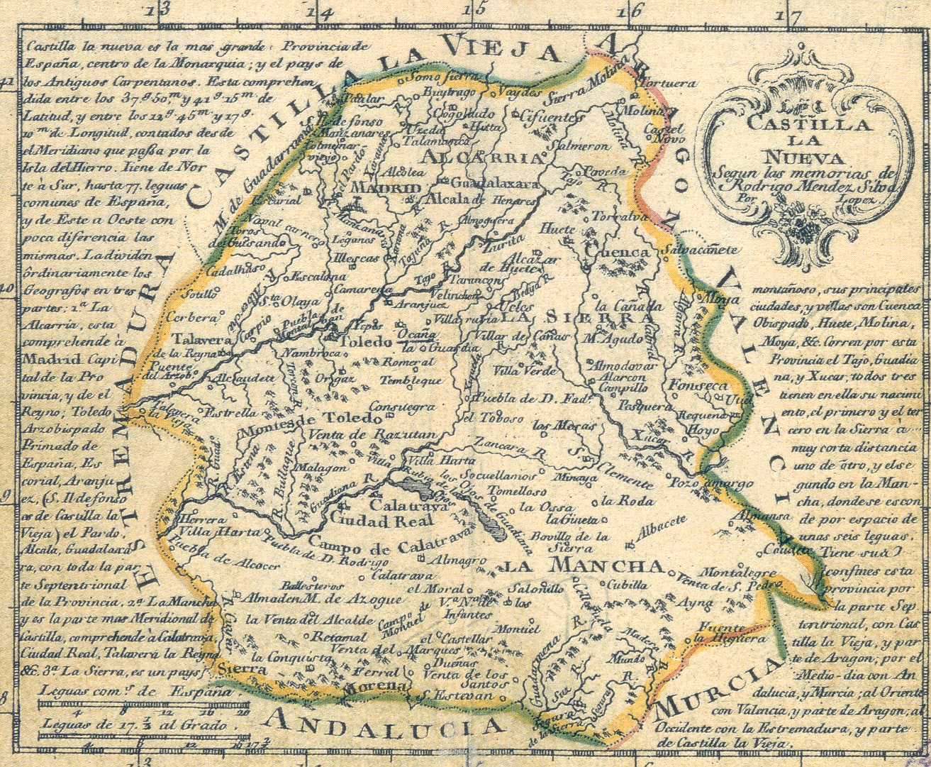
English: Map of New Castile by Tomás López
Español: Mapa de Castilla la Nueva por Tomás López |
|||||||||||||||||||
| Date | ||||||||||||||||||||
| Source | http://www.uam.es/personal_pdi/ciencias/depaz/mesa/default2.htm | |||||||||||||||||||
| Author |
|
|||||||||||||||||||
Licensing
[edit]
|
This work is in the public domain in its country of origin and other countries and areas where the copyright term is the author's life plus 100 years or fewer. | |
| This file has been identified as being free of known restrictions under copyright law, including all related and neighboring rights. | |
Province o
File history
Click on a date/time to view the file as it appeared at that time.
| Date/Time | Thumbnail | Dimensions | User | Comment | |
|---|---|---|---|---|---|
| current | 15:22, 24 July 2010 | | 1,313 × 1,081 (323 KB) | Javierllorente (talk | contribs) | {{Information |Description={{en|1=Map of New Castile by Tomás López}} {{es|1=Mapa de Castilla la Nueva por Tomás López}} |Source=http://www.uam.es/personal_pdi/ciencias/depaz/mesa/default2.htm |Author=Tomás López |Date=1785 |Permission= |other_versi |
You cannot overwrite this file.
File usage on Commons
There are no pages that use this file.
File usage on other wikis
The following other wikis use this file:
- Usage on ast.wikipedia.org
- Usage on azb.wikipedia.org
- Usage on br.wikipedia.org
- Usage on ca.wikipedia.org
- Usage on en.wikipedia.org
- Usage on es.wikipedia.org
- Usage on eu.wikipedia.org
- Usage on he.wikipedia.org
- Usage on ja.wikipedia.org
- Usage on sr.wikipedia.org
Metadata
Categories:
- 1785 maps of Spain
- Old maps of Castilla la Nueva
- Madrid in the 18th century
- Old maps of the province of Guadalajara
- Maps of the province of Toledo
- Maps of the province of Cuenca
- Maps of the province of Ciudad Real
- La Mancha de Cuenca
- Mancha Alta de Toledo
- La Alcarria
- Sierra de Guadarrama
- Maps of Spain by Tomas Lopez