File:Mapa Sistema Metrofor 2023.png
Jump to navigation
Jump to search
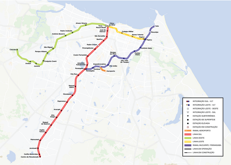
Size of this preview: 800 × 573 pixels. Other resolutions: 320 × 229 pixels | 640 × 459 pixels | 1,024 × 734 pixels | 1,280 × 918 pixels | 2,560 × 1,835 pixels | 3,627 × 2,600 pixels.
Original file (3,627 × 2,600 pixels, file size: 2.14 MB, MIME type: image/png)
Captions
Captions
Add a one-line explanation of what this file represents
Summary
[edit]
| Description |
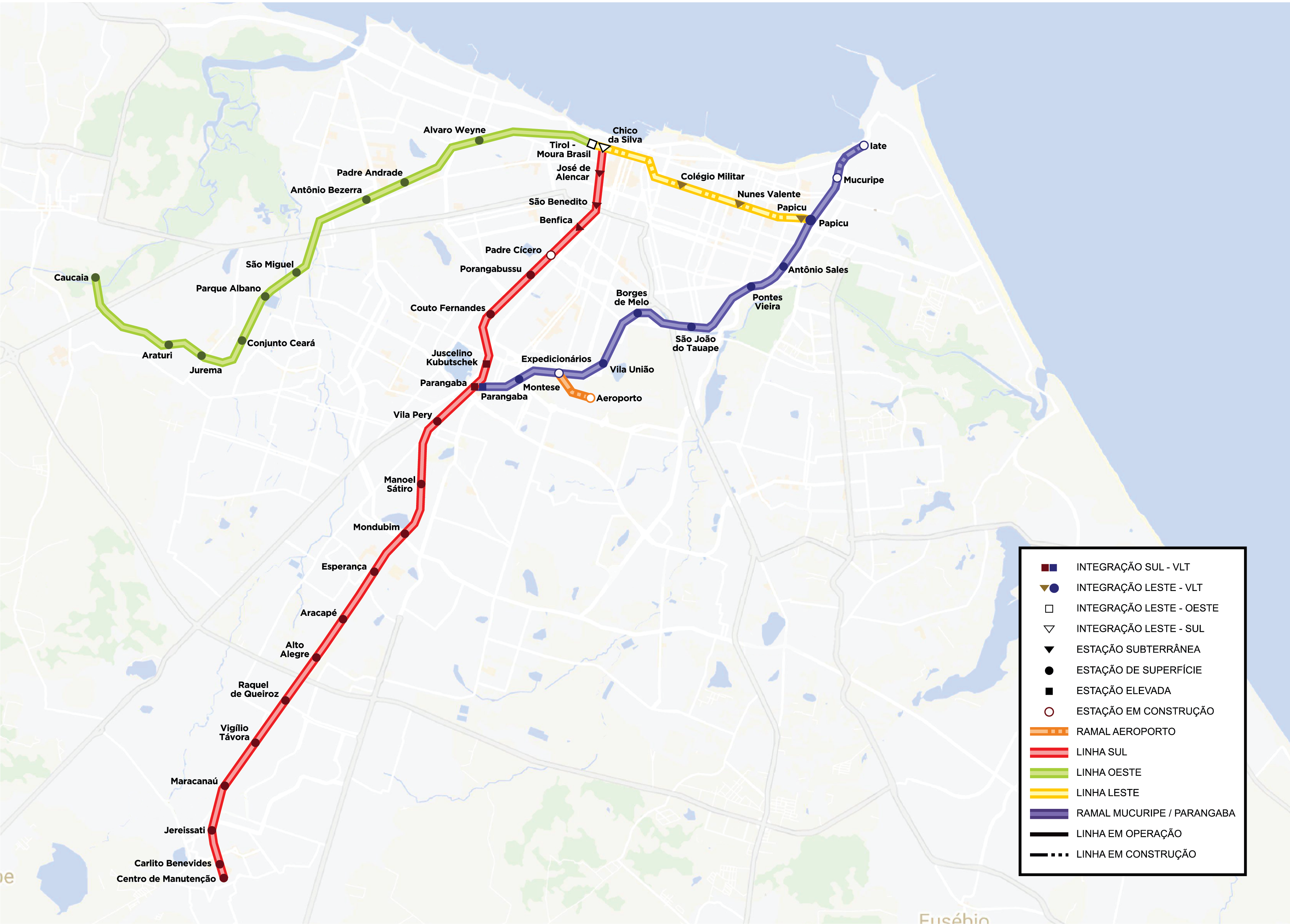
Português: Mapa do sistema do Metrô de Fortaleza (Metrofor). Na imagem estação presente as seguintes linhas: Linha Sul, em formato de Metrô é a primeira é maior linha do sistema ligando Fortaleza, Maracanaú e Pacatuba. Linha Oeste, operado por VLTs a diesel, liga Fortaleza a Caucaia. Linha Nordeste, ou Parangaba Mucuripe, operada por VLT a diesel, liga o bairro da Parangaba a região do Grande Mucuripe em Fortaleza. Também estão no mapa o futuro ramal aeroporto e a futura Linha Leste do Metrô. |
| Date | |
| Source | https://www.metrofor.ce.gov.br/wp-content/uploads/sites/32/2023/06/Mapa-Sistema-Metrofor-Ceara-2023.png |
| Author | Companhia Cearense de Transportes Metropolitanos |
Licensing
[edit]
This file is licensed under the Creative Commons Attribution-Share Alike 3.0 Unported license.
- You are free:
- to share – to copy, distribute and transmit the work
- to remix – to adapt the work
- Under the following conditions:
- attribution – You must give appropriate credit, provide a link to the license, and indicate if changes were made. You may do so in any reasonable manner, but not in any way that suggests the licensor endorses you or your use.
- share alike – If you remix, transform, or build upon the material, you must distribute your contributions under the same or compatible license as the original.
File history
Click on a date/time to view the file as it appeared at that time.
| Date/Time | Thumbnail | Dimensions | User | Comment | |
|---|---|---|---|---|---|
| current | 15:40, 6 August 2023 | | 3,627 × 2,600 (2.14 MB) | Ruan moreira (talk | contribs) | Uploaded a work by Companhia Cearense de Transportes Metropolitanos from https://www.metrofor.ce.gov.br/wp-content/uploads/sites/32/2023/06/Mapa-Sistema-Metrofor-Ceara-2023.png with UploadWizard |
You cannot overwrite this file.
File usage on Commons
There are no pages that use this file.
File usage on other wikis
The following other wikis use this file:
- Usage on eo.wikipedia.org
- Usage on it.wikipedia.org
- Usage on pt.wikipedia.org