File:Mapa San Benito.PNG
Jump to navigation
Jump to search

Size of this preview: 800 × 468 pixels. Other resolutions: 320 × 187 pixels | 640 × 374 pixels | 993 × 581 pixels.
Original file (993 × 581 pixels, file size: 80 KB, MIME type: image/png)
Captions
Captions
Add a one-line explanation of what this file represents
Summary
[edit]
| Description |
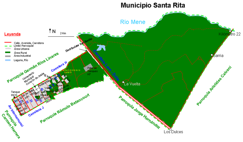
Español: Mapa completo de la parroquia San Benito, municipio Cabimas, Estado Zulia, Venezuela |
| Date | |
| Source | Own work |
| Author | Andrés González |
Licensing
[edit]
| I, the copyright holder of this work, release this work into the public domain. This applies worldwide. In some countries this may not be legally possible; if so: I grant anyone the right to use this work for any purpose, without any conditions, unless such conditions are required by law. |
File history
Click on a date/time to view the file as it appeared at that time.
| Date/Time | Thumbnail | Dimensions | User | Comment | |
|---|---|---|---|---|---|
| current | 02:44, 6 February 2013 | | 993 × 581 (80 KB) | Andrés González (talk | contribs) | Añadidos detalles, cambiados los símbolos de límite parroquial y área industrial |
| 15:07, 17 July 2008 |  | 971 × 583 (52 KB) | Andrés González (talk | contribs) | {{Information |Description={{es|1=Mapa completo de la parroquia San Benito, municipio Cabimas, Estado Zulia, Venezuela}} |Source=Own work by uploader |Author=Andrés González |Date=17/07/2008 |Permission= |other_versions= }} { |
You cannot overwrite this file.
File usage on Commons
There are no pages that use this file.
File usage on other wikis
The following other wikis use this file:
- Usage on es.wikipedia.org
- Usage on fr.wikipedia.org