File:Mapa Germán Ríos Linares.PNG
Jump to navigation
Jump to search
Size of this preview: 800 × 555 pixels. Other resolutions: 320 × 222 pixels | 640 × 444 pixels | 1,024 × 711 pixels | 1,174 × 815 pixels.
Original file (1,174 × 815 pixels, file size: 135 KB, MIME type: image/png)
Captions
Captions
Add a one-line explanation of what this file represents
Summary
[edit]
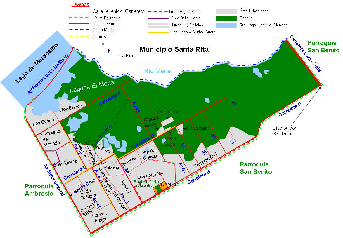
| Description | Mapa de la Parroquia Germán Ríos Linares, Municipio Cabimas, Zulia, Venezuela |
| Date | 01/07/2008 |
| Source | Own work |
| Author | Andrés González |
Licensing
[edit]
| I, the copyright holder of this work, release this work into the public domain. This applies worldwide. In some countries this may not be legally possible; if so: I grant anyone the right to use this work for any purpose, without any conditions, unless such conditions are required by law. |
File history
Click on a date/time to view the file as it appeared at that time.
| Date/Time | Thumbnail | Dimensions | User | Comment | |
|---|---|---|---|---|---|
| current | 03:03, 8 February 2013 | | 1,174 × 815 (135 KB) | Andrés González (talk | contribs) | Añadida leyenda, rutas de transporte y algunos sectores |
| 19:24, 7 February 2011 |  | 1,174 × 709 (102 KB) | Andrés González (talk | contribs) | Mapa mejorado con escala, norte, carreteras y mas barrios | |
| 20:57, 1 July 2008 |  | 745 × 475 (47 KB) | Andrés González (talk | contribs) | {{Information |Description=Mapa de la Parroquia Germán Ríos Linares, Municipio Cabimas, Zulia, Venezuela |Source=Own work |Date=01/07/2008 |Author=Andrés González |Permission= |other_versions= }} {{ImageUpload|basic}} |
You cannot overwrite this file.
File usage on Commons
There are no pages that use this file.
File usage on other wikis
The following other wikis use this file:
- Usage on es.wikipedia.org
- Usage on fr.wikipedia.org