File:Map of the roads from Monclova to Monterey, from Monterey to Saltillo, from Saltillo to Tanque San Felipe, and from Parras to Saltillo. LOC 2001622409.jpg
Jump to navigation
Jump to search

Size of this preview: 738 × 599 pixels. Other resolutions: 296 × 240 pixels | 591 × 480 pixels | 946 × 768 pixels | 1,261 × 1,024 pixels | 2,522 × 2,048 pixels | 4,392 × 3,567 pixels.
Original file (4,392 × 3,567 pixels, file size: 1.48 MB, MIME type: image/jpeg)
Captions
Captions
Add a one-line explanation of what this file represents
Summary
[edit]| Description |
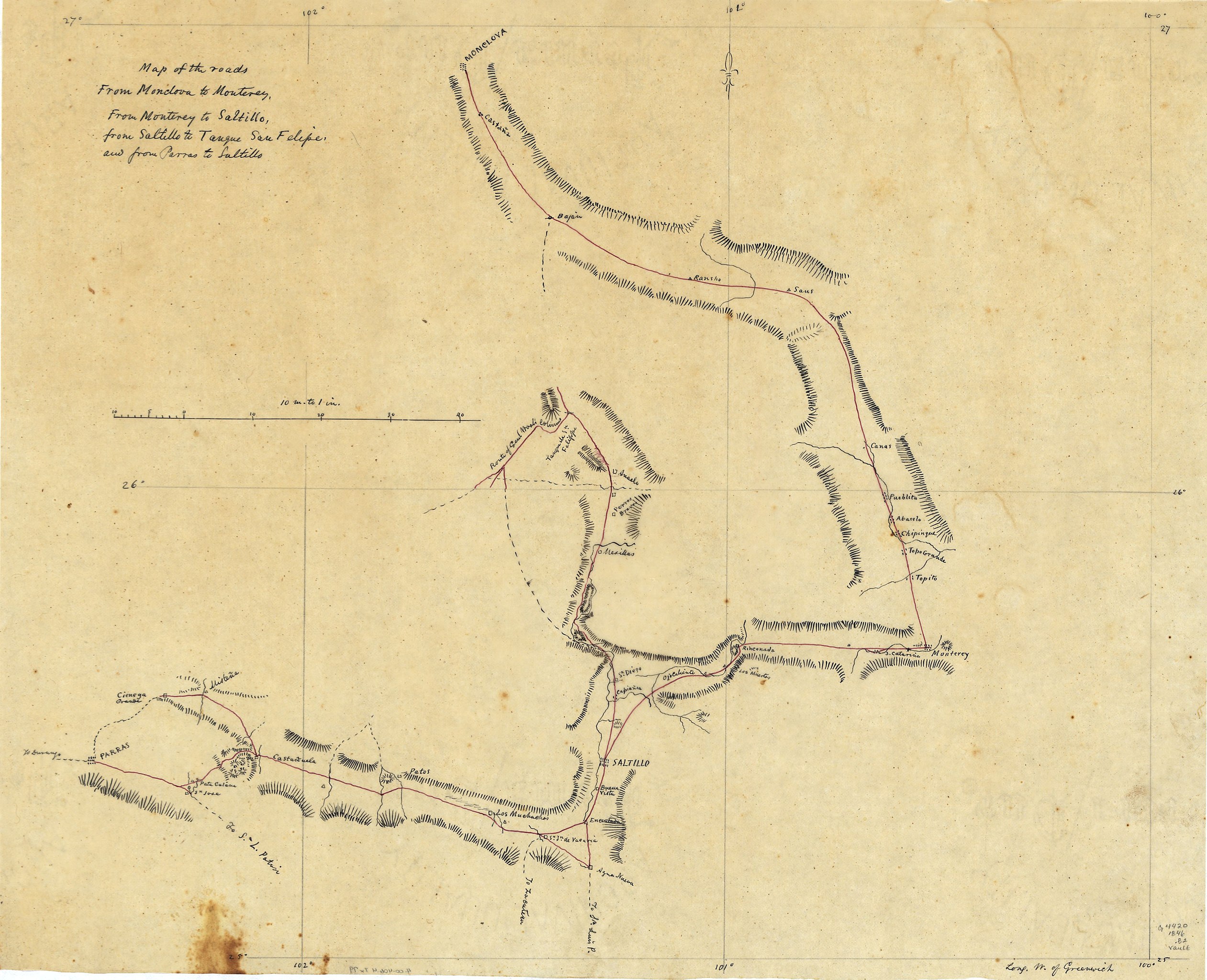
English: Shows southern state of Coahuila and northwestern state of Nuevo León. Relief shown by hachures. Pen-and-ink, red ink, and pencil on tracing paper. LC Luso-Hispanic World, 555 Available also through the Library of Congress Web site as a raster image. Vault |
||
| Title | Map of the roads from Monclova to Monterey, from Monterey to Saltillo, from Saltillo to Tanque San Felipe, and from Parras to Saltillo. | ||
| Shelf ID | G4450 1846 .B69 | ||
| Date | |||
| Source | https://www.loc.gov/item/2001622409/ | ||
| Author | Bruff, Joseph Goldsborough | ||
| Permission (Reusing this file) |
|
||
| Other versions |
|
||
| Location | Nuevo León. · Nuevo León · Coahuila · Mexico | ||
| Part of | American Memory · Catalog · Geography And Map Division · Cultural Landscapes | ||
| Subject | Maps, Manuscript · Mexico · Nuevo León (Mexico : State) · Coahuila (Mexico : State) · Nuevo León · Coahuila |


Licensing
[edit]
|
This is a faithful photographic reproduction of a two-dimensional, public domain work of art. The work of art itself is in the public domain for the following reason:
The official position taken by the Wikimedia Foundation is that "faithful reproductions of two-dimensional public domain works of art are public domain".
This photographic reproduction is therefore also considered to be in the public domain in the United States. In other jurisdictions, re-use of this content may be restricted; see Reuse of PD-Art photographs for details. | ||||
File history
Click on a date/time to view the file as it appeared at that time.
| Date/Time | Thumbnail | Dimensions | User | Comment | |
|---|---|---|---|---|---|
| current | 07:27, 25 May 2018 | | 4,392 × 3,567 (1.48 MB) | Fæ (talk | contribs) | LOC Maps https://www.loc.gov/item/2001622409/ #795 |
You cannot overwrite this file.
File usage on Commons
The following page uses this file: