File:Map of the irrigated lands of the Poudre Valley, Weld County, Colorado - DPLA - d4d700265fef483605f3ae8961d6f47f.jpg
Jump to navigation
Jump to search

Size of this preview: 713 × 599 pixels. Other resolutions: 286 × 240 pixels | 571 × 480 pixels | 914 × 768 pixels | 1,218 × 1,024 pixels | 2,437 × 2,048 pixels | 8,999 × 7,564 pixels.
Original file (8,999 × 7,564 pixels, file size: 11.69 MB, MIME type: image/jpeg)
Captions
Captions
Add a one-line explanation of what this file represents
Summary
[edit]This file was uploaded by the Digital Public Library of America, and the following item metadata was created by the contributing institution's staff.
Note: this data is being maintained by an automated bot, synced with the source data.
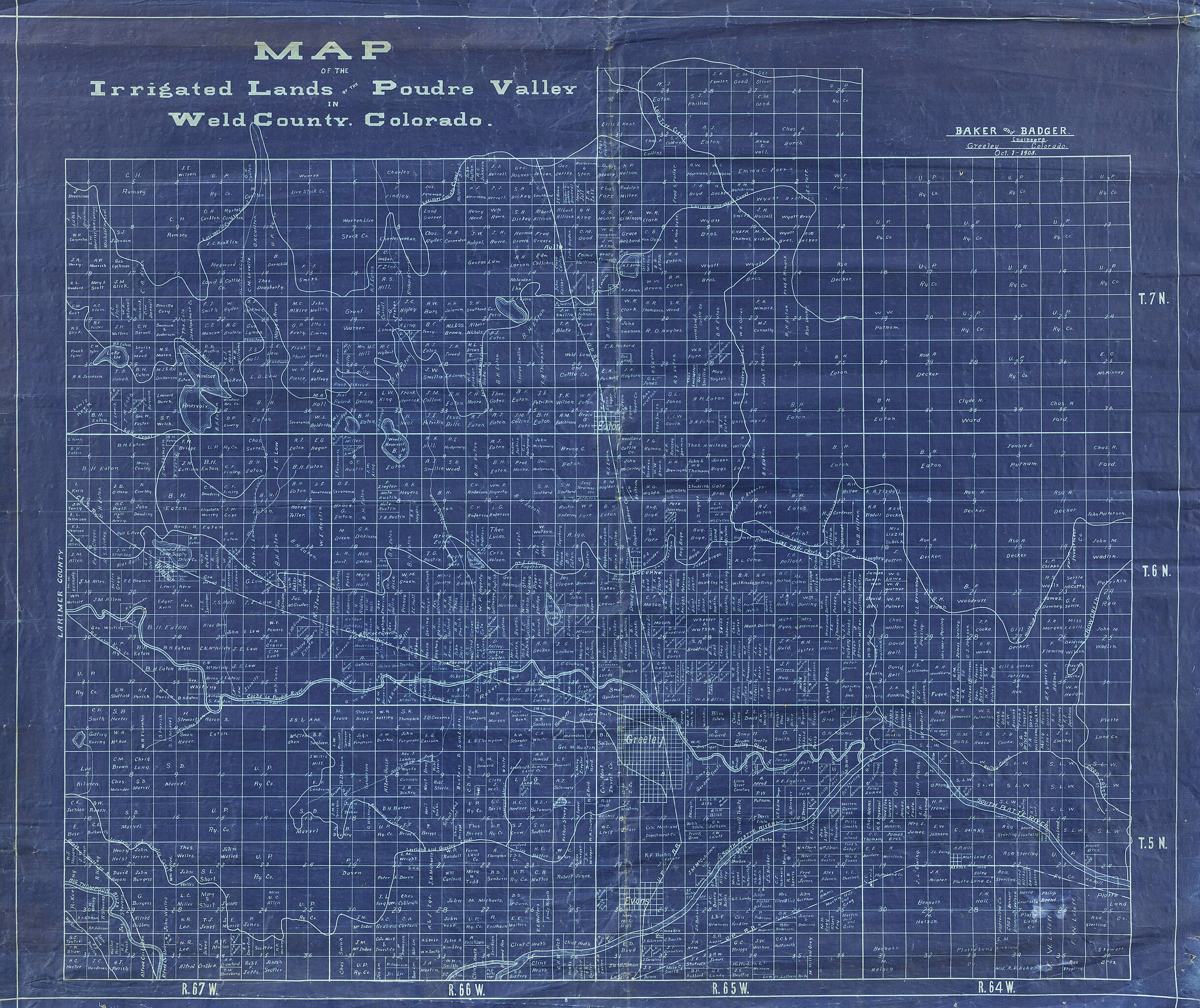
| Description | Blueprint map showing irrigated lands in the Weld County / Greeley area of northeast Colorado, including some land ownership information. | ||||||||||||||||||||
| Title | Map of the irrigated lands of the Poudre Valley, Weld County, Colorado, Irrigated lands of the Poudre Valley, Weld County, Colorado | ||||||||||||||||||||
| Institution |
|
||||||||||||||||||||
| Subject | |||||||||||||||||||||
| Source |
Plains to Peaks Collective |
||||||||||||||||||||
| Author |
Baker and Badger |
||||||||||||||||||||
| Permission (Reusing this file) |
Copyright determination made by Denver Public Library (Q69470198) using RightsStatements.org
|
||||||||||||||||||||
| Partnership |
|
||||||||||||||||||||


File history
Click on a date/time to view the file as it appeared at that time.
| Date/Time | Thumbnail | Dimensions | User | Comment | |
|---|---|---|---|---|---|
| current | 13:10, 18 December 2020 | | 8,999 × 7,564 (11.69 MB) | DPLA bot (talk | contribs) | Uploading DPLA ID d4d700265fef483605f3ae8961d6f47f |
You cannot overwrite this file.
File usage on Commons
There are no pages that use this file.