File:Map of the United States - exhibiting the post-roads, the situations, connexions & distances of the post-offices, stage roads, counties & principal rivers LOC 2003630384.jpg
Jump to navigation
Jump to search

Size of this preview: 800 × 582 pixels. Other resolutions: 320 × 233 pixels | 640 × 465 pixels | 1,024 × 745 pixels | 1,280 × 931 pixels | 2,560 × 1,862 pixels | 16,040 × 11,665 pixels.
Original file (16,040 × 11,665 pixels, file size: 22.83 MB, MIME type: image/jpeg)
Captions
Captions
Add a one-line explanation of what this file represents
Summary
[edit]| Warning | The original file is very high-resolution. It might not load properly or could cause your browser to freeze when opened at full size. |
|---|
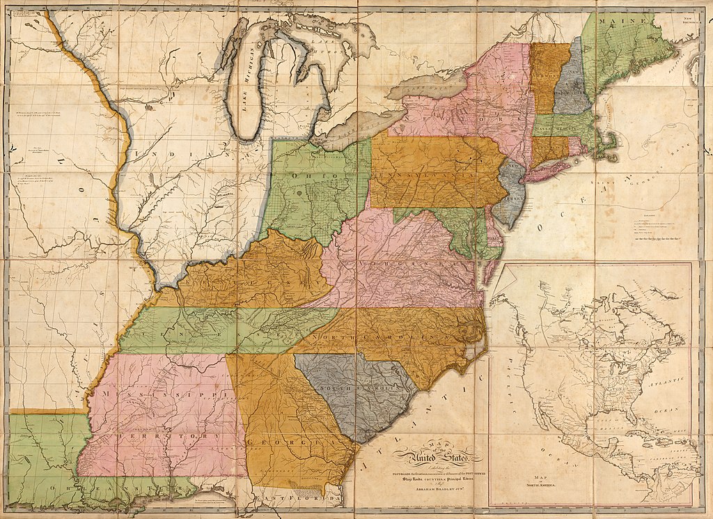
| Description |
English: Relief shown pictorially. Also shows townships in parts of Maine, New York, and Indiana Territory. Illinois (not named) is shown as part of Indiana Territory. Slipcase title and publisher's statement from printed labels affixed to slipcase. Earliest state of the 5th ed. Prime meridian: Washington D.C. "Entered according to the Act of Congress the 2nd day of June 1804 by Abraham Bradley Jun'r of the District of Columbia." Sectioned (to 36 panels) and mounted on cloth backing to fold to 23 x 17 cm. Imperfect: Lightly foxed, worm-holed in margin, slip-case flattened. Available also through the Library of Congress Web site as a raster image. Includes notes in map area and inset "Map of North America" (scale ca. 1:17,000,000). Acquisitions control no.: 2002-50 |
||
| Title | Map of the United States : exhibiting the post-roads, the situations, connexions & distances of the post-offices, stage roads, counties & principal rivers | ||
| Shelf ID | G3700 1804 .B7 G3700 1804 .B7 Copy 2 | ||
| Date | |||
| Source | https://www.loc.gov/item/2003630384/ | ||
| Author | Bradley, Abraham; Caldcleugh And Thomas | ||
| Permission (Reusing this file) |
|
||
| Location | United States · North America · North America. · United States. | ||
| Part of | American Memory · General Maps · Catalog · Geography And Map Division | ||
| Subject | United States · Maps · North America · Post Roads · Counties |

Licensing
[edit]
|
This is a faithful photographic reproduction of a two-dimensional, public domain work of art. The work of art itself is in the public domain for the following reason:
The official position taken by the Wikimedia Foundation is that "faithful reproductions of two-dimensional public domain works of art are public domain".
This photographic reproduction is therefore also considered to be in the public domain in the United States. In other jurisdictions, re-use of this content may be restricted; see Reuse of PD-Art photographs for details. | ||||
File history
Click on a date/time to view the file as it appeared at that time.
| Date/Time | Thumbnail | Dimensions | User | Comment | |
|---|---|---|---|---|---|
| current | 11:10, 24 May 2018 | | 16,040 × 11,665 (22.83 MB) | Fæ (talk | contribs) | LOC Maps https://www.loc.gov/item/2003630384/ #162 |
You cannot overwrite this file.
File usage on Commons
There are no pages that use this file.