File:Map of the Union troop positions southwest of Marietta, Georgia, June 10-July 3, 1864. LOC 2006635269.jpg
Jump to navigation
Jump to search

Size of this preview: 470 × 599 pixels. Other resolutions: 188 × 240 pixels | 376 × 480 pixels | 602 × 768 pixels | 803 × 1,024 pixels | 1,606 × 2,048 pixels | 2,730 × 3,481 pixels.
Original file (2,730 × 3,481 pixels, file size: 895 KB, MIME type: image/jpeg)
Captions
Captions
Add a one-line explanation of what this file represents
Summary
[edit]| Description |
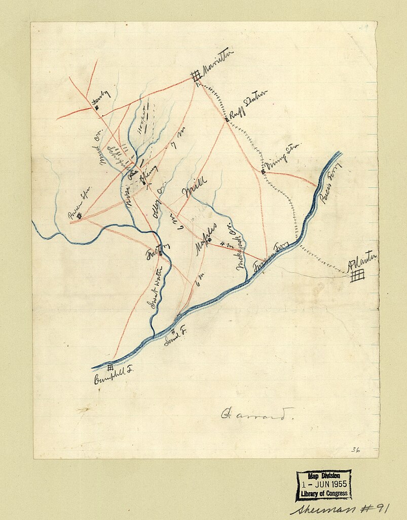
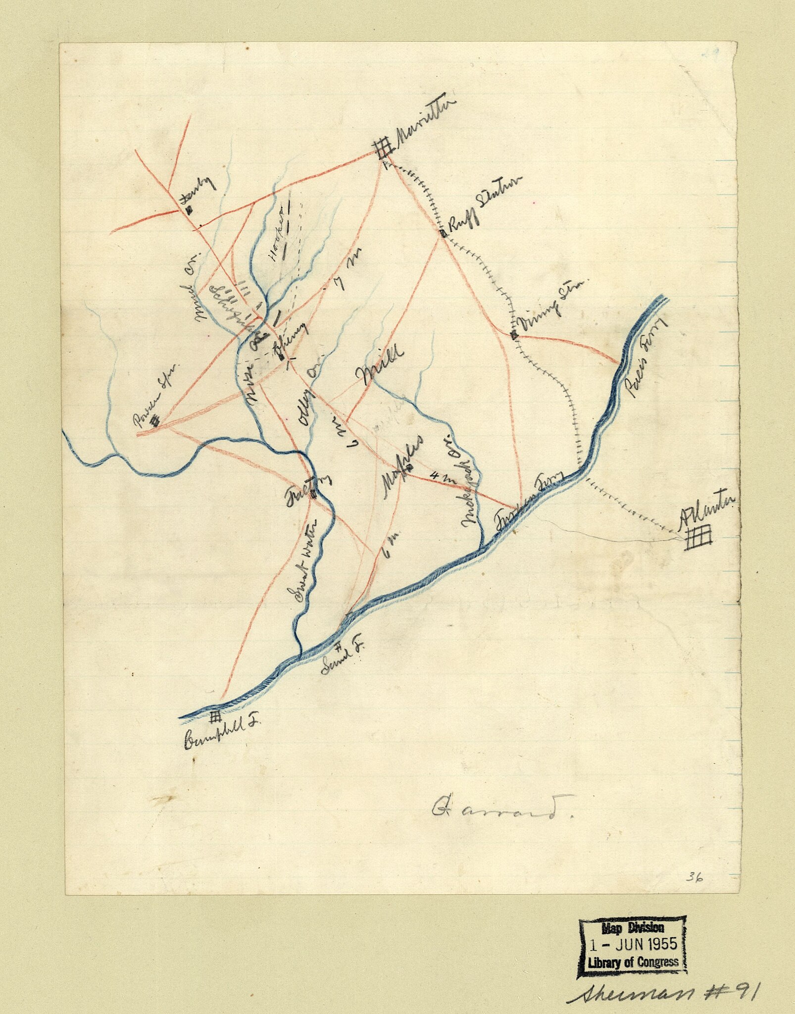
English: Title and date from Stephenson's Civil War maps, 1989. Similar to a map in the Atlas to accompany the official records of the Union and Confederate Armies, 1891-95, pl. 65, no. 3. LC Civil War maps (2nd ed.), S91, 192 Available also through the Library of Congress Web site as a raster image. Pencil (some col.) on verso of blue lined paper, mounted on paper. At bottom of map: Garrard. In lower right corner: 36. |
||
| Title | [Map of the Union troop positions southwest of Marietta, Georgia, June 10-July 3, 1864]. | ||
| Shelf ID | G3924.M4S5 1864 .M2 | ||
| Date | |||
| Source | https://www.loc.gov/item/2006635269/ | ||
| Author | Unknown author | ||
| Permission (Reusing this file) |
|
||
| Other versions |
|
||
| Location | United States · Marietta · Georgia | ||
| Part of | Military Battles And Campaigns · American Memory · Civil War Maps · Catalog · Geography And Map Division | ||
| Subject | Maps, Manuscript · Georgia · Civil War · United States · Marietta (Ga.) · Marietta · History |


Licensing
[edit]
|
This is a faithful photographic reproduction of a two-dimensional, public domain work of art. The work of art itself is in the public domain for the following reason:
The official position taken by the Wikimedia Foundation is that "faithful reproductions of two-dimensional public domain works of art are public domain".
This photographic reproduction is therefore also considered to be in the public domain in the United States. In other jurisdictions, re-use of this content may be restricted; see Reuse of PD-Art photographs for details. | ||||
File history
Click on a date/time to view the file as it appeared at that time.
| Date/Time | Thumbnail | Dimensions | User | Comment | |
|---|---|---|---|---|---|
| current | 06:57, 22 May 2018 | | 2,730 × 3,481 (895 KB) | Fæ (talk | contribs) | LOC Maps https://www.loc.gov/item/2006635269/ #13187 |
You cannot overwrite this file.
File usage on Commons
The following 3 pages use this file:
._LOC_2006635269.jpg&redirect=no)