File:Map of the South Carolina Lowcountry.svg
Jump to navigation
Jump to search

Size of this PNG preview of this SVG file: 752 × 599 pixels. Other resolutions: 301 × 240 pixels | 602 × 480 pixels | 964 × 768 pixels | 1,280 × 1,020 pixels | 2,560 × 2,040 pixels | 4,419 × 3,522 pixels.
Original file (SVG file, nominally 4,419 × 3,522 pixels, file size: 108 KB)
Captions
Captions
Add a one-line explanation of what this file represents
| Description |
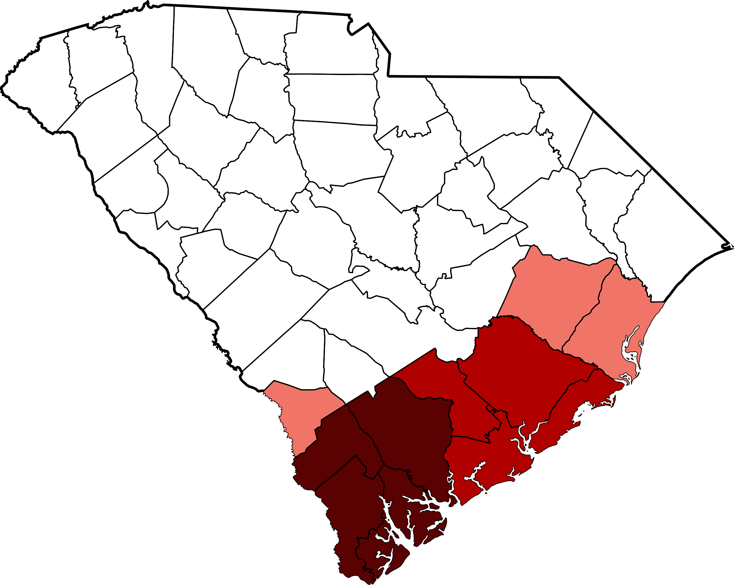
English: Map showing the counties included in the South Carolina Lowcountry. Beaufort, Colleton, Hampton, and Jasper Counties, in dark red, are always included in the definition. Berkeley, Charleston, and Dorchester Counties, in lighter red, are often included; and Allendale, Georgetown, and Williamsburg Counties, in pink, are sometimes included. |
||
| Date | |||
| Source | Based on File:Map of South Carolina highlighting Charleston County.svg by David Benbennick. | ||
| Author | Spyder_Monkey | ||
| Permission (Reusing this file) |
|
File history
Click on a date/time to view the file as it appeared at that time.
| Date/Time | Thumbnail | Dimensions | User | Comment | |
|---|---|---|---|---|---|
| current | 20:12, 16 September 2011 | | 4,419 × 3,522 (108 KB) | Spyder Monkey (talk | contribs) | {{Information |Description={{en|Map showing the counties included in the South Carolina Lowcountry. Beaufort, Colleton, Hampton, and Jasper Counties, in dark red, are always included in the definition. Berkeley, Charles |
You cannot overwrite this file.
File usage on Commons
There are no pages that use this file.
File usage on other wikis
The following other wikis use this file:
- Usage on de.wikipedia.org
- Usage on en.wikipedia.org
- Usage on es.wikipedia.org